From the Himalayas to the Indian Ocean: 10 Infrastructure Projects to Watch Across South Asia
Beneath the waters of Thane Creek, two enormous tunnelling machines are working towards Mumbai as part of the 21 km underground section of India’s Mumbai-Ahmedabad High-Speed Rail corridor. Sixteen kilometres will be driven by tunnel boring machines, while 7 km will pass beneath the creek, creating India’s first undersea railway tunnel.
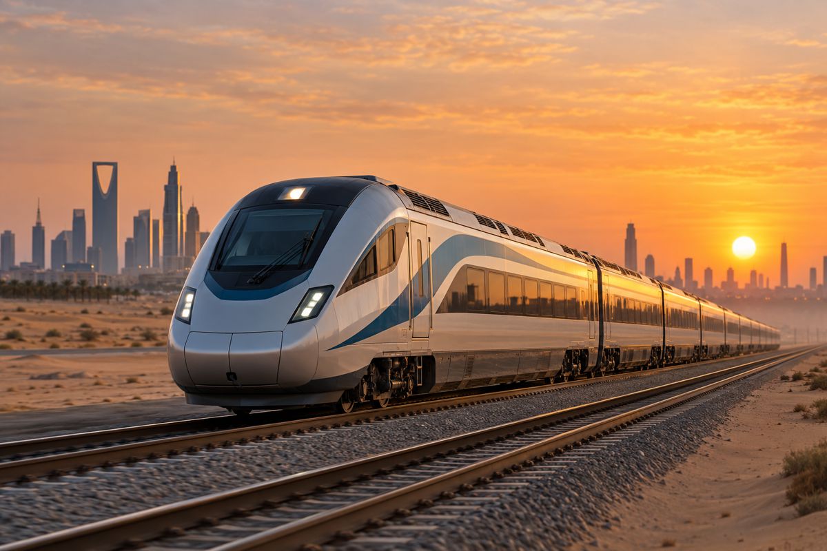
Above ground, the railway will extend for 508 km between Mumbai and Ahmedabad. Stations, viaducts, power infrastructure and railway systems are taking shape along a corridor designed for trains travelling at up to 320 km/h.
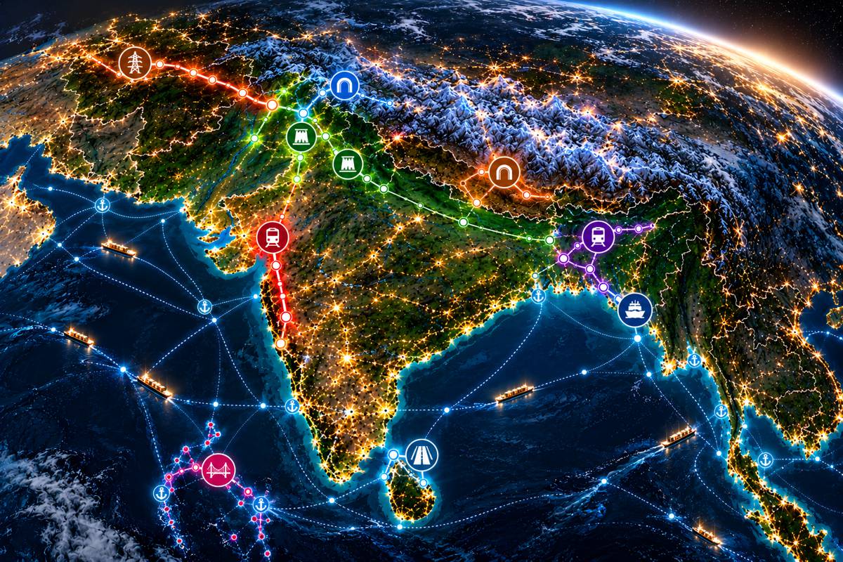
Mumbai is an extreme example of a problem repeated across South Asia. The region contains some of the world’s largest and most densely populated cities, several of its highest mountain ranges, enormous river systems, monsoon climates, crowded coastlines and island communities where developable land is exceptionally scarce.
In Kashmir, engineers are tunnelling beneath a Himalayan pass to maintain road access when winter closes the route above. In Pakistan, two enormous hydropower schemes are reshaping sections of the Indus. Bangladesh is constructing its first deep-sea port, while physical construction has begun on another mass-transit line for Dhaka.
Nepal is tunnelling beneath a landslide-prone section of highway. Colombo is carrying road traffic above existing streets to reach its port. In the Maldives, bridges and causeways are creating road connections between islands.
Briefing
- India’s 508 km Mumbai-Ahmedabad High-Speed Rail project is advancing above and below ground, including a 21 km tunnel section beneath Mumbai and Thane Creek.
- Pakistan is simultaneously constructing the Dasu and Diamer Basha hydropower projects on the Indus, with major dam works advancing during 2026.
- Bangladesh is developing its first deep-sea port at Matarbari while physical construction for Dhaka MRT Line 5 is concentrated at the Hemayetpur depot.
- Nepal’s Siddhababa Tunnel is approaching operation after being built beneath a landslide-prone section of the Siddhartha Highway.
- Projects in Sri Lanka, the Maldives and Afghanistan extend the regional construction picture from elevated port highways and island bridges to an international electricity network awaiting its final transmission link.
1. Mumbai-Ahmedabad High-Speed Rail, India
India’s first purpose-built high-speed railway is now a construction programme stretching across hundreds of kilometres.
The Mumbai-Ahmedabad High-Speed Rail corridor will connect Maharashtra and Gujarat through 12 stations over approximately 508 km. Much of the route is elevated, allowing the railway to cross roads, rivers, agricultural land and existing development without creating continuous barriers at ground level.
By March 2026, around 430 km of piers had been completed, together with 341 km of girders and 174 km of track bed. More than 150 km of overhead electrification masts had also been installed, while station construction was progressing along the route.
The most difficult engineering lies at the Mumbai end, where a 21 km underground section links Bandra Kurla Complex with the railway north of the city. Sixteen kilometres are being excavated by tunnel boring machines, while another 5 km has been constructed using the New Austrian Tunnelling Method.
The first TBM began a 6 km drive from Vikhroli towards Bandra Kurla Complex on 5 July 2026. Less than two weeks later, a second machine started from Sawli towards Vikhroli. Approximately 7 km of the route between the construction sites will pass beneath Thane Creek, creating India’s first undersea railway tunnel.
At the surface, construction teams are simultaneously dealing with the more familiar problems of building a railway through one of India’s most intensely developed metropolitan regions. Hundreds of kilometres of elevated railway ultimately have to disappear underground before reaching the heart of Mumbai.
2. Zojila Tunnel, India
More than 1,500 km north of Mumbai, tunnelling is solving a completely different transport problem.
The road between Srinagar and Ladakh crosses the Zojila Pass at an elevation where snow, avalanches and severe winter weather can interrupt traffic for extended periods. The Zojila Tunnel will carry the road beneath the pass, forming part of a wider 30.89 km project that includes connecting roads and associated infrastructure between the Z-Morh Tunnel and the Zojila crossing.
The principal tunnel extends for approximately 14.15 km. Main-tunnel breakthrough was achieved in June 2026, but substantial work remains before traffic can use the route. India’s National Highways & Infrastructure Development Corporation currently reports physical progress of approximately 69%, with completion expected in 2028.
Construction crews face altitude, snow, avalanche exposure, difficult access and a short working season in terrain where the existing road is itself vulnerable to closure. Once complete, traffic will pass beneath the Zojila Pass rather than depending on the exposed mountain road above.
3. Dasu Hydropower Project, Pakistan
Farther west, the Indus cuts through the mountains of northern Pakistan. At Dasu in Upper Kohistan, the river is becoming the centre of one of the country’s largest hydropower developments.
The complete Dasu scheme is planned for 4,320 MW of generating capacity, developed in two stages. Stage I, currently under construction, will provide the first 2,160 MW.
The project requires the main dam, underground power infrastructure, river diversion works, access roads, transmission connections and extensive supporting civil engineering in a steep valley where the Indus dictates much of the construction sequence.
During 2026, preparations have been advancing towards roller-compacted concrete placement for the main dam. WAPDA reported in February that prerequisite works were approaching completion and RCC construction was expected to begin during the year.
Progress has not been straightforward. In September, WAPDA called on the main contractor to deploy additional resources and accelerate construction, citing issues affecting progress and the need to meet contractual milestones.
River diversion, excavation, underground structures, dam construction and electromechanical installation depend heavily on one another. Much of the engineering at Dasu therefore takes place around the need to keep the Indus flowing while permanent structures progressively take shape around it.
4. Diamer Basha Dam, Pakistan
Farther upstream on the same river, Pakistan is constructing another enormous hydropower and water-storage project.
Diamer Basha is being built near Chilas, where the Indus passes between the mountains of Gilgit-Baltistan and Khyber Pakhtunkhwa. The roller-compacted concrete dam is designed to rise 272 metres, with a crest approximately 1,006 metres long. Its reservoir will provide around 10 billion cubic metres of gross storage, while 12 generating units are planned to provide 4,500 MW of installed capacity.
Construction is spread across a large collection of interconnected works. Activity during 2026 has included the power intake, dam pit, downstream cofferdam, left abutment, flushing tunnel, guide wall, batching facilities and other structures required before the main dam can rise from the valley floor.
In September, extraction and transportation of pozzolan began from Gini in Diamer. The material will be processed for use in the roller-compacted concrete forming the main dam, clearing another prerequisite before large-scale RCC placement begins.
Costs, schedules and revised project documentation have been subject to scrutiny within Pakistan as the programme has developed. Meanwhile, the physical works continue alongside those at Dasu downstream, placing two huge hydropower construction programmes on the same river system and requiring enormous quantities of material to be moved through difficult mountain terrain.
5. Matarbari Deep-Sea Port, Bangladesh
Bangladesh faces almost the reverse engineering problem. Rather than mountains restricting access, the country’s major ports have historically had to work with shallow coastal waters and heavily sedimented approaches.
Matarbari is under construction in Cox’s Bazar District and is set to become Bangladesh’s first deep-sea port, creating facilities capable of handling larger vessels than those accommodated by much of the country’s existing port infrastructure.
Chittagong has historically handled the overwhelming majority of Bangladesh’s container traffic, but water depths of approximately 7.5 to 9.5 metres and growing cargo volumes constrain the size and number of vessels that can be accommodated.
Building the new port requires substantial infrastructure on land as well as water. The wider programme includes access roads and bridges connecting Matarbari with Bangladesh’s transport network. One package covers approximately 10.5 km of port access road, four bridges, two roundabouts and a further north-south connector.
For Bangladesh’s trading economy, additional depth alongside the new terminals will allow larger vessels to call directly and provide additional capacity beyond the country’s existing port system. The coastline has not changed, but the infrastructure being built along it will change the size and type of shipping it can accommodate.
6. Dhaka MRT Line 5 Northern Route, Bangladesh
About 300 km north of Matarbari, Bangladesh faces a problem created by urban density. Dhaka has little spare room for new transport corridors at street level.
MRT Line 5 Northern Route is being developed as a roughly 20 km railway between Hemayetpur and Bhatara, combining approximately 13.5 km of underground railway with 6.5 km of elevated infrastructure. Fourteen stations are planned, nine underground and five elevated.
Physical construction is currently concentrated at Hemayetpur, where land acquisition for the depot has been completed and development of the site is under way. The tunnels, stations and other sections that will eventually carry the railway through Dhaka remain at earlier procurement and preparation stages.
Line 5 is therefore not yet a continuous 20 km construction site. The depot works are the physical beginning of a much larger urban railway whose later packages will have to introduce stations, shafts, tunnels and transition structures into an intensely developed city while roads, utilities, businesses and existing transport continue operating around them.
7. Siddhababa Tunnel, Nepal
On Nepal’s Siddhartha Highway, the engineering problem sits immediately above the road. The Siddhababa section between Butwal and Palpa passes beneath steep slopes notorious for landslides and rockfall, repeatedly exposing traffic on an important connection between Nepal’s hill districts, Butwal and the Terai.
The main Siddhababa Tunnel extends for approximately 1,126 metres and is accompanied by three bypass passages. Excavation, lining and road construction inside the main tunnel have been completed, while electromechanical systems, access roads and external protection works continue. Overall project progress was reported at just under 70% in September 2026.
The tunnel is only part of the engineering response. Slope protection, rockfall barriers and a planned rock shed are intended to improve safety around the approaches and remaining exposed sections of highway, while the project also includes upgrades to approximately 2.4 km of road.
Construction has been affected by the same environment the project is intended to protect motorists from. Monsoon conditions and flooding disrupted delivery of electrical equipment during 2026, delaying preparations for opening. Vehicles are expected to begin using the tunnel around the end of the year, although associated protection and road works will continue.
8. Colombo Port Access Elevated Highway, Sri Lanka
Limited road space around Colombo’s port has produced a different engineering response. The Port Access Elevated Highway carries a new road above existing infrastructure between the New Kelani Bridge and the port, avoiding streets already occupied by traffic, businesses, utilities and port-related movements.
The principal elevated highway extends for approximately 5.3 km. By the end of March 2026, Sri Lanka’s Road Development Authority reported the main civil works at 99.5% completion. The wider programme remains active, with associated facilities including the Maritime Facilitation Center and internal Sri Lanka Ports Authority roads still being delivered.
ADB continues to classify the project as active, with its loan closing date extended to September 2027.
Container terminals generate heavy traffic in parts of cities where road networks are often already heavily constrained. Expanding at ground level can require extensive land acquisition and demolition while adding further junctions to congested streets. Colombo’s elevated alignment separates part of that movement vertically and provides a more direct connection into the port.
The main viaduct is now close to completion, placing the project at the opposite end of the construction cycle from schemes such as Dhaka MRT Line 5. Associated works will determine how the new structure connects with the wider port and road system once traffic begins using it.
9. Greater Malé Connectivity Project, Maldives
Malé faces one of the most severe land constraints of any capital in South Asia. The city occupies an island of only a few square kilometres, while population, industry, housing and logistics increasingly extend onto neighbouring islands.
The Greater Malé Connectivity Project provides approximately 6.74 km of bridges and causeways connecting Malé with Vilimalé, Gulhifalhu and Thilafushi. Current reporting places construction at around 75% complete.
In September 2026, the bridge section between Malé and Vilimalé was physically connected while work continued on the wider project. Construction extends across open water, reef environments and constrained island shorelines.
The connections serve areas with different functions. Malé remains the administrative and commercial centre, Gulhifalhu is being developed around port and logistics activity, while Thilafushi accommodates industrial uses that cannot easily be fitted onto the capital island.
Most expanding cities can extend their road networks through adjoining land. Around Malé, connecting the expanding urban economy requires carrying that road network across the sea.
10. CASA-1000 Afghanistan Transmission Section
The final project is the missing section of an electricity system spanning four countries.
CASA-1000 is designed to transmit surplus hydropower from Kyrgyzstan and Tajikistan through Afghanistan to Pakistan, creating an electricity connection between Central and South Asia. Most of the infrastructure in Kyrgyzstan, Tajikistan and Pakistan has already been substantially completed, while construction of the Afghan section remains under way.
Work in Afghanistan stopped following the political change in August 2021, leaving the wider international system unable to operate as intended. Construction resumed in December 2024 under arrangements intended to ring-fence implementation and financial flows from Afghanistan’s interim Taliban administration.
By the end of 2025, contractors had completed 310 towers, 79 additional foundations and more than 18 km of conductor stringing from the remaining works following resumption. Construction is continuing, with completion currently expected by the end of 2027.
The transmission infrastructure already built in the other participating countries cannot operate as intended until the Afghan section is completed and the high-voltage direct-current system can be tested as a whole. The World Bank estimates that roughly $1 billion of infrastructure assets elsewhere risk remaining stranded if the connection is not finished.
CASA-1000 is an unusual example of infrastructure whose value depends almost entirely on continuity. Hundreds of kilometres of transmission infrastructure spread across several countries become an operational electricity network only when the remaining section closes the circuit.
Building Around the Constraints
South Asia contains almost every geographical condition capable of complicating infrastructure. Mountains, rivers, coastlines and monsoon weather coincide with some of the world’s most intensely developed urban areas, leaving major projects to work around both physical geography and infrastructure that is already there.
The response can be seen in the construction methods. Railways and highways disappear underground where the surface is unavailable or unreliable. Elevated structures create additional capacity above existing roads. Bridges and causeways extend transport networks between islands, while dams and transmission systems depend on infrastructure operating across entire river systems and national borders.
None of those approaches removes the underlying constraint. Zojila remains a Himalayan pass, the Indus remains a powerful river system, Dhaka and Mumbai remain intensely crowded cities, and Malé remains an island capital with exceptionally limited land.
The projects alter what can be built and operated within those conditions. Across South Asia, infrastructure rarely has the luxury of empty space.
Key Industry Questions
- What is the Mumbai-Ahmedabad High-Speed Rail project? The 508 km railway will connect Mumbai and Ahmedabad through 12 stations. Much of the route is elevated, while a 21 km underground section at the Mumbai end includes a 7 km undersea tunnel beneath Thane Creek.
- What is the Zojila Tunnel? Zojila is a 14.15 km road tunnel being constructed beneath the Zojila Pass between Kashmir and Ladakh. It forms part of a wider project intended to improve year-round road connectivity through terrain vulnerable to snow and severe winter weather.
- How large is the Dasu Hydropower Project? Dasu is planned as a 4,320 MW hydropower development on the Indus, constructed in two stages. Stage I, currently under construction, will provide 2,160 MW.
- How large will Diamer Basha Dam be? The roller-compacted concrete dam is designed to rise 272 metres and provide around 10 billion cubic metres of gross water storage. Its 12 generating units are planned to provide 4,500 MW of capacity.
- Why is Matarbari Port important to Bangladesh? Matarbari is being developed as Bangladesh’s first deep-sea port, providing infrastructure capable of handling larger vessels than those accommodated by many existing port facilities.
- What is Dhaka MRT Line 5 Northern Route? The planned approximately 20 km metro line will combine 13.5 km of underground railway with 6.5 km of elevated infrastructure between Hemayetpur and Bhatara, serving 14 stations. Physical construction is currently concentrated at the Hemayetpur depot.
- Why is Nepal building the Siddhababa Tunnel? The tunnel bypasses part of a landslide- and rockfall-prone section of the Siddhartha Highway between Butwal and Palpa. The main tunnel is approximately 1.126 km long, with associated slope protection and road works continuing around it.
- What is the Colombo Port Access Elevated Highway? The approximately 5.3 km elevated highway connects the New Kelani Bridge area with Colombo’s port, separating port-related traffic from parts of the congested street network below.
- What is the Greater Malé Connectivity Project? The project provides around 6.74 km of bridges and causeways connecting Malé, Vilimalé, Gulhifalhu and Thilafushi in the Maldives.
- Why is the Afghanistan section of CASA-1000 important? Afghanistan forms the central transmission link between hydropower infrastructure in Kyrgyzstan and Tajikistan and the receiving system in Pakistan. The wider CASA-1000 network cannot operate as intended until the Afghan section is completed.
Strategic Takeaways
- South Asia’s infrastructure challenge is shaped by the interaction between difficult physical geography and densely occupied urban and transport networks.
- Tunnelling is being used for very different purposes, from bringing high-speed rail into Mumbai to maintaining all-season Himalayan road access and bypassing unstable slopes in Nepal.
- Dasu and Diamer Basha place two exceptionally large hydropower construction programmes on the Indus, with river management and mountain logistics central to both.
- Matarbari, Colombo and Greater Malé show how limited coastal and urban space is pushing infrastructure into deeper water, above existing streets and between islands.
- CASA-1000 demonstrates the operational dependence of international infrastructure networks on completing every critical link in the system.