


Join the Global Geomatics Community as a CHCNAV Dealership
Are you interested in the world of geomatics? Do you want to be part of a thriving community that embraces cutting-edge technology and provides exciting dealership opportunities? Look no further!
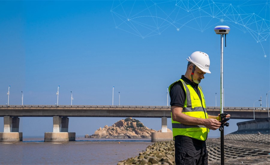
CHCNAV is a global leader in the geomatics industry, providing state-of-the-art GNSS solutions that empower professionals to achieve exceptional accuracy and productivity in their field work.
With a rich heritage of over 15 years, CHCNAV has built a reputation for delivering high-quality products and services that meet the diverse needs of our customers around the world, and is now is inviting business around the world to join the Global Geomatics Community and embark on a journey of growth and success.
Join the CHCNAV Geomatics Community
CHCNAV believes in the power of community, and are dedicated to fostering a vibrant and supportive community of geomatics professionals who share their knowledge, insights, and experiences to drive innovation and push the boundaries of what is possible in the field of geomatics.
By joining the Geomatics Community, you will have access to a wealth of resources, including technical documentation, software updates, training materials, and exclusive events. You will also have the opportunity to connect with fellow professionals, exchange ideas, and learn from each other’s successes and challenges.
CHCNAV Solutions
- Cadastral Surveying: As urbanization continues to rise, the precise measurement of property boundaries becomes increasingly crucial. Authorities require accurate land mapping to effectively manage properties. CHCNAV’s intelligent antennas and GNSS total stations play a pivotal role in providing this vital information with their advanced technology and precision capabilities.
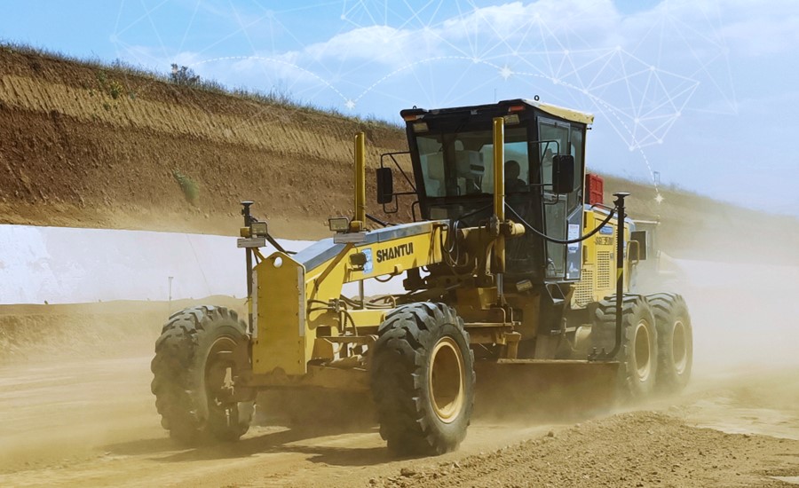
- Construction Surveying and Earthmoving: Precise measurements are vital to ensure that buildings, roads, and other structures are constructed according to plan. CHCNAV’s GNSS smart antennas, sensors, field controllers, and software equip surveyors with the accurate data they require to perform their duties with efficiency and precision. Moreover, CHCNAV’s GNSS RTK networks can greatly enhance construction project operations by delivering consistent positioning accuracy for all surveying tasks across the site, regardless of the brand of RTK rover used, thereby improving communication and coordination between different operators.
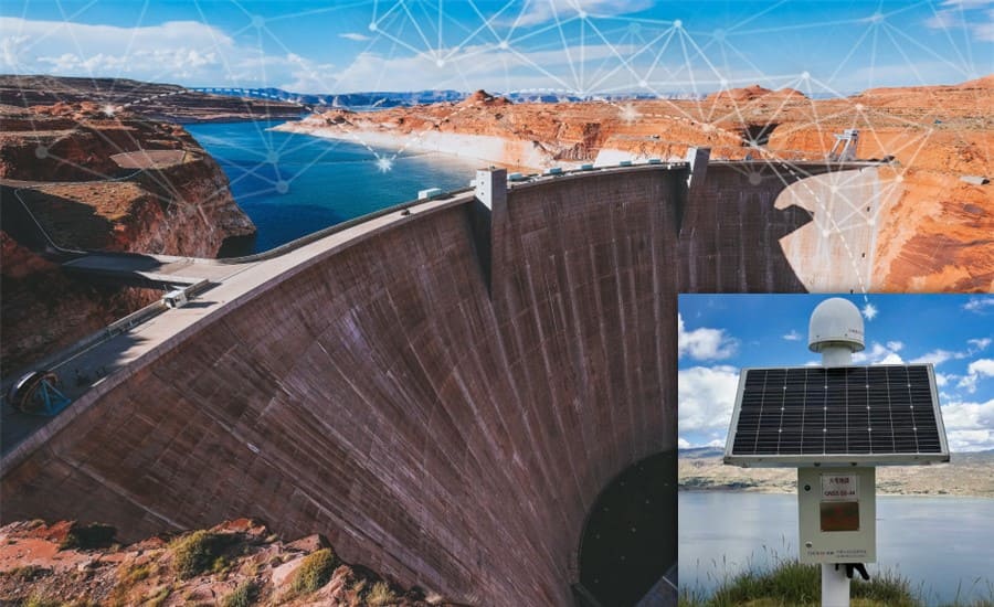
- Infrastructure Monitoring: CHCNAV’s GNSS sensors and antennas play a crucial role in mitigating natural disasters and facilitating swift emergency response by effectively monitoring critical infrastructure and the physical environment. Our cutting-edge CPS RTK Network software, P5 geodetic GNSS stations, and C220GR2 GNSS antennas provide a robust enterprise solution that delivers unparalleled accuracy and uninterrupted positioning and navigation services.
- Mine Surveying: Precise GNSS positioning is of utmost importance in every stage of open pit mining. Accurate topographic data is essential for ensuring the safety of personnel and machinery, as well as the overall success of mining operations spanning exploration, discovery, development, production, and reclamation. CHC Navigation provides a comprehensive suite of advanced technologies to assist mining companies in optimizing their exploration and development processes, thereby gaining a competitive edge in the industry.
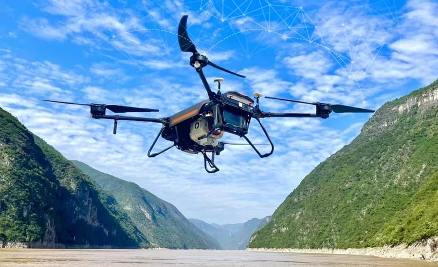
- Mapping and GIS, Photogrammetry, Laser scanning: Accurate GNSS data collection is critical for mapping, environmental planning, and urban design. Real-time or post-processed GNSS data is essential for georeferencing aerial surveys used in 3D modelling, as well as georeferencing point clouds generated by laser scanning and mobile mapping systems. CHCNAV provides cutting-edge devices specifically designed to meet the demand for highly precise topographic information, which is foundational to the success and dependability of any project.
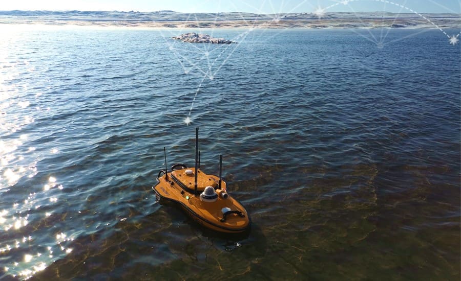
- Marine Surveying: Marine surveying involves a diverse array of tasks that heavily rely on GNSS technology, including seabed exploration, tidal and current estimation, and offshore monitoring through bathymetric and hydrographic surveys. The outcomes of these activities are crucial for marine construction and navigation. CHCNAV’s versatile and durable Uncrewed Surface Vessels (USVs) can be equipped with state-of-the-art instruments such as single or multibeam echo sounders, GNSS RTK receivers, and other sensors. This enables reduced survey time, improved work efficiency, and generation of high-resolution data that consistently meet the rigorous requirements of hydrographic survey projects.
Explore Dealership Opportunities
CHCNAV is committed to partnering with dealers around the world to expand their global reach and deliver cutting-edge GNSS solutions to customers in every corner of the globe. As a member of their Geomatics Community, you will have the opportunity to explore exciting dealership opportunities and become a brand ambassador.
As a CHCNAV dealer, you will benefit from a comprehensive support program, which includes product training, marketing materials, technical assistance, and attractive profit margins. You will also have access to an extensive product portfolio, which includes a wide range of GNSS receivers, surveying accessories, and software solutions to cater to various geomatics applications.
Why Choose CHCNAV
CHCNAV is not just another geomatics company – they are a technology-driven organization committed to pushing the boundaries of what is possible in the field of geomatics. Here are some reasons why you should choose CHCNAV as your preferred partner in the geomatics industry:
- Innovative Technology: CHCNAV is at the forefront of GNSS technology, with a rich portfolio of cutting-edge products that are designed to deliver exceptional accuracy, productivity, and reliability in the field.
- Global Presence: CHCNAV has a strong global presence, with a network of dealers and partners in over 100 countries. Their products and solutions are trusted by professionals around the world, making them a truly global brand.
- Comprehensive Support: CHCNAV is committed to providing comprehensive support to their dealers, including product training, marketing materials, technical assistance, and attractive profit margins, and are dedicated to ensuring the success of their partners in every way possible.
- Customizable Solutions: CHCNAV understands that every geomatics application is unique, and offers customizable solutions that can be tailored to meet the specific needs of their customers. Whether you are working in surveying, mapping, construction, or any other geomatics field, CHCNAV has a solution for you.
If you are passionate about geomatics and want to be part of a thriving community that embraces innovation and provides exciting dealership opportunities, then look no further than CHCNAV. Join their Geomatics Community to embark on a journey of growth and success with a global leader in GNSS technology.


