Esri Explores the Strategic Value of GIS in Higher Education with The Spatial Edge
Esri has published The Spatial Edge: The Strategic Advantage of GIS Skills Across Higher Education, a guide arguing that geographic information systems belong across an entire university rather than inside a handful of specialist departments. On the surface this is a book about teaching.
The more consequential story sits underneath that framing, because the guide is effectively a statement about where the next generation of geospatially literate staff will come from and how widely spatial thinking is spreading through the organisations that plan, build and operate the built environment. Infrastructure employers already compete for people who can read, model and act on location data, and the supply of those people is shaped in large part by what universities choose to teach and to whom.
The timing is not incidental. Spatial data has moved well beyond mapping into an operational layer that underpins asset management, network design, digital twins and real-time monitoring across transport, water and energy systems. Universities matter twice over in that shift, first as the training ground for graduates entering architecture, engineering and construction, and second as substantial infrastructure estates in their own right, running campuses that behave like small cities.
A book that pushes GIS out of the geography department and into facilities management, research administration and campus planning therefore speaks directly to two of the sector’s persistent concerns, namely the depth of the skills pipeline and the mainstreaming of spatial competence as a general professional asset rather than a niche technical one.
Briefing
- Esri has released The Spatial Edge: The Strategic Advantage of GIS Skills Across Higher Education, available in paperback and ebook at US$24.99, written by Thomas Fisher of the Minnesota Design Center and Len Kne of the University of Minnesota’s U-Spatial centre.
- The guide argues that GIS should extend beyond geography, planning and environmental studies into teaching, research, facilities operation and community engagement across the whole institution.
- Its central commercial message is workforce readiness, positioning geospatial literacy as an in-demand competency for careers in architecture, engineering and construction, business, health services and sustainable development.
- The book arrives against a documented geospatial skills shortage and steady double-digit growth forecasts for the GIS software market, with transport and logistics among the largest buyers of the technology.
- For infrastructure specifically, the convergence of GIS with building information modelling into digital twins is raising demand for staff who can work across both spatial and design data.
The Skills Gap Behind the Publication
The commercial heart of The Spatial Edge is not cartography but recruitment. Industry survey work reported by market analysts has found that a large majority of geospatial professionals, on the order of eight in ten in a widely cited readership survey, believe there is a gap between the skills employers need and the workforce available to supply them.
That shortfall lands hardest in sectors that have quietly become heavy users of location data, including utilities managing buried networks, transport authorities routing fleets and construction firms coordinating complex sites. United States labour statistics, as reported by education analysts, project growth of around ten per cent through 2032 for GIS technicians and analysts, faster than the average across all occupations, and specialist geospatial data science roles are forecast to expand more quickly still. Demand of that kind cannot be met by a small cohort of dedicated GIS graduates alone.
That is precisely the argument the book advances, and it is where the publication connects most directly to the built environment. The authors frame geospatial literacy as a cross-cutting skill that graduates will carry into architecture, engineering and construction, business, conservation, health services and sustainability work, rather than a qualification confined to mapping specialists.
The appeal is straightforward, since a civil engineer, quantity surveyor or facilities manager who can interpret spatial data adds capability without the friction of translating between disciplines. The economics reinforce the point. Estimates of the global GIS software market for 2026 sit in the region of thirteen to seventeen billion US dollars depending on how the category is defined, with forecasters projecting compound annual growth of roughly fourteen per cent over the following five years, and transport and logistics accounting for the single largest share of spending. A market growing at that rate needs a broader base of competent users, not simply more high-end specialists.
Universities as Infrastructure Estates
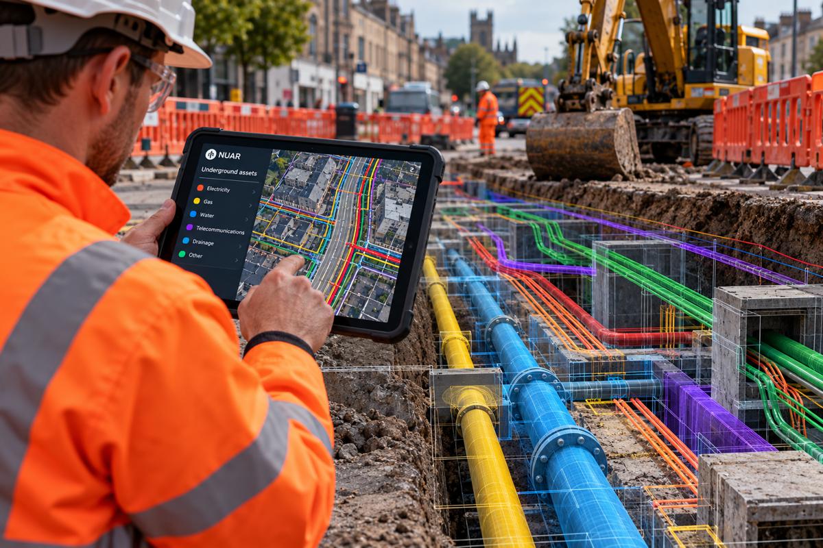
One of the more useful moves in the book, at least for a construction and infrastructure readership, is its treatment of the campus itself as an asset base to be managed spatially. A large university operates roads, utilities, energy systems, building stock, transport links and open space across a defined estate, and the operational challenges it faces mirror those of a municipality. Facilities teams increasingly turn to GIS to track assets, manage space and occupancy, plan maintenance and reduce energy consumption, using the same categories of spatial analysis that a highways authority or a water utility would recognise.
The scale can be considerable, and the University of Minnesota’s U-Spatial centre, co-directed by one of the book’s authors, supports the geospatial needs of more than two thousand researchers across around a hundred and fifty departments and centres, a level of internal demand that resembles an enterprise deployment rather than a teaching resource.
Read that way, the guide is as much about operations as pedagogy, and it lands in familiar territory for anyone working on smart campus or smart city programmes. Institutions are beginning to knit together building models, sensor data and geographic context into campus digital twins that support real-time monitoring, predictive maintenance and energy management, an approach documented in academic work on universities from Turin to a growing list of research campuses.
The value for the wider sector is that campuses function as accessible testbeds for spatial infrastructure management, close to the researchers refining the methods and small enough to iterate quickly. Lessons drawn from managing a campus estate through GIS transfer readily to the districts, corridors and utility networks that infrastructure owners run at larger scale.
Where GIS and Building Information Modelling Converge
The technical development that gives this book its infrastructure relevance is the steady convergence of GIS and building information modelling. Since 2017 Esri and Autodesk have pursued a strategic partnership to bridge the long-standing divide between geospatial data and design data, producing tools such as ArcGIS GeoBIM that connect their respective cloud platforms so that a building or asset model can be viewed in full geographic context.
That integration allows spatial information to travel across the whole asset lifecycle, from conceptual planning and design through construction and delivery and into long-term operation and maintenance. As those workflows mature, the boundary between the engineer who builds the model and the analyst who situates it in the landscape becomes harder to justify, and the premium shifts towards people who can move comfortably across both.
This is the practical reason a campus-wide push on spatial skills matters to construction and infrastructure. Digital twins for major projects, from water networks to airports, increasingly depend on combining BIM detail with geospatial context and live sensor feeds, and industry commentary consistently identifies the integration of these data types as the backbone of credible digital twin work. Building the pipeline of people who understand both sides of that equation is a workforce problem before it is a software problem.
A guide that encourages universities to embed spatial thinking into engineering, design and facilities courses, rather than treating it as a separate specialism, addresses the human side of a technical convergence that the sector’s largest platform vendors are already engineering into their products.
The Market Pulling Demand Higher
The wider geospatial market provides the backdrop that makes the skills question urgent. Beyond the GIS software segment, the broader market for geospatial solutions and analytics runs into the hundreds of billions of dollars and is forecast to keep expanding at double-digit rates, propelled by smart city programmes, national open-data mandates, cloud-native deployment and the rapid integration of artificial intelligence into spatial workflows.
Investors have taken notice, with private capital moving into geospatial platforms and infrastructure software, illustrated by transactions such as KKR’s acquisition of the telecoms-focused platform IQGeo and Bentley Systems’ purchase of the open-source 3D geospatial engine Cesium to strengthen its infrastructure digital twin offering. Capital of that kind tends to follow, and then amplify, demand for skilled people.
Artificial intelligence complicates and sharpens the picture rather than simplifying it. The emergence of what practitioners call GeoAI is raising the ceiling on what spatial analysis can deliver, from automated feature extraction in satellite imagery to predictive modelling of asset condition, while also reshaping which skills carry a premium.
Employers increasingly want geospatial professionals who can combine mapping with data science, automation and machine learning, and salaries for those hybrid roles sit well above traditional GIS analyst pay. For infrastructure organisations, the message is that spatial competence is becoming both more valuable and more demanding, which strengthens rather than weakens the case for widening the base of people exposed to it early in their education.
The Authors and the Case They Make
The credibility of the argument rests partly on its authorship, which spans design and technical geospatial practice. Thomas Fisher is director of the Minnesota Design Center and the Dayton Hudson Chair in Urban Design, a prolific author on architecture, practice and ethics who was once ranked among the most published writers on architecture in the United States. His involvement anchors the book in the language of design and the built environment rather than pure information technology, which helps explain its comfort with treating a campus as an estate to be planned and operated. Len Kne directs U-Spatial at the University of Minnesota and teaches on its Master of Geographic Information Science programme, bringing hands-on experience of running geospatial services at institutional scale across academia, government, industry and the non-profit sector.
The book itself is structured for practical adoption, building skills chapter by chapter, drawing on real case studies and including a glossary for readers coming to the subject from outside the discipline. It is aimed squarely at administrators, educators and campus leaders who influence curricula and operations rather than at existing GIS specialists, which is consistent with its central ambition of broadening participation.
The Spatial Edge is available in paperback under ISBN 9781589488953 and as an ebook under ISBN 9781589488977, both priced at US$24.99, and can be obtained through most online retailers, with Esri Press distribution handled by Ingram Publisher Services. Esri, founded in 1969 in Redlands, California, remains the global market leader in GIS software, with deployments across hundreds of thousands of organisations in more than a hundred countries.
Reading the Signal for Talent and Procurement
For infrastructure owners, contractors and consultancies, the practical takeaway is less about a single book and more about the direction it reflects. Spatial literacy is migrating from a specialist qualification towards a general professional competency, in step with the way spatial data has migrated from a mapping function towards an operational backbone. Organisations that treat GIS capability as something to be recruited in ones and twos may find themselves outmanoeuvred by those that build broad spatial fluency across engineering, project delivery and asset management teams.
The talent strategy that follows from this involves both graduate recruitment, favouring candidates with cross-disciplinary spatial exposure, and internal upskilling of existing staff who already understand the assets but not yet the data layer sitting on top of them.
There is also a procurement and partnership dimension worth watching. As the tools that combine geospatial and design data converge, the institutions producing graduates and the vendors supplying software are effectively co-designing the future workforce, and infrastructure employers have an interest in shaping that relationship rather than simply buying its output.
Sponsoring modules, supporting campus digital twin pilots and offering placements are all ways to influence the pipeline while gaining early access to it. Publications such as The Spatial Edge signal that higher education is increasingly receptive to that conversation, and the organisations that engage with it early are likely to find themselves better placed when the competition for geospatial talent intensifies further.

Key Industry Questions
- Why should a construction or infrastructure firm care about a book aimed at universities? Because universities are the primary source of the geospatial talent that infrastructure firms increasingly depend on, and the content of engineering, design and facilities courses shapes which graduates arrive job-ready. The book argues for embedding spatial thinking across many disciplines rather than confining it to specialists, which would widen the pool of engineers, surveyors and project managers who can work with location data without extra training. Campuses also operate as large infrastructure estates, so the operational methods described, covering asset tracking, space management and energy monitoring, translate directly to municipal and utility contexts. In short, the book is a leading indicator of how quickly spatial competence is spreading through the wider workforce.
- How serious is the geospatial skills gap? Survey evidence reported by market analysts suggests a substantial majority of geospatial professionals perceive a mismatch between the skills employers require and the workforce available, and labour projections point to above-average job growth for GIS analysts and technicians over the coming years. The pressure is intensified by artificial intelligence, which is raising the value of professionals who combine mapping with data science and automation. For infrastructure employers this shows up as competition for a relatively small group of hybrid specialists, alongside a broader shortage of general staff comfortable with spatial data. The precise scale varies by source and definition, but the direction of demand is consistent across independent analyses.
- Where does GIS actually add value in infrastructure operations? GIS supports asset inventory and tracking, network design, maintenance planning, routing and situational awareness, giving operators a single spatial view of dispersed assets. In transport and logistics, which represent the largest share of GIS spending, it underpins fleet routing, corridor management and cross-border compliance. In utilities it maps buried and above-ground networks and prioritises intervention by risk. Increasingly it also feeds digital twins, combining spatial context with design models and live sensor data to enable predictive maintenance and real-time monitoring. The common thread is that location becomes an organising layer for operational decisions rather than a static reference map, which is why demand for the underlying skills continues to rise.
- What is the significance of GIS and BIM converging? Building information modelling captures the detailed geometry and data of individual assets, while GIS situates those assets in their wider geographic and environmental context. Bringing the two together, as the Esri and Autodesk partnership has pursued since 2017, allows spatial information to flow across the whole asset lifecycle from design through construction into operation. That convergence is widely described as the foundation of practical infrastructure digital twins. The workforce implication is significant, because it erodes the old separation between design specialists and geospatial analysts and rewards people who can operate across both. Organisations that develop that cross-disciplinary capability are better positioned to deliver and operate connected, data-rich infrastructure.
- Are campus digital twins relevant to real infrastructure projects? They are, both as testbeds and as genuine operational deployments. A university estate combines building stock, utilities, transport and open space within a defined boundary, closely resembling a small city, which makes it a manageable environment for developing and refining spatial management methods. Research campuses have built digital twins that integrate building models, geographic context and sensor data to support energy management, occupancy planning and predictive maintenance. Because these environments sit close to the researchers advancing the field and are small enough to iterate quickly, the techniques proven on campus transfer readily to districts, corridors and utility networks. For infrastructure owners, campus programmes offer a lower-risk route to understanding what digital twin operations require in practice.
- How large is the geospatial market, and is it still growing? Estimates depend heavily on how the category is drawn. The GIS software segment for 2026 is generally placed somewhere between roughly thirteen and seventeen billion US dollars, with forecasters projecting compound annual growth of about fourteen per cent over the subsequent five years. The broader market for geospatial solutions and analytics, which includes hardware, imagery, services and location intelligence, runs into the hundreds of billions and is also forecast to grow at double-digit rates. Growth is driven by smart city investment, national open-data policies, cloud deployment and the integration of artificial intelligence. The consistent picture across independent forecasts is sustained expansion, which is what makes the associated skills question pressing for employers.
- What kinds of roles are emerging in this field? Alongside established GIS analyst and technician positions, employers are increasingly seeking geospatial data scientists, machine learning engineers focused on spatial models, digital twin modellers and product managers for spatial tools. These hybrid roles combine traditional mapping with programming, cloud computing and artificial intelligence, and they command notably higher pay than conventional analyst positions. For infrastructure organisations, the practical need is twofold, involving a small number of these specialists to lead spatial data strategy and a much larger base of engineers, planners and facilities staff who are comfortable using spatial tools in their day-to-day work. Building both layers is more effective than concentrating capability in an isolated GIS team.
- How can infrastructure employers respond to the pipeline challenge? The most durable response combines recruitment and internal development. On recruitment, firms can favour graduates with cross-disciplinary spatial exposure rather than looking only for dedicated GIS degrees. On development, they can upskill existing staff who understand the assets but not yet the spatial data layer, which is often faster than hiring specialists from a thin market. Engaging with universities directly, through sponsored modules, placements and support for campus digital twin pilots, offers a way to shape the pipeline while gaining early access to talent. The organisations that treat spatial fluency as a broad organisational capability, rather than a specialist function to be bought in, are likely to be better placed as competition for geospatial skills grows.
Strategic Takeaways
- Spatial literacy is shifting from a specialist qualification to a general professional competency, mirroring the way geospatial data itself has moved from a mapping function to an operational backbone across transport, water and energy systems.
- The documented geospatial skills gap is a workforce risk for infrastructure employers, and organisations that build broad spatial fluency across delivery and asset teams will out-compete those that recruit specialists one at a time.
- The convergence of GIS and building information modelling into digital twins is a talent challenge as much as a technical one, rewarding staff who can work across both spatial and design data as major vendors embed that integration into their platforms.
- University campuses function as accessible testbeds for spatial infrastructure management, and lessons drawn from operating a campus estate through GIS transfer readily to districts, corridors and utility networks at larger scale.
- With the geospatial market forecast to keep growing at double-digit rates and artificial intelligence raising the premium on hybrid skills, early engagement with the education pipeline, through sponsorship, placements and pilots, is a low-cost way to secure future access to scarce talent.