A New Era for Location-Aware Design with ArcGIS for Autodesk Forma
Designing with location in mind is no longer a luxury – it’s a necessity. And in a world where urban sprawl, sustainability pressures, and digital transformation collide, the recent launch of ArcGIS for Autodesk Forma couldn’t be timelier. The integration, born of a deepening partnership between Esri and Autodesk, is poised to shake up the architecture, engineering, construction, and operations (AECO) industry by embedding geospatial data directly into the early conceptual design process.
Esri, the global heavyweight in geographic information system (GIS) technology, has long championed the importance of spatial data in shaping smarter cities and more resilient infrastructure. Now, by embedding ArcGIS capabilities into Autodesk Forma – the platform known for its intuitive, AI-assisted early-stage design features – Esri is helping to unlock powerful possibilities for AECO professionals.
Kathleen Kewley, director for AEC global business development at Esri, summed up the momentum: “We’re excited to strengthen our partnership with Autodesk in creating a more cohesive project experience for the AECO industry. This will improve operational efficiency and drive better business outcomes by bringing Esri’s rich collection of data into Autodesk Forma.”
One Platform, Endless Insight
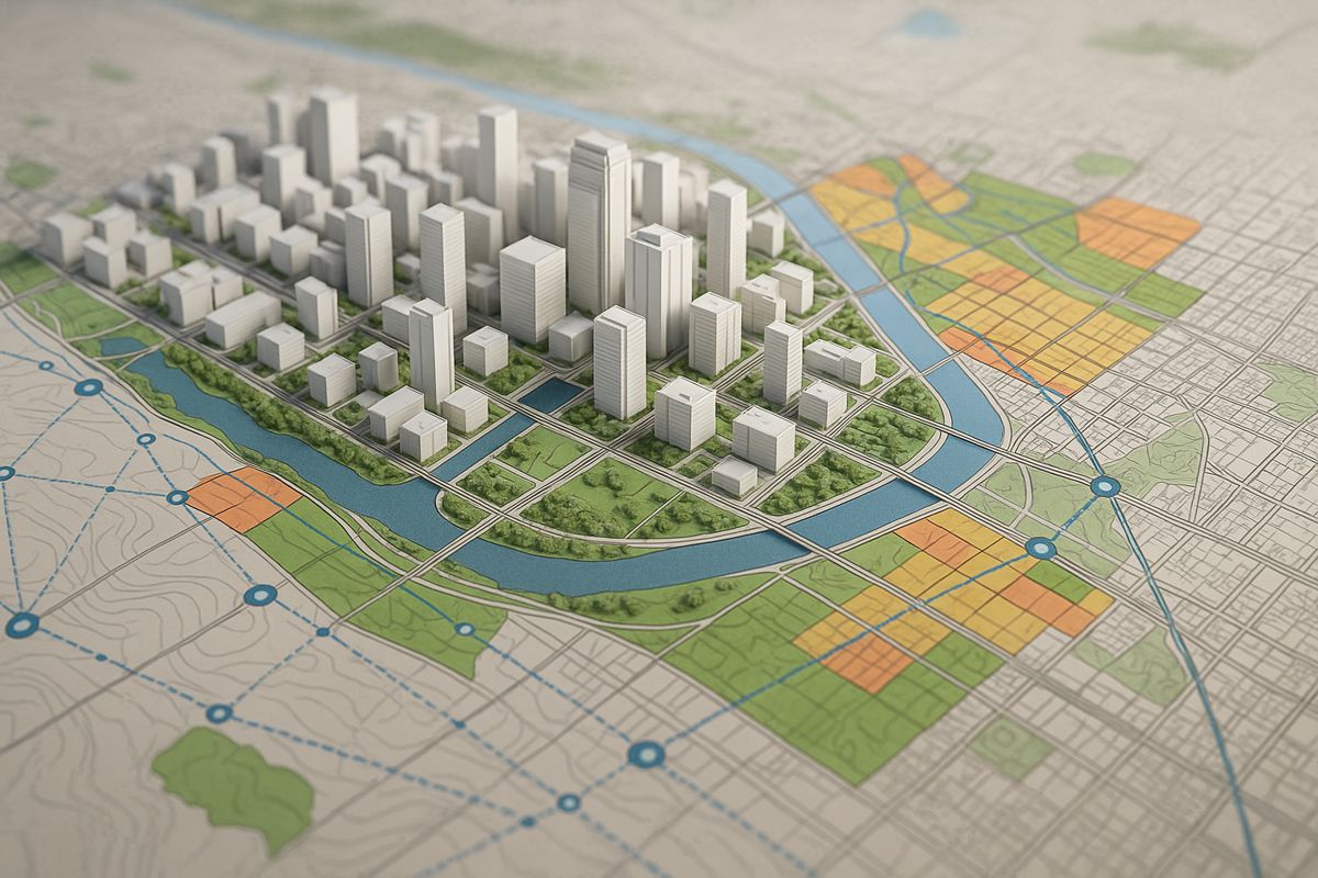
Gone are the days of switching between disparate systems to align design with site data. ArcGIS for Autodesk Forma integrates directly within the Forma platform, allowing designers to seamlessly access Esri’s base maps, GIS layers, and datasets from the acclaimed ArcGIS Living Atlas of the World.
This real-time access to topographic, demographic, environmental, and infrastructure datasets delivers a step-change for early-stage design. Instead of guesstimating conditions or manually importing datasets, teams can now:
- Instantly visualise land use, zoning, or hazard zones
- Analyse solar exposure, terrain, and drainage
- Account for biodiversity and protected zones
- Consider social and economic impact factors from the outset
And they can do all of this within the same design environment.
From Concept to Construction, and Everything In Between
Eric DesRoche, director of infrastructure business strategy at Autodesk, emphasised the shift: “AECO professionals who use Autodesk Forma will now be able to quickly update projects with the most up-to-date GIS data available. With access to the most accurate and current geographic information during the conceptual design stage, users can design with location in mind and ultimately deliver projects that are more sustainable, resilient and can better support local communities.”
That’s the key takeaway: this isn’t just a convenience upgrade. It’s a foundational rethink of how projects begin. Having GIS woven into the fabric of design from day one gives firms an edge in:
- Sustainability planning
- Cost estimation
- Permitting and compliance workflows
- Stakeholder engagement
From the outset, projects are better informed, which ultimately means fewer surprises, reduced delays, and tighter budgets.
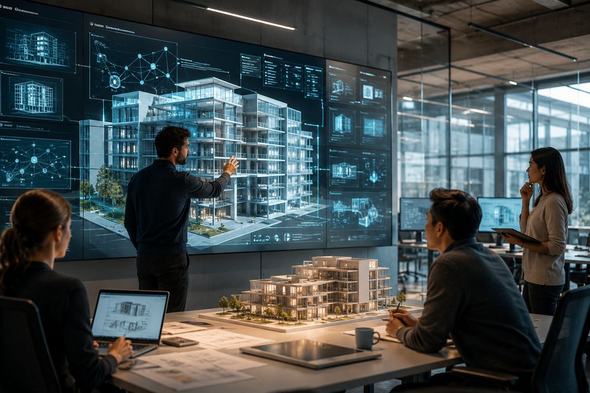
Bringing BIM and GIS Closer Together
While BIM (Building Information Modelling) continues to evolve as a cornerstone of digital construction, its true potential is often unlocked when paired with location intelligence. That’s where this new integration shines. ArcGIS for Autodesk Forma allows designs enriched with GIS data to be smoothly transitioned into tools like Autodesk Revit and Civil 3D.
It’s not just about maps anymore – it’s about spatially contextualising every pipe, pylon, park, and pathway. The extension makes it easier for engineers, planners, and architects to factor in everything from flood plains and elevation to traffic patterns and local demographics.
Dana Chermesh-Reshef, founder and CEO of urban planning tech firm inCitu, said it best: “Our augmented reality technology hinges on visualisations that function as counterparts to the physical world, so the seamless use of public and proprietary spatial data is critical for customers. ArcGIS for Autodesk Forma’s interface is easy to use and responsive, while accessing data is intuitive for AECO professionals with even limited to no GIS experience.”
Why It Matters Now
The AECO industry is staring down immense pressure: build faster, greener, and more cost-effectively, all while tackling labour shortages, urban density, and climate change. Digital transformation isn’t optional – it’s survival.
This partnership between two software titans represents more than just tech synergy. It symbolises a cultural shift. By giving all project stakeholders access to spatial intelligence from day one, ArcGIS for Autodesk Forma supports smarter decisions across the entire project lifecycle.
What’s more, the move echoes a broader trend: the blurring lines between GIS and BIM. These technologies, once siloed, are now coming together to support:
- Real-time visualisation
- Predictive modelling
- Digital twin creation
- Smart city planning
It’s this kind of joined-up thinking that’ll be critical to tackling the infrastructure challenges of the next decade.
A Glimpse into the Future
While the initial rollout focuses on conceptual design, Esri and Autodesk have made no secret of their long-term ambitions. Expect deeper integrations down the line, broader datasets, and more automation of workflows that bridge geospatial intelligence and built environment design.
As cities grow and climate pressures intensify, tools like ArcGIS for Autodesk Forma will likely become the industry standard. They don’t just provide information; they offer insight, foresight, and alignment across disciplines.
The AECO industry has long needed a way to ground its blue-sky ideas in real-world conditions without friction. With this integration, that vision is no longer a pipe dream – it’s already happening.
Smarter Starts for a Smarter Built World
ArcGIS for Autodesk Forma doesn’t just put maps into design software. It embeds intelligence into the foundation of every project. By unlocking access to Esri’s rich geospatial data, AECO professionals are now empowered to plan, design, and build in ways that are more collaborative, context-aware, and ultimately more human.
The built environment doesn’t exist in a vacuum. Neither should its design tools. And thanks to this forward-thinking integration, the future of spatially intelligent design just got a lot brighter.