The Moon Could Become an Anchor for Earth’s Navigation Satellites
Twenty-four BeiDou-3 navigation satellites were allowed to determine their own orbits for 60 days using inter-satellite ranging. Without an external correction, their average user range error eventually reached 7.85 metres. Add four hypothetical satellites orbiting the Moon to the calculation and the same error remained at 0.35 metres.
The difference comes from gravity.
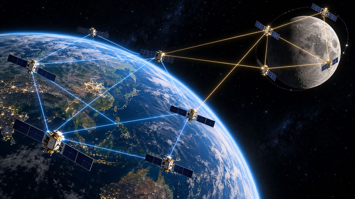
Researchers led by Xia Lin and Baojun Lin of the Chinese Academy of Sciences have demonstrated a potential way around one of the persistent weaknesses of autonomous satellite navigation. Their approach connects satellites in medium Earth orbit with spacecraft moving around the Moon, using the very different gravitational environments of the Earth and Moon to provide an absolute reference that a self-contained terrestrial constellation cannot create for itself.
The work remains preliminary. The BeiDou-3 measurements used in the study came from real inter-satellite links, but the links to the lunar satellites were simulated because the required lunar infrastructure does not yet exist. Even so, the results suggest an intriguing relationship between terrestrial and lunar navigation networks: infrastructure built to navigate spacecraft, equipment and eventually people around the Moon could also improve the resilience of navigation systems serving Earth.
Briefing
- Researchers combined 24 BeiDou-3 MEO satellites with four simulated satellites in elliptical lunar frozen orbits.
- The experiment processed 60 days of real BeiDou-3 inter-satellite ranging data alongside simulated Earth-Moon links.
- BeiDou user range error remained at 0.35 m in the joint solution, compared with 7.85 m without rotational correction.
- Adding the lunar satellites reduced the condition number of the position information matrix from approximately 10¹⁵–10¹⁸ to around 10².
- The concept could eventually connect terrestrial autonomous navigation with emerging lunar communications and positioning infrastructure.
Autonomous Orbit Determination
Modern global navigation satellite systems depend heavily on ground infrastructure. Monitoring stations determine precise satellite orbits, ground control systems generate updated ephemerides, and that information is uploaded to the constellation.
Inter-satellite links offer another possibility. If satellites can measure the distances between one another accurately enough, they can collectively estimate their own orbital states. BeiDou-3 is particularly relevant because inter-satellite links are already an operational part of the system, but relative ranging alone cannot fully determine the orientation of an entire constellation in space.
If the constellation gradually rotates while maintaining essentially the same internal geometry, the range measurements between its satellites provide insufficient information to detect that rotation. The resulting observation problem is rank deficient, allowing small orientation errors to accumulate until the calculated orbits begin to drift away from their true positions.
In the Chinese team’s 60-day experiment, autonomous orbit determination using the 24 BeiDou-3 MEO satellites alone showed precisely this behaviour. Radial accuracy remained comparatively stable, while tangential and normal errors increased. By day 60, mean constellation user range error had reached 7.85 m.
Existing approaches can constrain the drift using predicted orbital information. In the researchers’ comparison, prediction-based correction held the 60-day user range error to 0.60 m, a substantial improvement, although prediction itself gradually loses accuracy over sufficiently long periods. The alternative explored in the study was to introduce a reference operating in a very different gravitational environment.
Using Lunar Gravity as a Reference
Four satellites were introduced in elliptical lunar frozen orbits, or ELFOs, and connected mathematically to the BeiDou constellation through simulated inter-satellite measurements. These highly elliptical lunar trajectories are strongly influenced by the Moon’s gravitational field, making their dynamics sufficiently different from satellites orbiting Earth that rotational movement effectively invisible to the Earth constellation alone becomes detectable when Earth-Moon measurements are included.
The change is apparent in the observability calculations. With the 24 MEO satellites operating alone, the condition number of the position information matrix remained between approximately 10¹⁵ and 10¹⁸, which the researchers describe as computationally equivalent to a singular case. After the four lunar satellites were added, the condition number fell to the order of 10² and the previously ambiguous orientation became observable.
The improvement carried through into the calculated orbits. Three-axis rotational biases in the joint Earth-Moon solution remained within 13.59, 10.27 and 4.04 milliarcseconds during the 60-day test. Without rotational correction, the maximum biases reached 304, 105 and 21 milliarcseconds on the three axes.
For the 24 BeiDou MEO satellites, user range error remained at 0.35 m in the joint solution. The four lunar satellites also achieved maximum radial, along-track and cross-track errors below 0.16 m, 1.7 m and 1.8 m respectively, with maximum three-dimensional position error below 2.3 m.
The lunar spacecraft are therefore providing more than another set of ranging measurements. Their different gravitational environment changes what the combined navigation system is capable of observing.
Lunar Navigation Infrastructure
The concept arrives as lunar navigation infrastructure begins moving beyond theoretical studies. The European Space Agency’s Moonlight programme is developing a dedicated lunar communications and navigation service built around five satellites, including four navigation spacecraft, with coverage concentrated around the lunar south pole where many planned robotic and human missions are expected to operate.
ESA’s planned architecture uses highly elliptical lunar orbits and is intended to provide positioning services on and around the Moon. NASA, ESA and JAXA are also collaborating on LunaNet, an interoperability framework intended to allow government, commercial and international communications and navigation providers to work together around the Moon.
Neither programme validates the architecture proposed in the Chinese study, and connecting terrestrial GNSS with future lunar infrastructure would introduce questions around ranging equipment, communications, link availability, timing and interoperability. What the research demonstrates is that lunar navigation spacecraft could possess a useful characteristic simply because of the gravitational environment in which they operate.
A Navigation Network Across Two Gravitational Systems
The experiment used a centralised extended Kalman filter to estimate corrections to the positions and velocities of all participating satellites simultaneously. Three types of ranging link were considered: links between BeiDou MEO satellites, links among the lunar spacecraft and cross-links between the Earth and lunar constellations.
Those cross-links create the unusual geometry. A conventional GNSS constellation is designed primarily to provide positioning services towards Earth, while lunar navigation networks are being developed for an entirely different operating environment, with requirements including lunar landings, surface mobility, communications relay and coverage of regions where Earth may be obscured. Connecting the two creates a much larger measurement network spanning separate gravitational systems.
Ground stations remain extraordinarily capable and are unlikely to disappear from navigation-system operations. Autonomous orbit determination instead offers another layer of resilience if terrestrial communications, monitoring stations or control infrastructure become unavailable. The longer a constellation must operate independently, the more valuable an absolute reference becomes.
Such autonomy could also become increasingly useful farther from Earth, where conventional ground-dependent control is constrained by distance and communications delays. The Moon offers a second major gravitational environment close enough for regular communication with Earth-orbiting infrastructure.
The Missing Hardware
There remains an important boundary around the results. The BeiDou component of the study used real onboard inter-satellite link observations, giving the Earth-orbiting side of the experiment a stronger operational basis than a completely simulated constellation. The Earth-Moon links, however, were simulated because no operational network yet provides the four lunar spacecraft and continuous cross-links assumed in the experiment.
The researchers acknowledge this limitation. Future work is intended to replace simulated lunar measurements with real onboard observations as suitable missions become available. Link scheduling will also need further study because a lunar constellation cannot devote itself solely to improving the orbit determination of Earth satellites. It must simultaneously provide positioning, navigation and timing services to lunar users.
Those competing demands could become a substantial systems-engineering problem. A navigation satellite around the Moon may need to serve landers, rovers and other spacecraft while maintaining links within its own constellation and, potentially, ranging across hundreds of thousands of kilometres to satellites near Earth. The current study establishes the underlying observability benefit rather than a complete operational architecture.
From Separate Constellations to Space Infrastructure
Satellite navigation has traditionally been organised around individual gravitational centres. GPS, Galileo, BeiDou and GLONASS orbit Earth and primarily serve terrestrial users, while the emerging generation of lunar systems is being designed around the Moon. The boundary between those systems may prove less rigid than their original missions suggest.
A lunar navigation satellite designed to help a rover determine its position near the south pole could also provide a dynamical reference for satellites orbiting Earth. Earth navigation satellites could in turn become part of a wider measurement and timing architecture supporting operations between the two bodies.
The research by Lin and colleagues is an early mathematical demonstration rather than an operational blueprint, but the reduction in user range error from 7.85 m to 0.35 m points to something broader than improved orbit determination. Two navigation constellations operating in different gravitational environments can resolve an observability problem that one constellation cannot solve alone.
As lunar communications and navigation infrastructure begins to appear, the Moon may become more than another place requiring satellite navigation. Its gravity could become part of the navigation architecture itself.
Key Industry Questions
- What is autonomous orbit determination? Autonomous orbit determination allows satellites to estimate their own orbital positions using onboard measurements, including ranges measured between satellites, rather than relying continuously on ground monitoring and uploaded orbit information.
- Why can’t inter-satellite ranging completely determine a GNSS constellation’s orientation? Range measurements establish the relative distances between satellites. A small rotation of the entire constellation can preserve much of that relative geometry, leaving the overall rotational bias poorly observable from those measurements alone.
- How do lunar satellites help? Satellites orbiting the Moon experience a substantially different gravitational environment. Connecting their measurements with an Earth-orbiting constellation breaks the dynamical symmetry responsible for the rotational ambiguity.
- How accurate was the joint BeiDou-lunar solution? The study reported a 60-day user range error of 0.35 m for the 24 BeiDou-3 MEO satellites. The comparable figures were 7.85 m without rotational correction and 0.60 m using prediction-based correction.
- Were real lunar satellites used? No. The researchers used real onboard BeiDou-3 inter-satellite measurements but simulated the measurements involving the four lunar ELFO satellites.
- What is an elliptical lunar frozen orbit? An ELFO is a highly elliptical lunar orbit designed so that key orbital parameters remain comparatively stable under the Moon’s irregular gravitational field. Such trajectories are attractive for navigation systems requiring prolonged coverage of particular lunar regions.
- Could this remove the need for GNSS ground stations? The study does not establish that. Ground infrastructure performs numerous control, monitoring and system-management functions. Joint autonomous orbit determination could provide additional resilience and allow longer periods of accurate autonomous operation.
- Is this technology part of ESA’s Moonlight programme? Moonlight is developing a lunar communications and navigation constellation using highly elliptical lunar orbits, but the joint BeiDou-Moon autonomous orbit determination technique described in this study is separate research.
- What is LunaNet? LunaNet is a framework of interoperable communications and navigation standards being developed collaboratively by NASA, ESA and JAXA. It is intended to allow multiple providers and missions to participate in a compatible lunar network rather than defining one fixed constellation.
Strategic Takeaways
- Lunar navigation infrastructure may eventually provide useful reference measurements for Earth-orbiting navigation constellations as well as services around the Moon.
- Operating across two distinct gravitational environments can resolve an observability problem that inter-satellite ranging within a terrestrial GNSS constellation cannot eliminate by itself.
- Real BeiDou-3 ranging data strengthen the study, but simulated Earth-Moon links mean operational performance remains to be demonstrated.
- Cross-constellation link scheduling could become a significant engineering constraint when lunar satellites must support both lunar users and Earth-Moon ranging.
- Future navigation infrastructure may increasingly operate as an interconnected Earth-Moon system rather than as completely separate terrestrial and lunar constellations.