XAIS and EyeVi partner to deliver unique digital asset management to the UK
XAIS Asset Management has joined forces with EyeVi Technologies to bring a unique digital asset management capability to UK-based highway authorities – XAIS Infrastructure Vision (XAIS iV).
XAIS is already renowned for its XA© Asset Management System but this collaboration with EyeVi’s high-definition photographic imagery, LiDAR and 3D mapping technology brings unique end-to-end efficiencies in the way road infrastructure data can be collected, visualised and utilised. Ultimately making infrastructure monitoring, auditing, planning and maintenance more sustainable and cost-efficient.
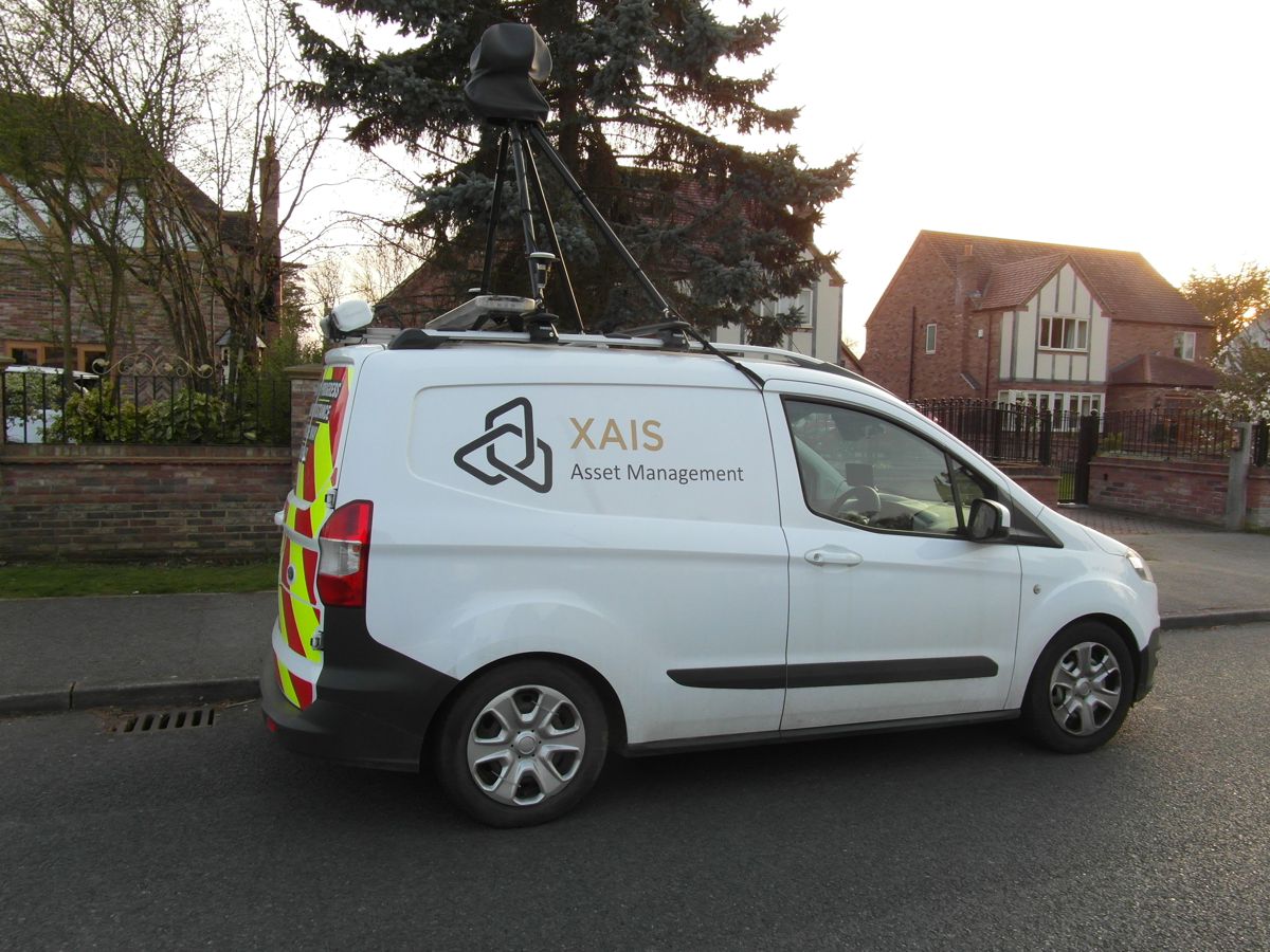
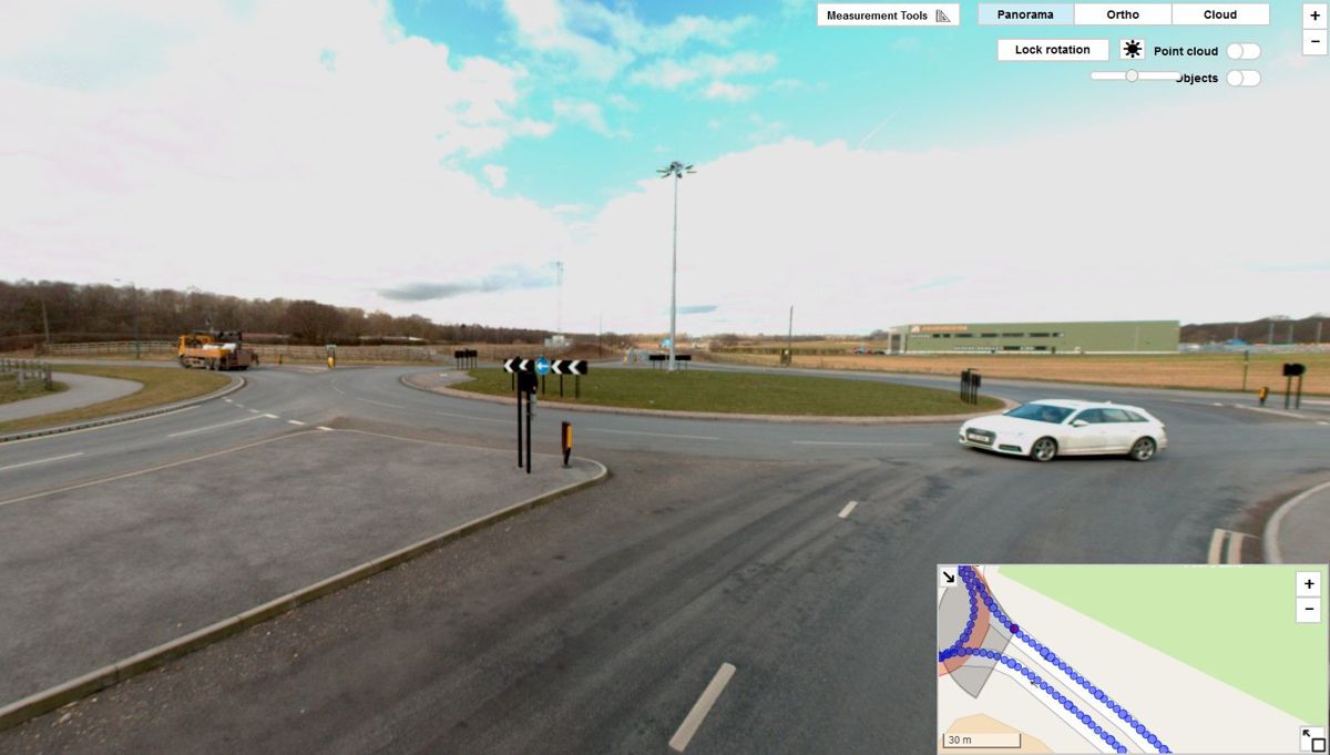
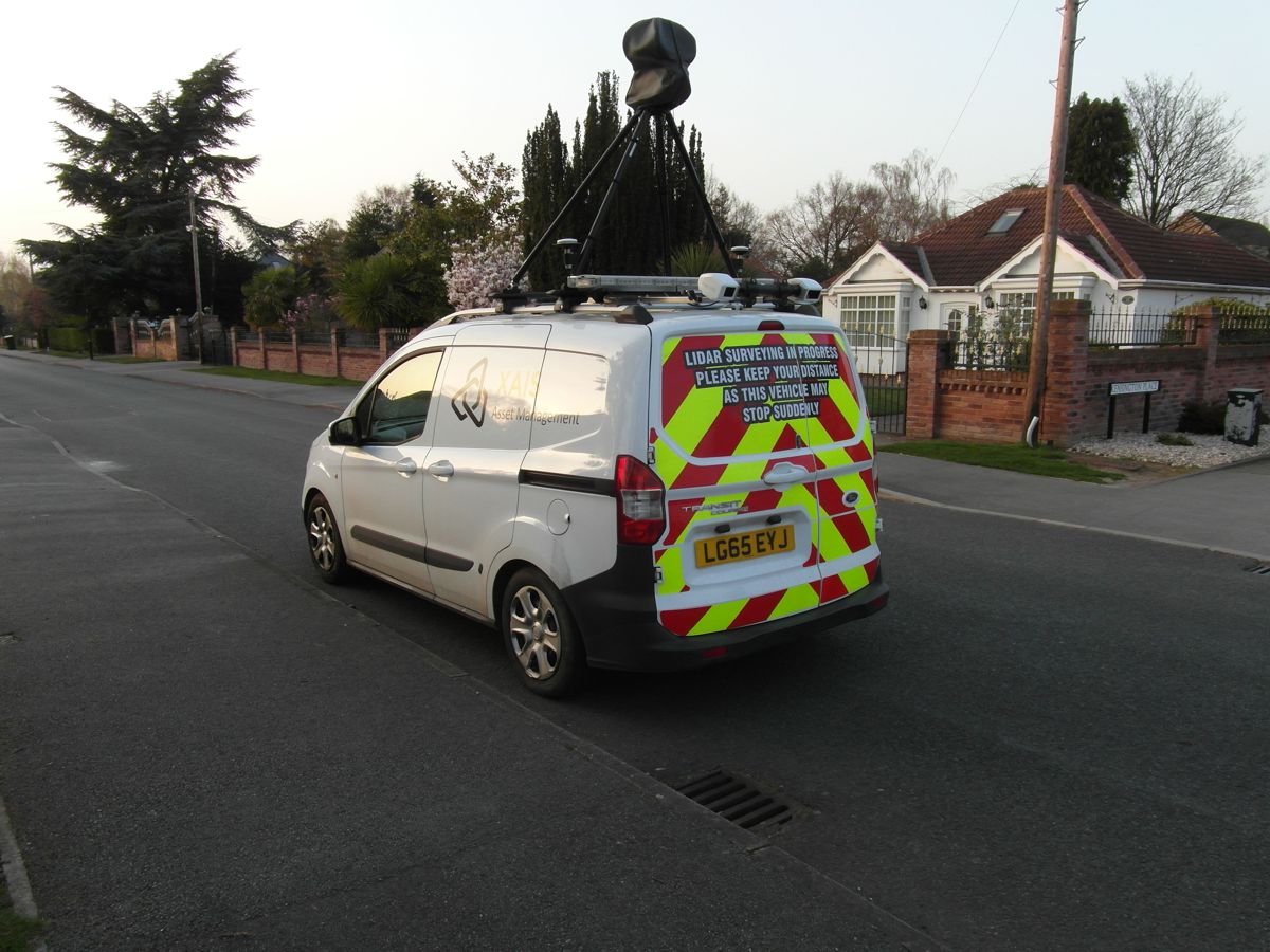
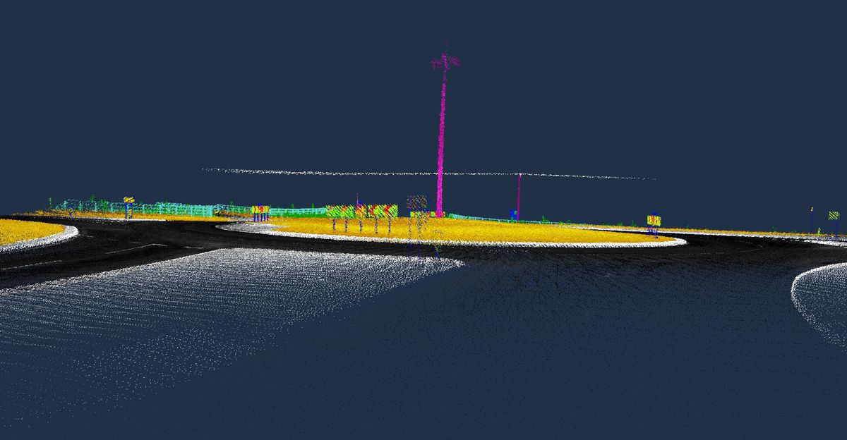
XAIS will now use EyeVi’s vehicle-mounted GNSS/INS system, 360° panoramic camera and LiDAR scanner to capture visual infrastructure assets and condition data in unprecedented detail. As the vehicle travels across the relevant sections of the authority’s network, it continuously records high-definition panoramic imagery, orthophotos, GPS and LiDAR point cloud data allowing engineer site visits to be minimised.
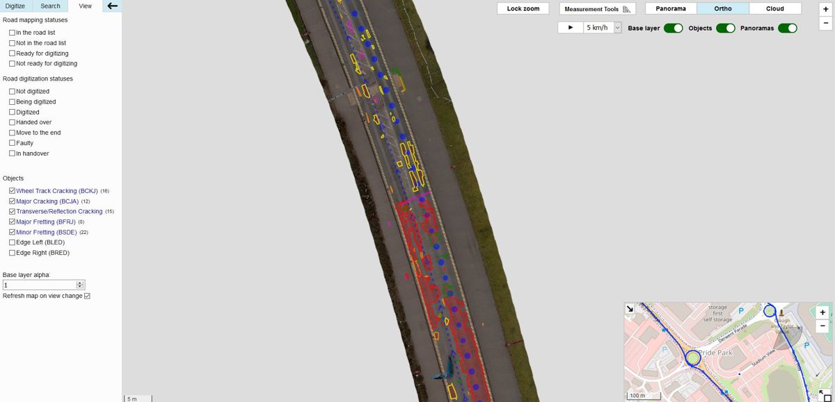
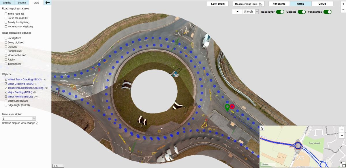
Cutting-edge artificial intelligence technology is applied to detect, measure and highlight defects – data is then uploaded and accessible in the authority’s XA© Asset Management System within one day and on any device. This gives all users of the system an unparalleled overview of current stock and condition.
All the existing benefits of working with XAIS still apply – but with even greater intelligence at the disposal of the highways authority and the XAIS consultancy team.
The digitally captured road data can then be accessed at any time to check/validate the asset inventory and road condition without the need to perform any further inspection work in the field. Easily updatable with a single vehicle pass, data can be used to analyse defects, plan the repair work, compare maintenance scenarios and optimise budgets over the entire lifecycle of each asset. XAIS iV continues the XAIS software ethos of “made by engineers for engineers” with measurement tools and other practical solutions for managing the infrastructure asset.
Perfect synergy. Specific expertise.
XAIS and EyeVi are aligned with a shared mission: to help highway authorities make more informed, practical engineering decisions through the effective use of data. However, until now they have operated at opposite ends of the asset management process, meaning prospective clients have not been able to truly maximise the opportunity presented by the latest technological advances.
As a result of this partnership and the system compatibility it brings, authorities can now combine state-of-the-art geospatial data with the ultimate in asset management software and infrastructure engineering expertise. And with data secure and accessible from any device, anywhere – XAIS iV becomes the one source of accurate data for highway authorities.
James Wallis, Executive Director at XAIS Asset Management, said: “With the combined benefits of two world leaders in their fields, the result is even greater than the sum of the parts. The seamless integration of the two products provides highway authorities with a truly full-service engineering solution for road infrastructure asset management. It delivers accurate, up-to-date information which enables highly informed decision making and minimises the need for site attendance until work is scheduled.
“At a time when public sector budgets are under increased pressure there is a need to demonstrate the adoption of technology-based efficiencies. This more accurate, fully digitised approach to infrastructure management and maintenance will be a game changer for highway authorities.
“While some highway authorities are data rich / information poor, the use of XAIS iV increases the use of the information available from the data, ensuring decision making is more evidence-based, the chosen approach is optimised and the reduction in man-hours is significant. What is more, our initial offering is only scratching the surface in the ways this technology can be embraced to ultimately change the way cities, towns and counties approach their transport strategy.”
Gaspar Anton, Founder & CEO at EyeVi Technologies, added: “The partnership between EyeVi and XAIS is more than a combination of two products. Both companies share the same dream of making road infrastructure management sustainable. I have been pursuing this vision through EyeVi with the expert know-how of my team in the geospatial field, while XAIS has focused its deep knowledge of road engineering into its road asset management platform development. By working together, we can make a great leap in efficiency in this sector through the technological edge that our combined solution bring. We can save hundreds of millions of pounds a year in the UK alone, by predicting road damage before it occurs and giving the authorities a smarter way to manage their road assets.
“I have a strong belief that through our partnership we can genuinely affect the whole industry. We are already able to bring efficiency gains to ongoing processes in road asset management and we are working together towards the next innovations in digital road infrastructure sector in the years to come.”
Cutting-edge solutions for highways authorities
The need for high-quality, regularly updated and cost-efficient digital data is rising rapidly.
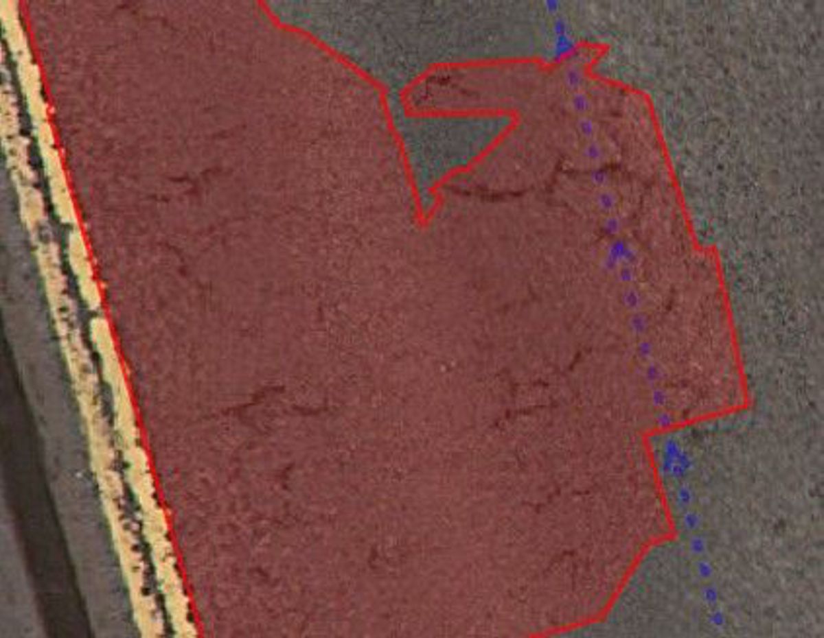
Keeping track of assets and preventing avoidable degradation is a must for local authorities. By capturing environments digitally, they can track defects, calculate costs and analyse vast amounts of road infrastructure data at high speed with AI classification and AI defect detection.
EyeVi provides on-demand mapping technology for transport infrastructure management, consulting and solutions companies. It has been used across five continents and over 150,000 km of data has been processed.
To aid predictive road maintenance it can be used to regularly and consistently capture fresh data, inspect road conditions and catalogue defects and asset inventory. Its AI feature extraction can be used to highlight those defects and attributes, register roadside objects, record accurate measurements and more.
One of the key benefits of the accurate HD visuals and the AI-driven defect detection is consistency. There is no variation, discrepancy or contrasting interpretations as is common when humans cover the same surface. The result is data you can completely trust.
XAIS, through its XA© Asset Management System software platform, provides the ability to capture, manage, integrate and analyse all information about a road infrastructure portfolio in one secure online platform. It enables long-term lifecycle planning – using digitally captured data to make strategic decisions and plan treatments to extend the life of the assets in the most cost-effective way possible. This is backed by a team of expert engineering consultants to support strategy, decision making and implementation to optimise budgets over the long term.
The future of road infrastructure asset management
Initially, XAIS and its clients will use EyeVi technology to automate a previously manual, or disjointed digital process, to bring accuracy and efficiency savings to the public sector’s asset management approach.
However, its potential is far greater. The LiDAR system is continuously recording point cloud data which presents almost limitless possibilities. Ultimately providing authorities with comprehensive 3D mapping of their entire infrastructure network.
Whether that be for more accurate measurements, bridge heights, clearance profiles, location coordinates and geometry of road signs and roadside objects, safety barriers (VRS), embankments, drainage, visibility analysis and more.
Tangible, explorable, visual representations on their screens – not ageing lists or estimated figures allowing margin for error. The potential uses for this would be endless – empowering decision-making with the most comprehensive and accessible data ever available. Technology that could enable the evolution of road safety, traffic management, smart cities and autonomous vehicle use.