


Mapping Underwater Terrain with Autonomous Boats Researchers at The University of Texas at El Paso have c ...
-
Mapping Underwater Terrain with Autonomous Boats
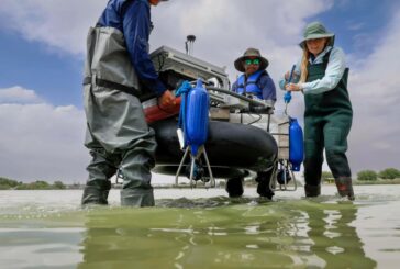
Mapping Underwater Terrain with Autonomous Boats
-
Finding the Safest Routes in Cities with new Mapping Algorithm

Finding the Safest Routes in Cities with new Mapping Algorithm
-
Transforming Unmanned Navigation and Robotics Integration with GNSS/INS Sensors

Transforming Unmanned Navigation and Robotics Integration with GNSS/INS Sensors
-
Revolutionising Underwater Surveying, Mapping and Inspection

Revolutionising Underwater Surveying, Mapping and Inspection
-
GeoPlace helping to launch Underground Pipe and Cable Digital Maps
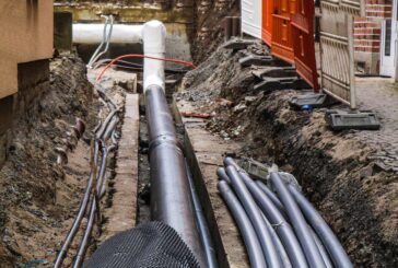
GeoPlace helping to launch Underground Pipe and Cable Digital Maps
-
New book explores Designing Map Interfaces to build effective Map Apps

New book explores Designing Map Interfaces to build effective Map Apps
-
New Fugro contract in Louisiana to focus on Safe and Sustainable Roads
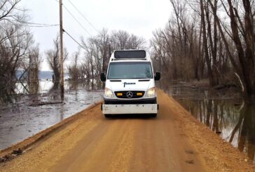
New Fugro contract in Louisiana to focus on Safe and Sustainable Roads
-
Revolutionized approach to Mapping is essential and unavoidable
Revolutionized approach to Mapping is essential and unavoidable
-
Esri to provide Malta with GIS Technology and Training

Esri to provide Malta with GIS Technology and Training
-
Esri joins Overture Maps Foundation to build Interoperable Open Map Data

Esri joins Overture Maps Foundation to build Interoperable Open Map Data
-
Czech Railway to use Ness Digital Maps built on Hexagon technology

Czech Railway to use Ness Digital Maps built on Hexagon technology
-
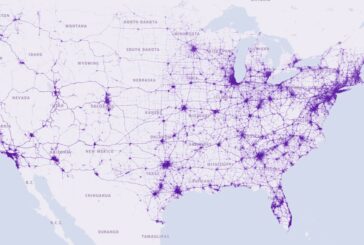
GIS data solutions for the Nevada Department of Transportation
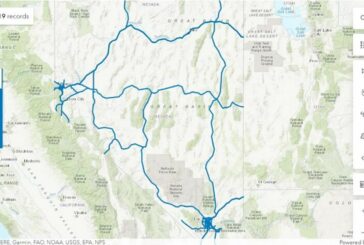
GIS data solutions for the Nevada Department of Transportation
-
Exodigo and Esri partner to Improve Underground Mapping

Exodigo and Esri partner to Improve Underground Mapping
-
Esri and Digital Earth Africa partner to support Sustainable Growth

Esri and Digital Earth Africa partner to support Sustainable Growth
-
MFE Inspection Solutions partners with Emesent for Autonomous LiDAR Mapping
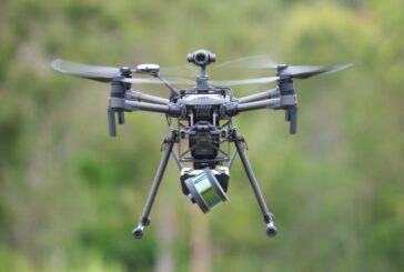
MFE Inspection Solutions partners with Emesent for Autonomous LiDAR Mapping
-
BlackSky partners with Esri for Dynamic Satellite Tasking for ArcGIS

BlackSky partners with Esri for Dynamic Satellite Tasking for ArcGIS
-
Aeva 4D LiDAR Technology helping NASA to Map the Moon

Aeva 4D LiDAR Technology helping NASA to Map the Moon
-
Esri StoryMaps brings sophisticated Mapping Technology to Storytelling

Esri StoryMaps brings sophisticated Mapping Technology to Storytelling
-
Subsurface Utility Mapping Tools to map Subsurface Infrastructure

Subsurface Utility Mapping Tools to map Subsurface Infrastructure
-
Esri updates Land-Cover Maps with new global datasets

Esri updates Land-Cover Maps with new global datasets