GeoPlace helping to launch Underground Pipe and Cable Digital Maps
GeoPlace has provided expert resource to support the creation of the National Underground Asset Register (NUAR) which is being launched by the Geospatial Commission, part of the Department for Science, Innovation and Technology (DSIT), today.
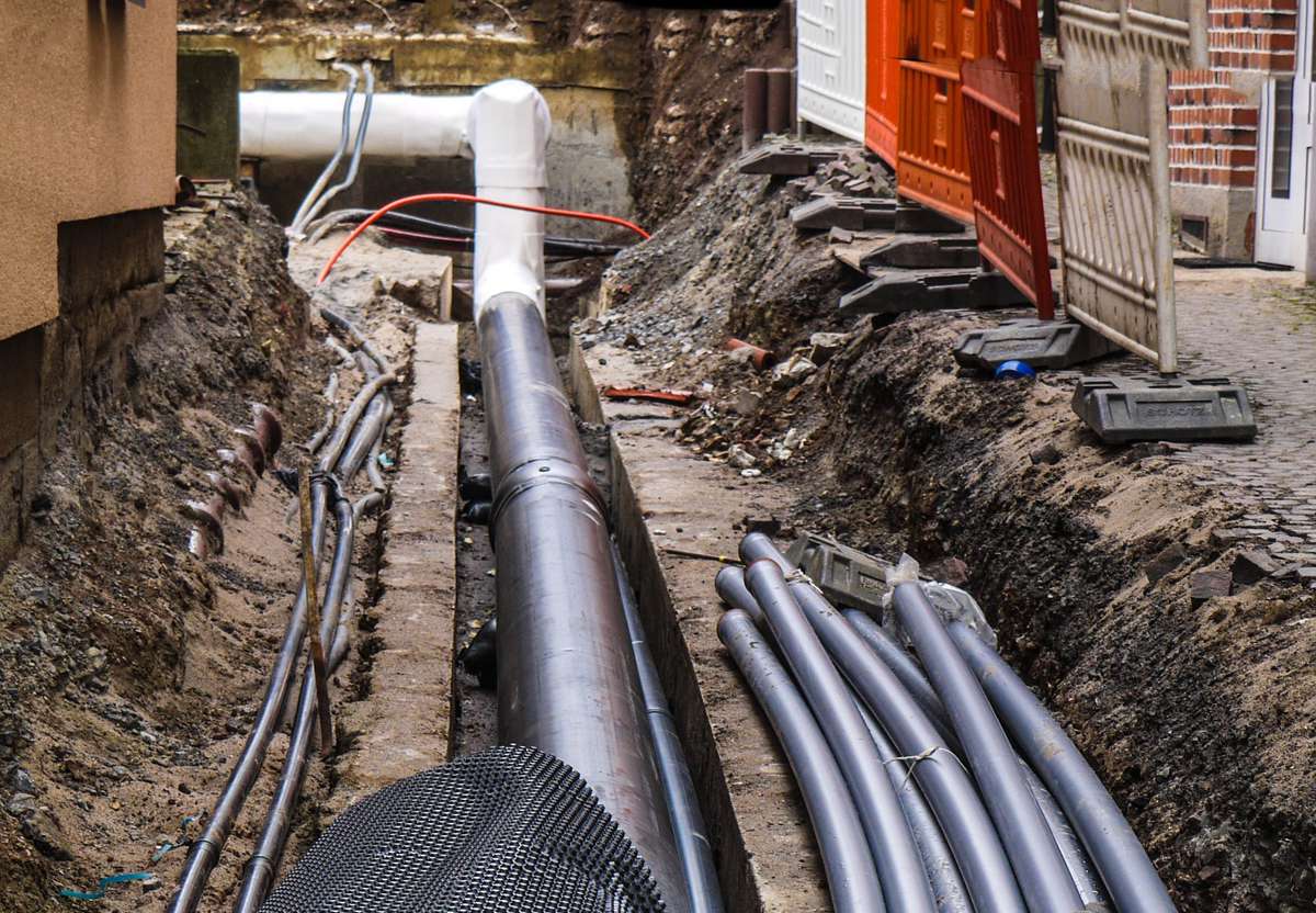
NUAR is a revolutionary underground digital map to support economic growth, improve safety and reduce delay:
- Accidental strikes on the pipes and cables beneath our feet cost the UK economy £2.4 billion each year and put workers’ safety and lives at risk
- The National Underground Asset Register (NUAR) is envisaged to deliver at least £350 million per year of economic growth through increased efficiency, reduced asset strikes and reduced disruptions for citizens and businesses
- The first phase of the NUAR has been launched covering North East England, Wales and London, and the service is on track to deliver across the rest of England and Northern Ireland in 2024/25.
GeoPlace has provided advice to the Commission as well as specifically supporting the Asset Owner Engagement Team focussing on working with local authorities. The aim is to help them understand the benefits of NUAR and put in place the necessary agreements to allow data to be provided from authorities to NUAR.
DSIT Minister, Viscount Camrose, visited industry representatives and asset owners in Newcastle for the launch to discuss the current challenges that they face and the opportunities that NUAR provides.
This first phase of NUAR contains data from the public and private sector organisations who own pipes and cables in North East England, Wales and London. This includes all of the major energy and water providers, such as Northumbrian Water, Wales and West Utilities, Southern Electric Power Distribution and National Grid, as well as smaller providers of these services, telecommunications companies, transport organisations and local authorities.
Viscount Camrose, Parliamentary Under Secretary of State, Department for Science, Innovation and Technology said: “The government’s National Underground Asset Register will transform how the UK manages its buried infrastructure. This first step towards UK-wide access, starting in North East England, Wales and London, has been achieved through strong collaboration between government and industry and the ingenuity of the programme team in the Geospatial Commission.
NUAR is a tangible example of how this government is driving innovation to improve public services and grow the economy – priorities of both the Department for Science, Innovation and Technology, and the Prime Minister. It will help us expedite projects like new roads, new houses, and broadband roll-out.”
This first phase, also known as the ‘minimum viable product’ (MVP), is available to eligible organisations in the three areas. It is intended to complement current business practices initially and will allow users to both plan for future adoption and provide valuable feedback to enhance the service further.
Dr Steve Unger, Independent Commissioner, Geospatial Commission, said: “This first release of NUAR is a major milestone in a programme that will benefit everyone. By using the power of location data to plan and deliver street-works more effectively, it will improve the efficiency with which we supply essential services and it will minimise the disruption experienced by other road users. Many different asset types are buried beneath our feet, owned by many different organisations, large and small. We are delighted by the number of asset owners that have recognized the value of working with us, to make the data that they hold more accessible.
And this release is just the start! Whilst it contains data from over 70 organisations, we have already received data from over 100 more, and we are working with many more than that to progress their involvement in the programme. I urge any asset owner that is not yet engaging with us to do so as soon as possible, to start benefiting from the service and ensure it best meets their needs.”
Once fully operational across England, Wales and Northern Ireland, NUAR will help improve efficiencies in construction and development, reduce disruption to the public and businesses (from extended road closures and congestion), improve workers’ safety and is envisaged to deliver at least £350 million economic growth per year.
Steven Brandwood, Director of Engagement, GeoPlace said: “We are pleased to be able to provide our experience in working with local government to create and maintain national geospatial datasets to help get this important national data set launched.”
Simon Hamlyn, CEO, Chartered Institution of Civil Engineering Surveyors, said: “NUAR will certainly improve public welfare and society in general and is without doubt, definitely the right thing to be doing, now and for future generations.”
Colin Sawkins, Assurance and Enabling Specialist, Cadent Gas Limited, said: “The ability to be able to virtually search for all available assets prior to excavating for a gas or water leak or other similar urgent works puts the operatives in a far superior position to aid in their avoidance of damaging underground assets.”
Bob Wood, Technical Systems Manager, Darlington Borough Council, said: “Engineers preparing schemes will have instant access to asset owners’ records and will be able to produce a single plan, rather than compiling it from a variety of sources.
As an asset owner we will no longer have to answer individual requests for plans. Our records will be in NUAR and obtainable direct from there.”
Thomas Davies, Senior Civil Engineer, Powys County Council said: “This is a hugely positive step into utility information and will speed up how we access information.”
There is estimated to be around 4 million kilometres of buried pipes and cables in the UK, and a hole dug every 7 seconds to install, fix, maintain or repair these assets that are critical in keeping the water running, gas and electricity flowing and our telecommunications lines connected. Approximately 1 in every 65 holes dug results in an accidental asset strike (c. 60,000 a year), causing around £2.4 billion worth of economic cost, putting workers’ lives at risk and disrupting our day-to-day lives.
There are 650+ asset owners across the public and private sectors (including energy, water and telcos) who hold data about their own assets, which they are required by law to share for the purposes of ‘safe digging’. However, currently there is no standardised method to do this with multiple organisations having to be contacted for each dig, providing information in varied formats, scales, quality and on different timelines resulting in a complex and inefficient process for installing, maintaining, operating and repairing buried assets.
NUAR is a government-led programme creating a single, comprehensive data-sharing platform on the location and condition of underground assets. The fundamental purpose of NUAR is to streamline the data-sharing process, reduce the risk of potentially lethal utility asset strikes and promote more efficient management and maintenance of underground assets.
The MVP will provide the first cohort of users in North East England, Wales and London with access to the emerging platform. In line with the Government Service Standard, the Geospatial Commission is committed to iterative delivery where users are placed at the centre of product and service design, and are given access to core functionality early and often to help ensure the service best meets user needs and expectations. NUAR will be iteratively enhanced until it is fully operational, including the service’s features, as well as data completeness, coverage and currency, and user base
NUAR will operate across England, Wales and Northern Ireland. Scotland already benefits from a system of this kind and the Geospatial Commission has worked closely with colleagues in the Scottish Government on this development.
Following a competitive procurement round, the Geospatial Commission appointed Atkins to deliver the ‘build phase’ of NUAR. Atkins are working with Ordnance Survey, 1Spatial, GeoPlace and the Greater London Authority.
This NUAR ‘build phase’ follows two pilots in North East England and London which ran between 2019 and 2021. The North East England pilot was initiated following Northumbrian Water Group’s 2018 Innovation Festival, with Ordnance Survey leading the delivery. The London pilot was led by the Greater London Authority.