Bathymetric Lidar Reveals the Hidden Landscape of Utah’s Great Salt Lake
Beneath the shallow, increasingly unpredictable waters of Utah’s Great Salt Lake lies a landscape that scientists are beginning to map in unprecedented detail. Submerged microbialite formations, geological structures and areas of exposed lakebed are being examined through an ambitious aerial surveying programme, using laser technology capable of measuring underwater terrain where conditions allow.
The work comes as the lake’s long-term decline continues to expose extensive areas of sediment, raising concerns about migratory bird habitats, airborne dust and the management of water resources across the surrounding region. For surveyors, the task is particularly demanding. Shifting shorelines, variable water clarity and extensive shallow areas complicate the collection of reliable measurements, while the lake’s changing physical environment makes comparisons with historical mapping increasingly difficult.
A collaborative project involving the Utah Geological Survey, Aero-Graphics and Dewberry is addressing these challenges through bathymetric lidar, complementary survey techniques and advanced geospatial processing. The findings will be explored during a keynote presentation at Geo Week 2027, taking place from 23 to 25 February at the Salt Palace Convention Center in Salt Lake City.
Briefing
- The Utah Geological Survey and its partners are undertaking detailed bathymetric mapping of the Great Salt Lake.
- Aerial survey work has covered approximately 400 square miles of the lake’s southern arm, alongside selected wetland areas.
- Preliminary findings include detailed microbialite formations, desiccation-related polygons and previously unidentified geological features.
- Green-wavelength bathymetric lidar is being used alongside complementary survey and processing techniques.
- The project’s technical challenges and scientific findings will feature in a Geo Week 2027 keynote.
Mapping a Landscape Beneath the Water
The Great Salt Lake presents an unusual surveying environment, combining shallow water, high salinity, fluctuating shorelines and geological features that have not always been adequately represented in existing elevation datasets. Traditional mapping provides an understanding of the lake’s general form, but detailed information about submerged terrain has historically been more difficult to obtain.
According to the Utah Geological Survey, aerial data acquisition began across nearly 400 square miles of the lake’s southern arm in spring 2025, together with three wetland areas east of the lake. The programme is intended to improve the quality of available lakebed elevation information and provide researchers with a more detailed representation of features that are difficult to examine through conventional approaches.
Preliminary findings described by the Geological Survey include microbialite formations, large polygons associated with desiccation processes and previously unidentified mounds that may be related to groundwater springs. These observations offer new opportunities to investigate the lake’s geological and ecological characteristics, although further interpretation and verification will be necessary before the origins of some features can be established with confidence.
Microbialites are particularly interesting because they form part of the Great Salt Lake’s distinctive aquatic environment. Created through processes associated with microbial communities, these structures can provide important habitat within saline ecosystems. Their distribution and physical characteristics are therefore relevant to research into the lake’s ecology as well as its underwater geology.
The ability to examine such features in greater detail is one of the principal advantages of high-resolution bathymetric surveying. Rather than relying entirely on widely spaced depth measurements or older terrain models, researchers can begin to investigate the shape and distribution of underwater structures across larger areas, subject to the coverage and quality of the acquired data.
The Challenges of Bathymetric Lidar
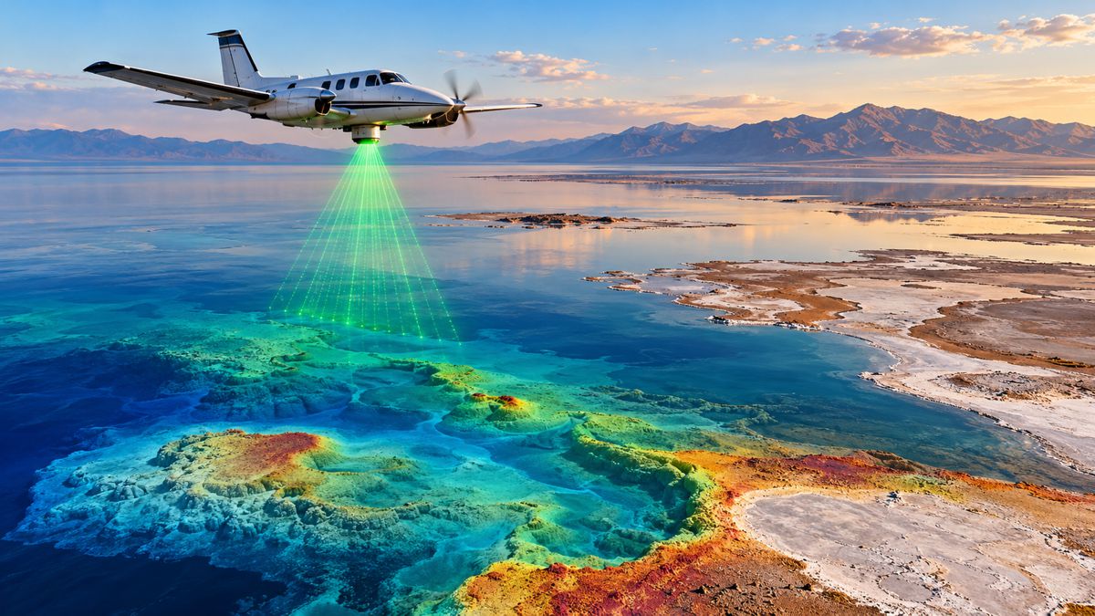
Bathymetric lidar measures underwater topography using laser pulses transmitted from an airborne platform. Whereas conventional topographic lidar generally employs near-infrared wavelengths to measure exposed ground and structures, bathymetric systems use green-wavelength light capable of penetrating water under suitable conditions.
By analysing the timing of reflected laser signals, surveyors can calculate water depths and develop three-dimensional representations of submerged terrain. The technique is particularly useful across shallow water environments where conventional vessel-based surveying may be difficult, although its effectiveness depends on water clarity, depth, surface conditions and the characteristics of the lakebed.
Those limitations are especially pronounced at the Great Salt Lake. Suspended sediment and other material can scatter or absorb laser energy before it reaches the bottom, reducing the depth and reliability of the measurements. Conditions can also vary considerably across the lake, requiring survey teams to plan acquisition around the areas and periods most likely to produce useful results.
Water-level fluctuations introduce another complication. Across the lake’s broad, shallow margins, relatively small changes in elevation can move the shoreline substantially, altering the boundary between exposed terrain and submerged ground. Survey datasets collected at different times must therefore be carefully referenced and interpreted if they are to support meaningful comparisons.
The project combines aerial acquisition, multi-sensor planning and advanced processing to address these difficulties. Aero-Graphics brings Utah-based aerial surveying expertise, while Dewberry and the Utah Geological Survey are among the organisations contributing to the wider programme. The published project information does not establish the complete sensor configuration or final accuracy achieved across the survey area, and the extent of usable bathymetric coverage should not be confused with the total area flown.
Michael Vanden Berg of the Utah Geological Survey acknowledged the difficulties while describing the detail emerging from successful measurements.
“The challenges of data collection are immense… but where we do get data, that data provides a level of detail about the lakebed never seen before,” he said.
Producing a coherent terrain model from different sources also requires consistent positional referencing, quality control and an understanding of where measurements remain incomplete. These are familiar considerations in hydrographic surveying, reservoir assessment and coastal engineering, but the Great Salt Lake combines them in an environment where both the water and the exposed landscape are continually changing.
Understanding the Environmental Pressures
The Great Salt Lake’s ecological importance extends far beyond Utah. Its wetlands provide habitat for migratory birds travelling across the Americas, while its saline waters support specialised biological communities and economic activities associated with the lake’s natural resources.
Declining water levels have placed increasing pressure on those systems. As previously submerged areas become exposed, wind can mobilise fine sediments from the lakebed, creating potential air-quality concerns for surrounding communities. The extent, composition and behaviour of those exposed surfaces are therefore important considerations in environmental monitoring.
Detailed topographic and bathymetric information can help researchers understand how water moves through the lake’s shallow basins, how wetlands respond to changing levels and where particular geological or ecological features are located. When combined with hydrological observations and other environmental datasets, the mapping may also improve the foundations for modelling future conditions.
The preliminary identification of possible groundwater-related features adds another line of investigation. Establishing whether particular mounds are associated with groundwater discharge would require supporting geological and hydrological evidence, but their detection illustrates how improved terrain data can direct scientific attention towards features that were previously difficult to distinguish.
There are limits to what mapping alone can achieve. Bathymetric lidar cannot determine future water availability, resolve competing demands on the lake’s inflows or establish the environmental consequences of every exposed sediment area. Those questions depend on wider research and management decisions. Accurate terrain information nevertheless provides a more reliable physical framework within which such investigations can take place.
Presenting the Findings at Geo Week 2027
The mapping programme will form the basis of a keynote titled A Lake in Crisis: Mapping Utah’s Great Salt Lake, scheduled for 24 February 2027 during Geo Week in Salt Lake City.
The session will bring together representatives from the geospatial project and the scientific community to examine the difficulties of surveying the lake, the information emerging from the work and the questions that remain unanswered.
Kelly Francis, Co-President of Aero-Graphics, will moderate the discussion. She will be joined by Bonnie Baxter, Director of the Great Salt Lake Institute at Westminster College; Josh Novac, Associate Vice President and Program Manager at Dewberry; and Michael Vanden Berg, Energy & Minerals Program Manager at the Utah Geological Survey.
Francis described the broader importance of understanding the lake’s changing physical environment.
“The Great Salt Lake is local to Utah. Its importance is not. Its wetlands support migratory species across the Americas. Its changing water levels affect ecosystems, communities, industry, and the surrounding environment. Understanding those consequences begins with understanding the physical landscape itself,” she said.
The panel is expected to discuss survey methodology, the challenges of working in turbid and variable water conditions, and what the resulting data reveals about microbialite structures, wetlands, lakebed morphology and geological features. Future research requirements will also form part of the discussion.
Geo Week brings together professionals involved in surveying, geospatial data acquisition, mapping and related technologies. The Great Salt Lake project offers a substantial technical case study, particularly for specialists working with difficult underwater environments and datasets that must remain useful as physical conditions change.
Establishing a Record of a Changing Lake
The immediate achievement of the Great Salt Lake mapping programme is the ability to examine parts of its underwater landscape in considerably greater detail than was previously possible. As researchers interpret the emerging data, features that were poorly represented in historical surveys can be investigated with a clearer understanding of their shape, distribution and relationship to the surrounding terrain.
Future surveys could extend that record, allowing scientists to compare measurements collected under different conditions and identify changes that might otherwise remain difficult to detect. Such comparisons will depend on consistent survey methods, documented accuracy and careful treatment of areas where water conditions prevent reliable measurements.
For a lake whose shoreline can move substantially as water levels fluctuate, establishing that physical record is an important undertaking. The new mapping will not determine the Great Salt Lake’s future, but it can provide researchers with a more detailed account of the landscape against which that future will unfold.
Key Industry Questions
- What is bathymetric lidar? Bathymetric lidar is an airborne surveying technique that uses green-wavelength laser pulses to measure underwater terrain. It is particularly effective in relatively shallow, clear water, although depth and turbidity can limit its performance.
- How large is the Great Salt Lake mapping project? The Utah Geological Survey has described aerial acquisition across approximately 400 square miles of the lake’s southern arm, together with three wetland areas east of the lake. This figure describes the survey programme rather than necessarily indicating complete validated underwater coverage.
- What has the survey discovered? Preliminary findings include detailed microbialite formations, desiccation-related polygons and previously unidentified mounds that may be associated with groundwater springs.
- Why is the Great Salt Lake difficult to survey? Variable water clarity, suspended material, high salinity, extensive shallow areas and fluctuating shorelines complicate data acquisition and the interpretation of measurements collected at different times.
- Can bathymetric lidar operate in turbid water? Its performance declines as suspended material scatters and absorbs laser energy. Alternative or complementary survey techniques may be required where the laser cannot reliably reach the lakebed.
- Why are microbialites important? Microbialites are structures associated with microbial activity. In the Great Salt Lake, they form part of the underwater environment and are relevant to research into the lake’s ecology and geological processes.
- How can lakebed mapping support environmental management? Accurate elevation data can contribute to hydrological modelling, wetland assessment, habitat research and the monitoring of exposed lakebed surfaces when combined with other environmental information.
- When will the findings be presented at Geo Week? The keynote A Lake in Crisis: Mapping Utah’s Great Salt Lake is scheduled for 24 February 2027 at the Salt Palace Convention Center in Salt Lake City.
Strategic Takeaways
- Bathymetric lidar can provide high-resolution terrain measurements across shallow aquatic environments, but water clarity remains a fundamental operational limitation.
- Combining aerial acquisition with complementary survey methods can improve coverage where individual technologies encounter difficult conditions.
- Detailed mapping of microbialites and geological formations can support investigations that were previously constrained by limited underwater terrain information.
- Repeatable elevation datasets can provide a stronger foundation for monitoring environments affected by fluctuating water levels.
- Survey accuracy, coverage and consistent referencing are essential when geospatial information is used to support environmental research and management.