Industrial Drones Become Flying Sensor Platforms in Canada
The industrial drone is becoming less important than what hangs underneath it.
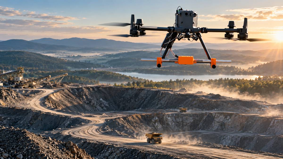
Across surveying, mining, utilities and environmental monitoring, increasingly specialised instruments are being adapted to fly aboard commercial UAV platforms. Ground-penetrating radar can search below the surface, magnetometers can map variations in magnetic fields, echo sounders can measure water depth, methane detectors can inspect for gas emissions, and gamma-ray spectrometers can undertake radiometric surveys.
SPH Engineering’s decision to expand its Canadian partnership with Measur, a division of The Hoskin Group, reflects the increasingly specialised ecosystem developing around these applications. Measur has been appointed Master Distributor in Canada for a selected portfolio of SPH Engineering sensor systems covering mining, hydrography, geophysics, oil and gas, utilities and environmental monitoring.
The equipment being distributed bears increasingly little resemblance to the conventional perception of a drone survey. Rather than simply putting a camera in the air, these systems combine an aircraft, specialist scientific instrument, positioning information, flight-planning software and data-processing workflow into a surveying platform.
Buying a capable drone is relatively straightforward. Building a dependable airborne measurement system around it is considerably more complicated.
Briefing
- Measur has become SPH Engineering’s Master Distributor in Canada for selected specialised drone sensor systems.
- The portfolio includes sonar, echo sounders, magnetometers, ground-penetrating radar, methane detection and gamma-ray spectrometry.
- Applications extend across mining, hydrography, utilities, geophysics, environmental monitoring and oil and gas.
- Measur will provide Canadian customers with product selection, demonstrations, training and first-line technical support.
- The agreement expands a relationship dating back several years, with Measur already established as a significant distributor of SPH Engineering technology.
Beyond Aerial Photography
Commercial drones initially established themselves in construction and surveying largely through photography and photogrammetry. LiDAR subsequently extended their ability to capture accurate three-dimensional information, while specialist payload integration is now pushing UAVs into areas previously occupied by very different pieces of surveying equipment.
The portfolio being represented by Measur includes EchoNIMBUS multibeam and side-scan sonar payloads, EchoLogger echo sounders, MagNIMBUS and SENSYS MagDrone magnetometers, Zond Aero ground-penetrating radar systems, Falcon Plus methane detectors and Medusa Radiometrics gamma-ray spectrometers.
These instruments measure fundamentally different physical phenomena. Some look beneath the ground, others below water. Magnetometers measure magnetic fields, while methane detectors and radiometric instruments turn the aircraft into airborne environmental or geophysical sensing platforms. Making those combinations work requires an integration architecture around the sensor and aircraft.
Measur describes SPH Engineering’s SkyHub onboard computer and UgCS flight-planning software as an integration layer between commercial drone platforms and specialist sensors. SkyHub can combine sensor output with aircraft positioning information, geotag measurements and record mission data locally, while the flight system controls the aircraft according to the requirements of the survey.
This becomes particularly important when a sensor needs to maintain a controlled relationship with the surface rather than simply fly at a conventional altitude.
Taking Ground Radar into the Air
Traditional ground-penetrating radar systems are commonly moved across the surface on carts or other ground-based platforms. The equipment transmits electromagnetic pulses and measures reflections produced by changes in subsurface dielectric properties, potentially identifying objects, interfaces and other features below the surface.
Moving the radar onto a UAV changes the operating environment. The antenna can cross ground that may be difficult, dangerous or impractical for a person or vehicle to traverse, but maintaining the correct altitude, flight line and sensor position becomes critical to the quality of the survey.
SPH Engineering’s ZondAero family has been developed for this type of airborne operation. Different antenna frequencies trade penetration depth against resolution, allowing systems to be configured for applications ranging from shallow high-resolution investigations to deeper geophysical surveys.
The Zond Aero 500, for example, uses a 500 MHz shielded antenna and can be mounted on medium-sized enterprise UAVs. Measur’s technical documentation also makes clear that the radar itself is only one part of the installation, with additional components and software required to create a complete airborne GPR system. It is a useful illustration of why specialist drone distribution increasingly involves more than putting equipment in a catalogue.
Surveying Water Without a Boat
Bathymetry presents a different operating environment. Echo sounders measure water depth acoustically and have traditionally been deployed from boats or other surface platforms. Suspending suitable equipment beneath a drone creates another option for locations where putting people or vessels onto the water may be difficult.
A Canadian project provides a practical example. In July 2024, Altomaxx Technologies carried out a UAV bathymetric survey of the Bow River in Calgary using an SPH Engineering integrated bathymetry kit equipped with an EchoLogger dual-frequency echo sounder. The work was undertaken to obtain water and sediment depth information supporting riprap calculations for a bridge expansion project.
The fast-moving river presented an environment where conventional vessel-based bathymetry would introduce additional operational and safety considerations. Instead, the measurement instrument was taken to the survey area from the air.
Multibeam systems extend that capability further. Measur’s current portfolio includes compact multibeam echo sounders intended for UAV deployment, capable of gathering underwater topographic information for hydrographic surveys, waterway inspection and environmental monitoring. In practical terms, the aircraft becomes one component of a hydrographic surveying system rather than the centre of the operation.
Sensors Become the Differentiator
Airborne magnetometers can support mineral exploration, detection of buried metallic objects and other geophysical investigations. Methane detectors allow UAVs to inspect pipelines, tanks, landfills and other assets while keeping the sensor and operator away from potentially hazardous areas, while gamma-ray spectrometry extends the platform into radiometric surveying.
The value of these systems lies in matching the aircraft to the sensor, integrating the instrument with positioning and flight-control systems, designing an appropriate mission and ensuring that the resulting information enters the professional workflow correctly.
“Specialized drone operations are rarely about the drone alone. The value comes from combining the right sensor, workflow, and application expertise for a specific industrial task,” said Janis Janums, Partnership Director at SPH Engineering. “By expanding our partnership with Measur, we are bringing that expertise closer to customers in Canada and creating a stronger local setup for industries where reliable field data is critical.”
Building Canadian Technical Support
The Canadian agreement consequently includes considerably more than product distribution. Measur will provide customers with assistance in solution selection, demonstrations, end-user training and first-line technical support, with dedicated in-house expertise for customer training. SPH Engineering will provide Measur with product training, certification and technical resources.
That arrangement is particularly relevant for instruments whose usefulness depends heavily on correct deployment. Selecting a radar frequency, configuring a magnetometer survey or integrating an echo sounder into a UAV mission requires knowledge extending beyond piloting the aircraft.
Measur already has experience developing this part of the market. Its relationship with SPH Engineering dates back at least to 2023, when Measur, SPH Engineering and Altomaxx announced a North American partnership covering integrated drone solutions.
By 2024, according to an SPH Engineering case study published the following year, Measur had become one of the company’s largest distributors. SPH reported that the relationship had helped Measur move into projects involving mining companies, government agencies and universities. The Master Distributor appointment therefore represents another stage in an established technical and commercial relationship.
“Our customers are increasingly looking to improve access, safety, and data quality through drone operations in complex industrial environments. Over the past few years, SPH Engineering has proven to share these same priorities. With their continued focus on innovation and exceptional customer experience, expanding our partnership will help Canadian industries advance as leaders across the environmental, energy, and critical infrastructure sectors, backed by strong local support,” said Aaron Dinich, National Sales Manager at Measur.
Justin Warren, Chief Executive Officer of The Hoskin Group, added: “Expanding our partnership with SPH Engineering reinforces our commitment to bringing specialized, innovative drone sensor technologies to customers across Canada.”
A Market Built Around Applications
Enterprise UAVs can now carry a widening range of sensors, from conventional RGB and thermal cameras through LiDAR, water sampling, gas detection, magnetometers, GPR and bathymetric equipment. That diversity changes the purchasing conversation.
A mining company looking for magnetic survey capability is not fundamentally shopping for a drone. A utility attempting to locate buried infrastructure is interested in subsurface information. An engineer surveying a river needs dependable bathymetric data, while an operator checking a pipeline for methane needs a measurement system capable of covering the asset safely and efficiently.
As sensors become smaller and integration improves, more instruments that once depended on people, vehicles, boats or larger aircraft can potentially migrate onto UAV platforms. Not every survey will benefit from being airborne, and the limitations of individual sensing technologies remain unchanged simply because they are attached to a drone. Soil conditions still affect radar penetration, water conditions affect hydrographic work, and every sensor has its own requirements for positioning, calibration and interpretation.
What has changed is the number of ways those instruments can now be deployed. The expanded SPH Engineering and Measur relationship is a distribution agreement, but the portfolio behind it shows how far professional drone technology has moved beyond aerial photography and towards specialised industrial measurement.
The most interesting question is increasingly not which drone is flying, but what the drone has been equipped to measure.
Key Industry Questions
- What is a specialised drone sensor platform? It combines a UAV with an application-specific instrument such as ground-penetrating radar, a magnetometer, echo sounder or gas detector, together with the flight-control, positioning and data systems required to conduct the survey.
- Can drones carry ground-penetrating radar? Yes. Lightweight GPR systems such as the ZondAero range are designed for UAV deployment. Their performance still depends on factors including antenna frequency, flight height, ground conditions and survey configuration.
- How can a drone conduct a bathymetric survey? An echo sounder can be carried or suspended from a UAV and used to measure water depth acoustically. Depending on the system and application, this can provide an alternative to putting personnel and surveying equipment aboard a boat.
- What are drone magnetometers used for? Applications include geophysical investigation, mineral exploration and detection or mapping of buried metallic objects. The UAV allows the instrument to follow planned survey lines without requiring a person to traverse the ground.
- Why is payload integration important? A sensor needs more than a physical mounting. Measurements may need to be synchronised with aircraft positioning, accurately georeferenced and collected while the aircraft maintains a suitable height and flight path.
- Does a drone replace conventional surveying equipment? Not automatically. UAV deployment provides another way of carrying measurement instruments and can be particularly useful where access, terrain or safety makes conventional deployment difficult. Suitability depends on the sensor, required accuracy and operating environment.
- What will Measur provide under the Canadian agreement? Its role includes solution selection, demonstrations, end-user training and first-line technical support for the selected SPH Engineering sensor portfolio.
- How long have Measur and SPH Engineering worked together? Their publicly documented North American relationship extends back at least to 2023. SPH Engineering reported that Measur had become one of its largest distributors by 2024.
Strategic Takeaways
- Specialist sensors are becoming a larger part of the value proposition in professional drone operations.
- GPR, magnetometry, bathymetry and gas detection bring very different technical requirements, making integration and application knowledge important parts of the commercial offering.
- UAV deployment can move measurement equipment into locations where conventional ground crews, carts, boats or other platforms face access or safety constraints.
- Local training and technical support become more valuable as drone payloads move from cameras towards specialist scientific and industrial instrumentation.
- The Canadian agreement builds on an established SPH Engineering and Measur relationship rather than creating a new distribution channel from scratch.