Topcon Takes its Geomatics Ecosystem Underground with Proceq GPR
Topcon Positioning Systems is extending its geomatics workflow below ground through a new collaboration with Proceq, bringing ground penetrating radar data into the same positioning and mass-data environment increasingly used to map construction sites and infrastructure.
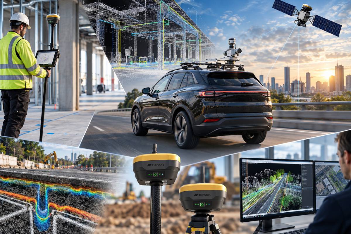
Announced at INTERGEO 2026 in Munich, the agreement will enable Proceq GPR systems to work with Topcon GNSS technology, Topnet Live correction services and Collage Web mass-data workflow software across Europe, the Middle East and Africa. The combination is intended to give detected underground features a precise spatial position and make that information easier to incorporate into wider surveying, engineering and infrastructure datasets.
The individual technologies are already well established. Underground utility detection, however, can produce a specialist dataset that sits apart from topographic surveys, point clouds, design models and other project information. Linking GPR observations directly to accurate coordinates makes it possible to retain a more useful digital record of what exists beneath a site and where it sits in relation to everything above it.
The Proceq agreement also follows a separate Topcon integration with Geophysical Survey Systems Inc. (GSSI) announced in March 2026, combining radar equipment with Topcon positioning, Topnet Live and Collage Web. Two GPR collaborations built around a similar architecture point towards a broader subsurface role for Topcon’s geomatics ecosystem.
Briefing
- Topcon and Proceq are integrating GPR, GNSS positioning and mass-data workflow technologies for customers across EMEA.
- Proceq subsurface data can be combined with Topcon GNSS, Topnet Live correction services and Collage Web.
- Proceq’s GS8000 platform already combines GPR measurements with GNSS positioning and digital mapping capabilities.
- Topcon announced a separate GPR integration with GSSI in March 2026.
- Georeferenced underground information can become part of the digital datasets retained throughout construction and infrastructure projects.
Giving Underground Data Coordinates
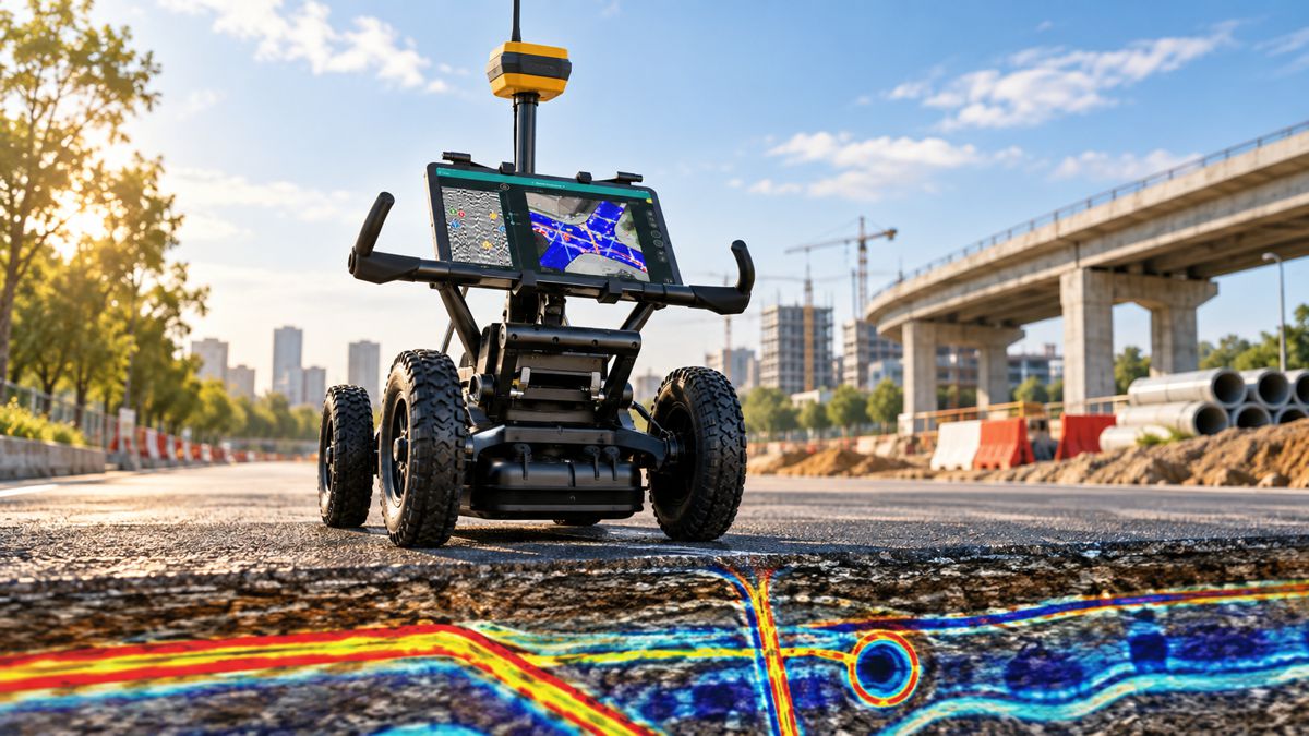
Ground penetrating radar works by transmitting electromagnetic energy into the ground and recording reflections created where the properties of subsurface materials change. Depending on ground conditions, antenna configuration and the target, those reflections can reveal pipes, cables, structures, voids and other features without excavation.
Detection is only part of the surveying problem. Once something has been found, its position needs to be established accurately enough for the information to remain useful.
Proceq has already pushed its GS8000 platform towards that combination of detection and mapping. The system uses stepped-frequency continuous-wave radar technology and incorporates GNSS positioning so that radar observations can be associated with geographic coordinates as they are collected. Proceq describes the platform as both a GPR and surveying tool, capable of digitising detected features and linework onto a 3D map for subsequent CAD and GIS use.
A radar anomaly marked temporarily on a road surface is useful to the crew standing beside it. A georeferenced subsurface feature retained as part of the project record can be used by surveyors, designers, contractors and asset managers long after the original scan has finished.
There are limits to the precision that should be inferred from such a system. The accuracy of a mapped underground object depends on more than the quality of the GNSS coordinates at ground level. Proceq identifies dielectric calibration, positioning quality and the correct coordinate system among the factors affecting the final 3D result, while ground conditions and interpretation of the radar signal remain fundamental parts of GPR surveying.
The technology can also operate where satellite positioning becomes difficult. Proceq says the GS8000 can receive continuous positioning information from third-party terrestrial systems such as robotic total stations, allowing mapped surveys to continue indoors or in other GNSS-restricted environments. It can also operate as a conventional GPR without absolute positioning.
Connecting Field Data to the Project
The Topcon collaboration extends that georeferencing into a larger data environment.
“Proceq provides ground penetrating radar technology, and we are pleased to collaborate with them to deliver advanced, compatible technologies for industry professionals across EMEA,” said Ron Oberlander, head of the Topcon Geomatics and Construction Platforms. “By combining Proceq’s GPR capabilities with Topcon’s GNSS technology, Topnet Live correction services, and Collage Web mass-data workflow software, we are connecting subsurface information with precise spatial context to support more informed analysis and decision-making.”
Collage Web provides the cloud element of Topcon’s mass-data workflow, allowing point clouds and other spatial datasets to be published, visualised and shared through a web environment. It sits alongside a growing reality-capture portfolio covering terrestrial scanning and other forms of spatial data acquisition.
GPR adds information about objects that cannot be seen from the surface. On an infrastructure project, those datasets frequently overlap. Road reconstruction may involve topographic surveying, utility location, pavement investigation, drainage records, existing structures and subsequent machine-control or setting-out operations. Keeping underground observations tied to the same coordinate framework reduces the separation between utility detection and the rest of the survey.
The quality of the underlying data remains critical. GPR does not automatically identify every buried object, and accurate positioning does not remove the need for experienced interpretation and appropriate verification. Performance varies with soil properties, moisture, target material, depth and surrounding conditions, while GNSS depends on satellite visibility, correction availability and the operating environment.
Specialist interpretation therefore remains necessary. The integration improves how the resulting information can be positioned, retained and shared once it has been collected.
A Broader Subsurface Portfolio
The Proceq collaboration follows Topcon’s March 2026 agreement with GSSI, which used much the same architecture. That integration combined GSSI GPR technology with the Topcon HiPer XR GNSS receiver, Topnet Live correction services and Collage Web.
GSSI chief executive Chris Green described the objective at the time as bringing radar and GNSS information together to produce a more complete representation of conditions above and below ground. With integrations now spanning both GSSI and Proceq equipment, Topcon appears to be positioning its geomatics technology as the spatial and workflow layer around specialist subsurface systems.
That fits with the development of its wider geomatics portfolio, where terrestrial scanning, reality capture, GNSS and cloud-based mass-data management increasingly connect field acquisition with processing and downstream engineering systems. GPR brings underground observations into that environment, although the data requires different interpretation and carries different uncertainties from conventional surface surveying.
The practical value grows when those observations survive beyond the original investigation. Construction projects repeatedly rediscover underground infrastructure because records can be incomplete, utilities may have been installed differently from their drawings, and previous investigations are not always retained in a form that can readily be reused.
Digitally positioning GPR findings provides a better foundation for retaining what has actually been observed. Surveyed underground features can be incorporated into CAD and GIS environments, compared with existing records and carried forward as the project develops. Repeated surveys, construction records, utility investigations and reality-capture datasets can then contribute to a progressively richer spatial record of the asset.
“Collaborating with Topcon is a key element of our growth strategy for subsurface intelligence,” said Alexandre Novo, senior vice president, head of Business Unit Subsurface Insights GPR at Proceq. “Together, we are combining Topcon’s global leadership in positioning and geomatics with Proceq’s advanced GPR technology to expand, unlock new markets and applications, and accelerate the digitalization of infrastructure worldwide.”
The commercial ambitions are clear, but the immediate engineering proposition is practical. Precisely locating what a subsurface survey has found, and retaining that information alongside the rest of the project’s geospatial record, gives the next surveyor, engineer or contractor somewhere better to start.
Key Industry Questions
- What is ground penetrating radar? Ground penetrating radar transmits electromagnetic signals into the ground and measures reflected energy from changes in subsurface materials. The resulting data can be interpreted to locate buried utilities, structures, voids and other features.
- Why combine GPR with GNSS? GNSS associates detected subsurface features with geographic coordinates, allowing findings to be mapped, revisited and incorporated into CAD, GIS and other project datasets rather than existing only as radar traces or temporary surface markings.
- What are Topcon and Proceq integrating? The collaboration brings Proceq GPR technology together with Topcon GNSS solutions, Topnet Live correction services and Collage Web mass-data workflow software for applications across EMEA.
- Does Proceq GPR already support GNSS? Yes. The Proceq GS8000 combines radar data with GNSS positioning and can digitally map detected features. The Topcon collaboration expands the positioning and data-workflow options around that information.
- Can GPR be used where GNSS is unavailable? Yes. The GS8000 can operate without absolute positioning as a conventional GPR, while Proceq also supports external terrestrial positioning systems such as robotic total stations for work in GNSS-restricted environments.
- How accurate is mapped GPR information? Accuracy depends on positioning quality, radar interpretation, dielectric calibration, coordinate systems and ground conditions. Precise GNSS coordinates at the surface do not by themselves guarantee equivalent accuracy for an interpreted underground feature.
- Has Topcon integrated with other GPR manufacturers? Yes. Topcon announced an integration with GSSI in March 2026 combining GPR equipment with Topcon GNSS, Topnet Live and Collage Web.
- Where can subsurface mapping data be used? Georeferenced underground information can support utility mapping, construction planning, infrastructure investigation, CAD and GIS workflows, asset records and subsequent survey or engineering work.
Strategic Takeaways
- Subsurface surveying is becoming easier to incorporate into established geomatics workflows as radar measurements are georeferenced at collection.
- Topcon’s agreements with Proceq and GSSI put its positioning and data environment around equipment from two specialist GPR manufacturers.
- Accurate positioning increases the reuse value of underground surveys by allowing observations to become part of persistent project datasets.
- Ground conditions, signal interpretation and verification remain fundamental to GPR survey quality regardless of positioning accuracy.
- Retaining observed underground features alongside wider geospatial records can reduce the need for later project teams to begin investigations with incomplete information.