Topcon Builds the Connected Geomatics Workflow at INTERGEO 2026
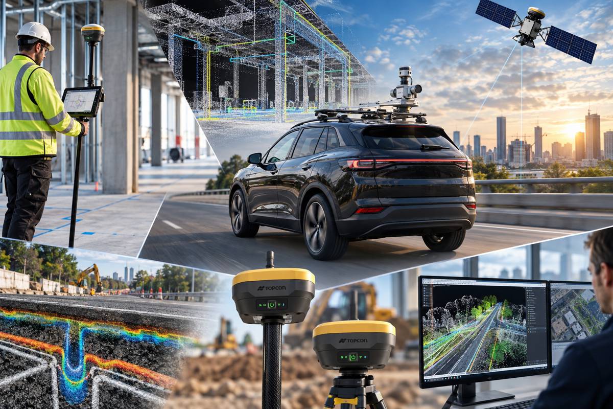
Topcon Positioning Systems has used INTERGEO 2026 in Munich to introduce a substantial expansion of its geomatics portfolio, spanning interior positioning, mobile mapping, GNSS, point-cloud processing, deformation monitoring and subsurface investigation. Individually, the launches address quite different jobs. Taken together, they show where Topcon is putting much of its effort: reducing the boundaries between capturing spatial information, processing it and putting it to work on construction and infrastructure projects.
The portfolio includes the new Origo spatial positioning system for interior layout, CR-M2 mobile mapping platform, HiPer S1 and HiPer V1 GNSS receivers, expanded MAGNET software and a new generation of Delta Watch monitoring technology. Topcon has also extended its subsurface capabilities through a collaboration with Proceq, combining ground penetrating radar with GNSS positioning and mass-data workflows.
Surveying and geomatics have spent years becoming progressively more digital, yet many projects still move information between specialised instruments, software packages, field crews and engineering teams through a series of disconnected steps. Topcon’s announcements at INTERGEO concentrate on making those steps less visible to the user.
Briefing
- Topcon has expanded its geomatics portfolio at INTERGEO 2026 in Munich, held from 15 to 17 September.
- Origo provides interior spatial positioning without requiring prism line of sight or pole levelling.
- The CR-M2 mobile mapping system targets infrastructure, utilities, construction, urban planning and corridor mapping applications.
- New HiPer S1 and HiPer V1 receivers extend Topcon’s GNSS portfolio and support connected and Hybrid Positioning workflows.
- Topcon’s collaboration with Proceq connects ground penetrating radar with GNSS positioning and mass-data software for projects across EMEA.
Moving Layout Away From Line of Sight
Among the more unusual additions is Topcon Origo, a spatial positioning system developed for interior building layout. Conventional optical layout depends upon maintaining line of sight and generally requires equipment to be established and levelled at suitable positions as work progresses through a building.
Origo approaches the job differently. It uses reusable spatial reference maps and a fixed origin to maintain the project reference, while the scanner and controller are carried together on a mobile rover pole. Topcon says this removes the need for repeated station setups and allows points to be positioned without the prism line-of-sight and pole-levelling constraints associated with conventional optical workflows.
Neil Vancans, head of Topcon Geomatics Sales, describes the intention in practical terms: “The increased simplicity and reliability create a vastly more productive layout process, offering an intuitive workflow that is significantly more efficient and easier to operate than traditional optical methods.”
Data can be transferred through MAGNET Enterprise, including reference maps, panoramas and point clouds. An easier positioning instrument has value on its own, but the productivity of the overall process also depends upon what happens to its data before and after someone carries it across a building floor.
Reality Capture Expands Beyond Scanning
Topcon is extending the software available for its Capture Reality CR-S handheld scanning systems. New modules for MAGNET Bridge turn captured point clouds into information intended for specific applications, including trench and pipeline mapping, forestry, road asset extraction and 3D Gaussian splatting.
The CR-M2 takes the same approach into mobile mapping. It is aimed at applications including sewer and drainage planning, underground utilities, fibre-optic network deployment, as-built documentation, infrastructure inventory and condition assessment, corridor mapping and construction monitoring.
In July 2026, Topcon entered a strategic agreement with GreenValley International covering surveying, mapping, construction, forestry and other spatial-intelligence applications. The companies said planned work would include handheld, aerial and mobile LiDAR acquisition and processing, with future developments extending into robotic systems, autonomous monitoring and real-time cloud processing and transfer.
The CR-M2 sits comfortably within that approach. Different methods of spatial capture can feed common processing and data environments, allowing the appropriate sensor to change while more of the downstream workflow remains familiar.
Positioning and Monitoring
Topcon has also added the HiPer S1 and value-tier HiPer V1 receivers to its GNSS range, with configurations supporting network rover operation through an RTK correction service such as Topnet Live, LongLink connectivity and conventional base-and-rover arrangements. Both support the major satellite constellations and can operate within Topcon’s Hybrid Positioning approach, linking robotic total stations and GNSS receivers within the same workflow.
Earlier in 2026, Topcon announced a collaboration with Fixposition covering future integrated products using visual-aided positioning alongside RTK GNSS. Topcon specifically identified dense urban environments, interiors and indoor-outdoor transitions as situations where satellite availability can become difficult. Combining positioning technologies offers a way of maintaining the workflow as operating conditions change rather than reorganising the job around the limitations of a single instrument.
MAGNET Field and Office 2026 provides the connection into processing and data management. The latest release expands field-to-office connectivity while supporting integrated positioning, allowing information collected by field crews to move into processing and modelling environments across different projects and equipment platforms.
Infrastructure monitoring presents another version of the same data problem. Delta Watch powered by GEOvis brings visualisation, reporting, alarms, project administration, stakeholder communication and geodetic network adjustment into Topcon’s Delta Solutions deformation monitoring environment. Developed with Amberg Infra 7D and based on GEOvis technology, the cloud platform can combine measurements from total stations and GNSS receivers with geotechnical, structural and environmental sensors.
Least-squares adjustment is incorporated into the workflow for geodetic network processing, while automated and manually collected observations can be handled within the same environment. On bridges, tunnels, railways, excavations, slopes and other monitored assets, large volumes of measurements from different instruments still have to be validated, interpreted and delivered to the engineers responsible for the asset.
Connecting What Lies Below Ground
Topcon’s collaboration with Proceq extends the workflow underground. Announced during INTERGEO, the agreement allows Proceq ground penetrating radar systems to be used alongside Topcon GNSS technology, Topnet Live correction services and Collage Web mass-data workflow software across Europe, the Middle East and Africa.
GPR can reveal buried structures and anomalies, but the observations need an accurate position within the wider project coordinate system if they are to become useful engineering data. Combining subsurface detection with positioning provides a route from radar observations to spatially referenced records that can be incorporated into surveying, design and asset-management workflows.
Topcon pursued a similar approach earlier in 2026 through an integration with Geophysical Survey Systems Inc., pairing GSSI ground penetrating radar with Topcon GNSS, Topnet Live and Collage Web. The subsequent Proceq collaboration extends that model to another specialist technology supplier and specifically into the EMEA market.
Rather than manufacturing every specialist sensor within a closed portfolio, Topcon is connecting third-party technologies to its positioning and data infrastructure. Contractors and surveyors can therefore select specialised equipment while retaining a common spatial framework around the resulting information.
The Geomatics Platform Takes Shape
Neil Vancans framed the INTERGEO announcements around flexibility rather than replacement: “Industry professionals are looking for flexible technologies that fit within their existing processes. Topcon addresses this need through open integrations, cross-platform compatibility, and connected workflows.”
Construction technology has no shortage of capable instruments. Surveyors can collect dense point clouds, GNSS receivers can establish precise positions, monitoring systems can generate continuous measurements and GPR can expose features hidden beneath the surface. The harder problem is maintaining context as information travels between them.
Topcon’s INTERGEO portfolio treats positioning as the common thread running through capture, layout, mapping, monitoring and subsurface investigation. Its partnerships with GreenValley, Proceq and others broaden the sensors feeding that environment, while MAGNET, Collage Web and Delta Watch handle different parts of the information chain.
The result is less a collection of surveying instruments than the continuing construction of a geomatics platform. Instruments remain fundamental, but their usefulness increasingly depends upon how easily the information they produce can travel from the point where it was measured to the engineer, machine, model or asset record that eventually needs it.
Key Industry Questions
- What is Topcon Origo? Origo is an interior spatial positioning system designed for building layout. It uses spatial reference maps and does not require conventional prism line of sight or pole levelling.
- What applications is the Topcon CR-M2 intended for? Applications include infrastructure and utility mapping, sewer and drainage planning, fibre-optic deployment, as-built documentation, condition assessment, corridor mapping and construction monitoring.
- What is Hybrid Positioning? Within Topcon’s workflow, Hybrid Positioning allows robotic total stations and GNSS receivers to be used together, giving field teams greater flexibility when conditions or measurement requirements change.
- What does Delta Watch powered by GEOvis do? It combines monitoring data with visualisation, reporting, alarms, project administration, communication and geodetic network adjustment within a cloud-based environment.
- Why combine GPR with GNSS? GNSS provides precise spatial context for information detected by ground penetrating radar, helping subsurface observations become geographically referenced project data.
- What is Topcon’s relationship with GreenValley International? The companies entered a strategic agreement in July 2026 covering spatial-intelligence technologies, including handheld, aerial and mobile LiDAR acquisition and processing.
- Where does MAGNET fit into the workflow? MAGNET connects field collection with office processing and data management. The 2026 Field and Office release adds workflow and connectivity enhancements intended to improve the movement of project data between field and office teams.
- When and where is INTERGEO 2026 being held? INTERGEO 2026 is taking place in Munich, Germany, from 15 to 17 September 2026.
Strategic Takeaways
- Topcon is increasingly treating capture, positioning, processing and monitoring as parts of one data workflow rather than separate product categories.
- Origo addresses an operational constraint of conventional interior layout by reducing dependence on line of sight and repeated instrument setup.
- Mobile and handheld reality capture are becoming application workflows, with processing software carrying more responsibility for turning point clouds into usable project information.
- Partnerships with specialist manufacturers allow Topcon to broaden its spatial-data ecosystem without supplying every sensing technology itself.
- Interoperability and continuity of information between field, office, model and asset are becoming as important as individual instrument capabilities.