When Infrastructure Starts Changing the Weather
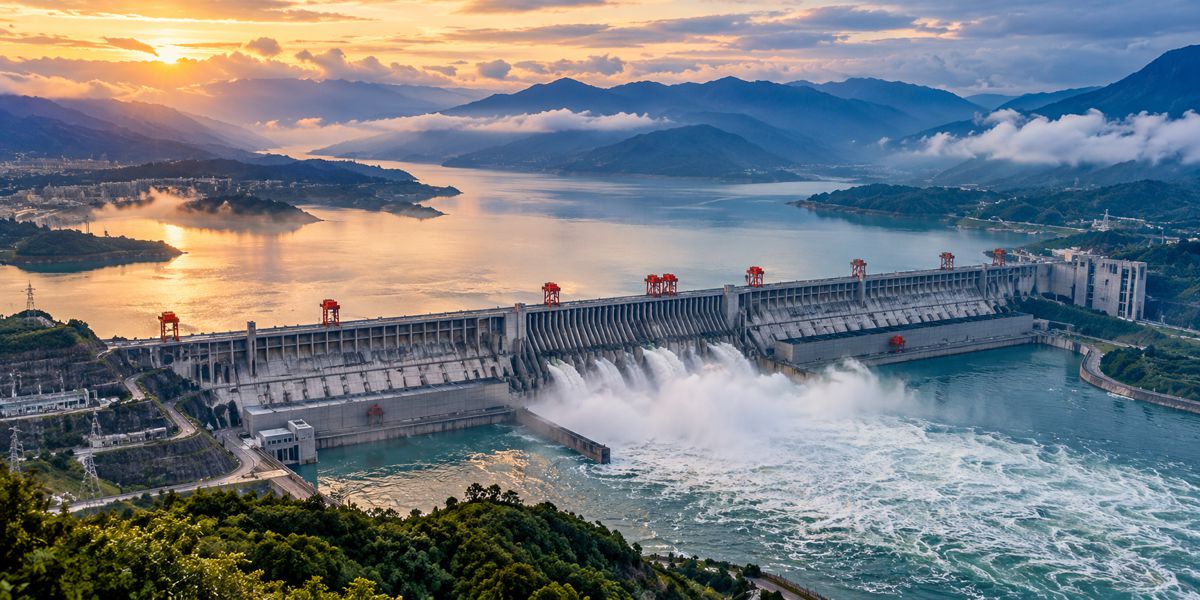
When China’s Three Gorges Reservoir filled, around 40 cubic kilometres of water were moved into a new position on the surface of the Earth. It was enough for scientists at NASA’s Jet Propulsion Laboratory to calculate that the redistribution of mass would increase the length of a day by approximately 0.06 microseconds.
The effect is far too small to have any practical consequence, and Earth’s rotation changes continually as water, atmosphere, ice and other masses move around the planet. Yet the calculation offers an unusual measure of engineering scale. A dam built for electricity generation, flood control and navigation is large enough for the movement of water behind it to register, however faintly, in the rotational dynamics of the Earth.
The atmosphere responds much more readily to changes at the surface. Flooding a valley replaces soil, vegetation, settlements and a flowing river with a large body of open water whose thermal and evaporative behaviour is quite different. Irrigation moves water from rivers, reservoirs and aquifers onto otherwise drier land, where crops return some of it to the atmosphere. Cities substitute asphalt, concrete, glass and roofs for soil and vegetation, while forest clearance and restoration change the movement of water between the ground and the air.
Engineers have traditionally approached this relationship from the other direction, designing infrastructure to withstand wind, rainfall, floods, heat, drought, sediment movement and other environmental forces. As infrastructure and land-use interventions become larger, however, the conditions surrounding them can no longer always be regarded as an entirely independent background. At sufficient scale, engineering becomes one of the processes modifying that background.
Briefing
- Filling China’s Three Gorges Reservoir with around 40 km³ of water was calculated by NASA to increase the length of the day by approximately 0.06 microseconds through redistribution of mass.
- Satellite observations and modelling have identified changes in precipitation and land-surface temperature associated with the Three Gorges Reservoir, although later research found the annual regional rainfall effect to be weak.
- A global study of 1.42 million natural and artificial lakes found reservoirs accounted for about 16% of lake evaporation despite holding only 5% of lake storage capacity in the dataset.
- Africa’s Great Green Wall has a stated ambition to restore 100 million hectares of degraded land by 2030, potentially changing vegetation, surface roughness, evapotranspiration and dust generation across parts of the Sahel.
- The IPCC recognises that land-cover changes can influence temperature, rainfall and wind through changes in albedo, evapotranspiration, surface roughness and atmospheric moisture recycling.
The Three Gorges Experiment
Popular accounts sometimes describe Three Gorges as a dam that slowed the Earth. There is a kernel of truth in the claim, but without scale it becomes misleading. Earth’s rotation responds continuously to movements of mass as the atmosphere circulates, oceans move, groundwater levels change and ice accumulates or melts. Storing tens of billions of tonnes of water at a different position relative to the Earth’s rotational axis produces the same physical response. NASA’s calculation is therefore an elegant demonstration of conservation of angular momentum rather than evidence that Three Gorges has meaningfully altered the passage of time.
Its interaction with the atmosphere is more complicated. The reservoir extends for hundreds of kilometres through the Yangtze valley, replacing a varied terrestrial and river environment with an enormous artificial water surface. Because water stores and releases heat differently from soil and vegetation, while also providing a continuous source of evaporation, filling the reservoir changed the exchange of energy and moisture between the landscape and the lower atmosphere.
A 2006 study archived by NASA combined Tropical Rainfall Measuring Mission data, MODIS land-surface temperature observations and high-resolution atmospheric modelling to examine conditions after the reservoir rose sharply from 66 metres to 135 metres in June 2003. Researchers found reduced precipitation close to the reservoir and increased precipitation farther away, particularly between the Daba and Qinling mountains, with the apparent climatic response extending over roughly 100 kilometres. NASA’s Earth Observatory subsequently reported that daytime land-surface temperatures fell by about 0.67°C between the mountain ranges, probably because increased evaporation contributed to greater cloud cover.
Later research complicated that picture. A 2017 study in the Journal of Meteorological Research, comparing observations from 1984 to 2003 with those from 2004 to 2013, found no significant change in the overall regional precipitation pattern following construction of the dam. Annual rainfall differences were small, although higher reservoir levels may have slightly reduced precipitation locally.
Both findings can coexist because weather around a reservoir is embedded within a much larger atmospheric system whose behaviour varies from season to season and year to year. Changing the surface alters the exchange of heat and moisture, but those changes compete with regional circulation, topography, ocean conditions and natural climate variability. Three Gorges demonstrates that an engineered landscape can influence atmospheric processes without establishing that a single structure has become the dominant control on regional weather.
Thousands of Artificial Lakes
Three Gorges attracts attention because a single structure and reservoir are so conspicuous, but dams collectively present a different question. The International Commission on Large Dams maintains a world register containing more than 55,000 dams, ranging from relatively modest structures to reservoirs extending across hundreds or thousands of square kilometres. Taken together, they have inserted a vast network of artificial water surfaces into river systems around the world.
The hydrological consequence is visible in global evaporation measurements. Research published in Nature Communications in 2022 examined 1.42 million natural and artificial lakes between 1985 and 2018 and estimated average annual evaporation of 1,500 ± 150 km³. The 6,715 artificial reservoirs in the dataset contained only about 5% of total lake storage capacity yet contributed approximately 16% of evaporation, equivalent to around 235 km³ annually, with reservoir evaporative losses increasing faster than the overall trend across the lakes studied.
Some of the water held behind dams is consequently entering the atmosphere rather than continuing immediately through the terrestrial and river system. How much that affects surrounding conditions depends heavily on geography. A shallow reservoir exposed to intense solar radiation in an arid climate behaves differently from a deep reservoir in a cool mountain valley, and water evaporating from either may travel considerable distances before returning as precipitation.
Dam engineering has long considered changes to river flows, sediment transport, fisheries and downstream environments. The atmospheric exchange above the resulting reservoir is another physical consequence of converting land and flowing water into a comparatively large and persistent open-water surface.
Irrigation and the Engineered Water Cycle
The redistribution becomes larger again when irrigation is considered. Instead of concentrating water within reservoirs, irrigation spreads it across agricultural landscapes, taking supplies from rivers, reservoirs and aquifers and applying them to land where evaporation from soil and transpiration through crops return a substantial proportion to the atmosphere.
According to the UN Food and Agriculture Organization, irrigated agriculture occupies around 20% of cultivated land while producing approximately 40% of the world’s food, with agriculture accounting for around 70% of global freshwater withdrawals. The canals, pumping stations, pipelines and wells supporting that production are normally considered in terms of water supply and agricultural productivity, although collectively they also alter where water meets the atmosphere.
Regional climate modelling has demonstrated the effect. Research in California found that irrigation shifted part of the surface energy balance away from sensible heating and towards evaporation and transpiration, producing average August cooling of around 0.38°C across the state. Cooler and moister air subsequently moved beyond the irrigated grid cells, while the study published in Geophysical Research Letters also identified changes in land-sea and inland breeze circulations.
Similar processes have been modelled across Asia. Research examining heavily irrigated river basins found increased latent heat flux and reduced sensible heating, with cooling extending into the lower troposphere and changes appearing in upper-level circulation. None of this requires the infrastructure to have been designed with atmospheric modification in mind. From the atmosphere’s perspective, the purpose of the pumps and canals is irrelevant; what has changed is the amount of moisture and energy being exchanged across a large area of land.
Changing the Surface of the Sahel
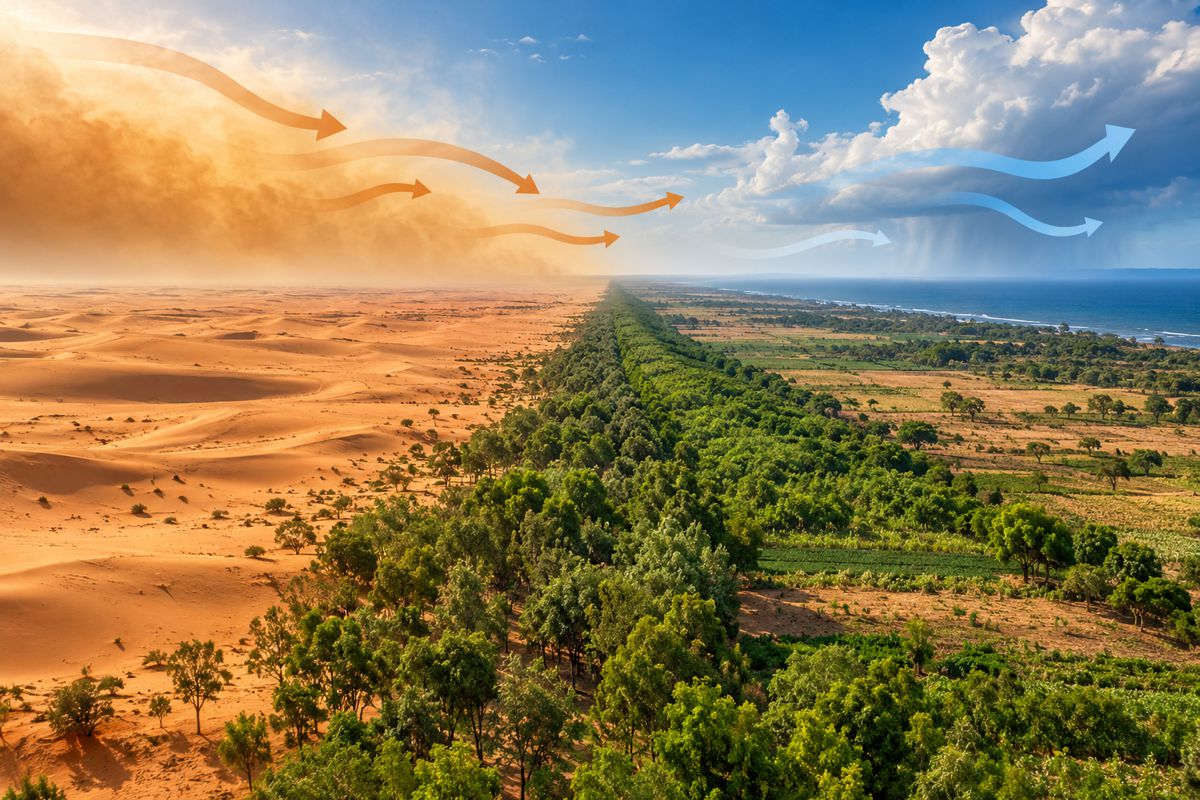
Africa’s Great Green Wall approaches the same relationship from another direction. Originally associated with the striking idea of a belt of trees stretching across Africa south of the Sahara, it has evolved into a much broader programme of landscape restoration, agroforestry, vegetation recovery and sustainable land management rather than a continuous forest running from the Atlantic to the Red Sea.
The United Nations Convention to Combat Desertification describes an ambition to restore 100 million hectares of degraded land by 2030 across an initiative involving 22 African countries. That is equivalent to one million square kilometres, although restoration across such a large programme will inevitably comprise many different landscapes and forms of land management rather than uniform tree planting.
Replacing sparsely vegetated ground with grasses, shrubs and trees changes several physical properties at once. Vegetation increases aerodynamic roughness, roots and ground cover protect exposed soil, leaves intercept radiation, and plants draw water from the ground before returning it to the atmosphere through transpiration. The interaction with wind is particularly relevant in the Sahel because airborne mineral dust depends partly on wind being able to exert sufficient shear stress on exposed soil.
A Geophysical Research Letters study of Sahelian vegetation and wind found that declining surface wind speeds associated with increasing vegetation roughness were the most likely explanation for an observed reduction in dust emissions. A separate 10-year observational study at two Sahelian stations reached the process from another direction, finding that for comparable wind-speed classes, increasing vegetation progressively reduced airborne PM10 concentrations, with reductions exceeding 80% in the highest vegetation classes under some conditions.
Vegetation therefore acts both by protecting material that might otherwise be eroded and by increasing resistance to near-surface airflow. Across a sufficiently large area, the consequences extend beyond whether sand or soil remains where it started, because Saharan mineral dust routinely travels thousands of kilometres across the Atlantic.
Satellite observations analysed through NASA’s CALIPSO programme estimated that approximately 22,000 tonnes of phosphorus carried in Saharan dust reaches the Amazon each year, roughly comparable with the phosphorus the basin loses through rain and flooding. The same airborne material interacts with radiation, clouds and atmospheric processes during its journey, linking conditions on African soil with systems far beyond the continent.
It would be a considerable leap from those observations to conclude that completing the Great Green Wall will materially alter Atlantic weather. A 2023 modelling study published by the American Meteorological Society tested hypothetical configurations covering between 0.8 million and 1.25 million km² and found no significant evidence that the intervention would materially change the characteristics of Sahelian summer precipitation or produce adverse precipitation changes in neighbouring regions. The model also exhibited wet and dry biases against observations, reflecting the difficulty of reproducing land-atmosphere interactions across a region where rainfall is influenced by both continental and oceanic conditions.
The modelling leaves a more interesting question than a prediction of dramatic weather change. Restoration on the scale envisaged by the Great Green Wall changes enough land to justify examining atmospheric responses beyond the project areas, while the evidence so far provides no reason to assume those responses will be either large or simple.
Forests as Water Infrastructure
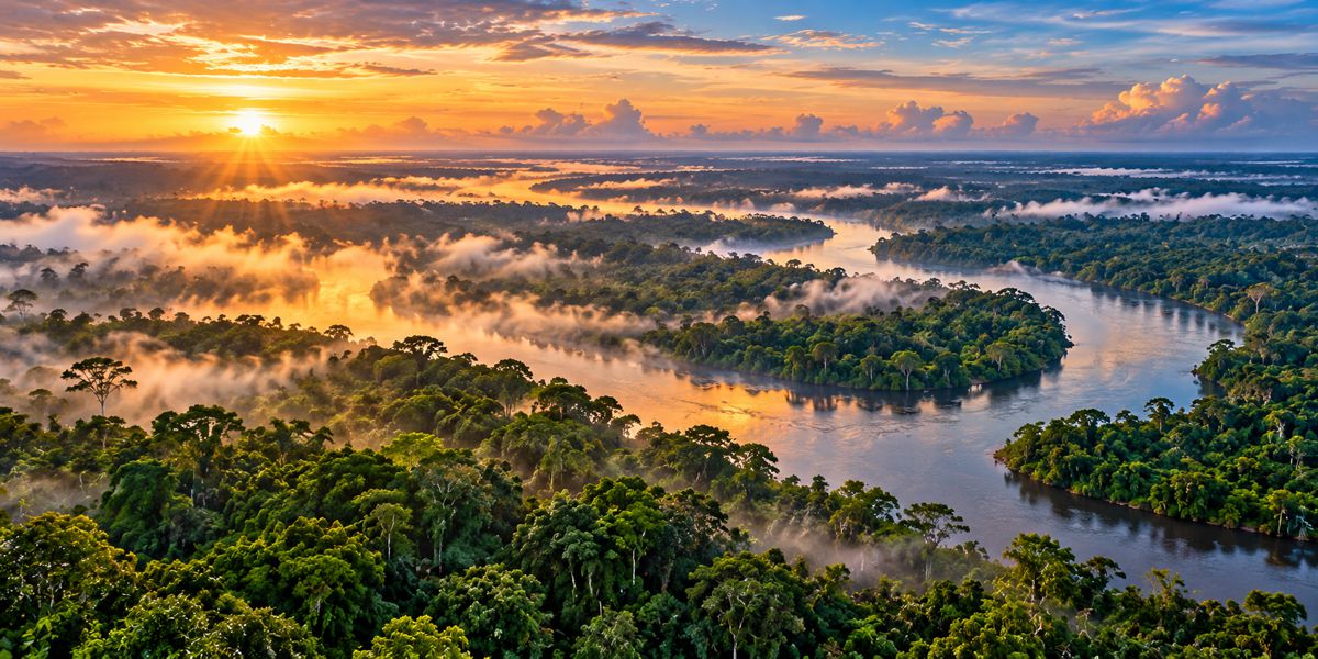
The Amazon shows more clearly how vegetation can become part of a continental water cycle. Tropical forest draws water from the soil and releases it through leaves, replenishing atmospheric moisture as air travels across the landscape and allowing some of that water to return as rainfall farther downwind.
A landmark Nature study of tropical rainfall and vegetation, combining satellite observations with atmospheric transport modelling, found that across more than 60% of the tropical land surface studied, air that had travelled over extensive vegetation produced at least twice as much rain as air passing over sparse vegetation. The observed relationship was consistent with evapotranspiration maintaining moisture in air travelling over forest rather than allowing it to decline steadily as rainfall removed water from the atmosphere.
A 2026 Nature Communications study examining four decades of change across the Amazon found an 8% to 11% decline in annual precipitation across the southern basin during the observation period. The researchers attributed 52% to 72% of that decline to widespread deforestation in the southern basin and upwind areas of South America, with reduced forest-sourced moisture accompanied by greater atmospheric stability and changes in moisture transport.
Individual roads, mines, farms, transmission corridors and settlements do not control Amazon rainfall. As land conversion accumulates, however, the resulting surface begins to behave differently from the forest it replaced, while atmospheric moisture continues moving across boundaries that exist on planning maps but have no physical meaning to the air above them.
The Variables the Atmosphere Actually Sees
The different examples are connected by a relatively small group of physical variables. In its assessment of direct human influence on the regional water cycle, the IPCC identifies changes in permeability, surface albedo, evapotranspiration, surface roughness and leaf area among the mechanisms through which land modification alters surface energy and water balances. It also finds evidence that land-use change can produce local and remote responses in precipitation and river flow by modifying moisture transport and recycling, land-sea thermal contrasts and associated wind patterns. The assessment is set out in Chapter 8 of the IPCC Sixth Assessment Report.
Those mechanisms do not all push climate in the same direction. Planting trees can darken the surface and increase absorption of solar radiation while simultaneously increasing evapotranspiration and evaporative cooling. Removing vegetation may increase reflectivity but reduce that cooling. Irrigation can lower surface temperatures while adding moisture to the atmosphere, and a reservoir can increase local evaporation without necessarily producing more rain in its immediate surroundings.
Infrastructure is therefore one influence within a system already responding to topography, seasons, ocean temperatures, natural variability and long-term climate change. The difficulty is not establishing that engineered surfaces interact with the atmosphere, which follows directly from the physics, but determining when the resulting signal becomes large enough to separate from everything else occurring at the same time.
Cities and Engineered Heat
Cities provide a familiar example because the signal is relatively easy to observe. Urban development replaces permeable and vegetated ground with materials whose thermal and hydrological behaviour is markedly different, while buildings alter airflow, drainage removes water that might otherwise evaporate, and vehicles, industry and cooling systems add waste heat.
The resulting urban heat island has become an engineering consideration in its own right. The IPCC’s assessment of urban climate notes that cities can be several degrees warmer at night than surrounding areas as built surfaces store heat while natural cooling processes are reduced. Engineers subsequently have to design buildings, pavements, drainage and cooling systems for an urban thermal environment partly created by the accumulated infrastructure already present.
The feedback is now so familiar that it rarely attracts the same attention as a giant dam or continental restoration programme. Yet it demonstrates the same underlying relationship: once enough of the surface has been changed, the environmental conditions experienced by the infrastructure are no longer entirely independent of the infrastructure itself.
Beyond the Project Boundary
Environmental assessment necessarily begins with projects that have identifiable boundaries. A dam has a reservoir, catchment and downstream river. A highway occupies a corridor in which noise, drainage, habitat, emissions and land take can be studied. Those boundaries are indispensable for planning and regulation, but some of the physical processes affected by development operate across much larger areas.
Water evaporating from a reservoir can travel before falling as rain, just as mineral dust raised in Africa can cross the Atlantic and atmospheric moisture released by forest can be recycled repeatedly as air moves across a continent. Changes in surface heat can influence pressure and circulation, while vegetation alters the turbulence and friction experienced by air moving above it. The distance over which an effect propagates depends on the mechanism, location and scale rather than the administrative boundary of the project that initiated it.
Cumulative development makes the distinction harder. The global network of reservoirs was not created by one dam, irrigated agriculture did not emerge from one water scheme, Amazonian land conversion cannot be attributed to one road, and urban heat islands are not produced by individual buildings. Each decision may have a negligible atmospheric effect when considered alone while contributing to a very different surface when repeated thousands of times.
Climate models already incorporate many of these interactions because reproducing the atmosphere requires some representation of the land and water beneath it. Satellite observations and increasingly sophisticated land-surface and atmospheric models are also making those relationships more accessible to infrastructure planners. The remaining challenge is partly one of deciding when the scale or cumulative character of development justifies looking beyond conventional project boundaries.
Infrastructure as Part of the Climate System
Describing every large development as climate engineering would obscure an important distinction. Geoengineering proposals are deliberately intended to manipulate the climate, whereas Three Gorges was built for power generation, flood management and navigation, the Great Green Wall is intended to restore degraded landscapes, and irrigation infrastructure exists primarily to produce food.
The atmosphere does not respond to those intentions. It encounters a new body of open water where land once existed, vegetation where soil was previously exposed, irrigated crops where the surface was drier, or asphalt and buildings where vegetation once exchanged water with the air. Whether the resulting atmospheric response is detectable depends on the scale of the change and the physical setting in which it occurs.
Environmental assessment has become increasingly capable of modelling complex hydrology, ecology, emissions and climate risks acting upon major infrastructure. For the largest interventions, and particularly where similar developments accumulate across a region, there is a corresponding case for examining whether the altered surface itself becomes one of the environmental variables.
The 0.06 microseconds associated with Three Gorges remains little more than a scientific curiosity, but it offers an unusually tangible reminder of how large human engineering has become. Enough water can now be stored behind a single dam for its redistribution to appear in calculations of planetary rotation, while reservoirs, irrigation, cities, deforestation and landscape restoration collectively alter the surfaces across which the atmosphere continuously exchanges heat, water and momentum.
Infrastructure still has to withstand the environment, but at sufficient scale the environment may also have to be modelled with the infrastructure in it.
Key Industry Questions
- Can the Three Gorges Dam really affect the Earth’s rotation? Yes, although the effect is extraordinarily small. NASA calculated that redistributing around 40 km³ of water into the reservoir would increase the length of the day by approximately 0.06 microseconds through a change in the Earth’s distribution of mass.
- Has the Three Gorges Dam changed regional weather? Research has detected changes in precipitation and land-surface temperature associated with the reservoir, including reduced rainfall nearby and increased rainfall farther away. Later research found no significant change in the overall regional precipitation pattern and only a weak effect on annual rainfall.
- Can reservoirs change rainfall? Potentially. Large reservoirs alter evaporation, surface temperature and atmospheric moisture. The response depends heavily on reservoir size, geography, season and the surrounding climate, and additional atmospheric moisture does not necessarily fall as rain near the reservoir.
- Could the Great Green Wall affect weather outside the Sahel? The physical mechanisms exist because vegetation alters roughness, evapotranspiration, albedo and dust generation. Current modelling does not establish that the planned restoration will cause major changes in Sahelian or Atlantic weather.
- Why is Saharan dust relevant to climate? Mineral dust interacts with radiation and clouds and can travel across oceans. Saharan dust also transports nutrients, including phosphorus, across the Atlantic to the Amazon.
- Does irrigation alter climate? Large-scale irrigation can affect regional temperature, humidity and atmospheric circulation by increasing evaporation and evapotranspiration. Modelling has identified cooling and circulation changes in heavily irrigated regions.
- Can cumulative infrastructure have a larger climatic effect than individual projects? Yes. Individually small changes to vegetation, water storage, irrigation or urban surfaces can become significant when repeated across very large areas. The magnitude and direction of the response depend on the surface change and regional climate.
- At what size does an infrastructure project begin affecting climate? There is no fixed threshold. The response depends on the area and type of surface changed, surrounding climate, terrain, atmospheric conditions and the cumulative extent of similar development.
- Should atmospheric effects form part of environmental assessments for mega-projects? For projects capable of substantially altering land cover, open water, vegetation, surface energy or atmospheric moisture, land-atmosphere effects can be a legitimate modelling consideration. The appropriate scope depends on the project and location.
Strategic Takeaways
- Infrastructure assessment increasingly needs to consider the characteristics of the surface being created as well as the structure being built.
- Cumulative development can become environmentally significant even where the atmospheric influence of each individual project is negligible.
- Reservoirs, irrigation and land restoration alter water and energy exchanges in ways that can extend beyond conventional project boundaries.
- Satellite observation and atmospheric modelling are making land-atmosphere effects increasingly measurable at infrastructure-relevant scales.
- Mega-project assessment may increasingly need to consider climate as a two-way engineering variable, with the atmosphere acting on infrastructure while altered land and water surfaces interact with the atmosphere.