Velodyne Lidar launches AI Intelligent Infrastructure solution with Bluecity
Velodyne Lidar today launched its Intelligent Infrastructure Solution designed to solve some of the most challenging and pervasive infrastructure problems.
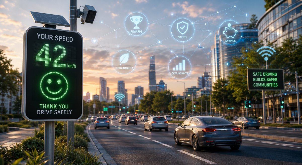
This new solution combines Velodyne’s award-winning lidar sensors and Bluecity’s powerful artificial intelligence (AI) software to monitor traffic networks and public spaces. It generates real-time data analytics and predictions, helping to improve traffic and crowd flow efficiency, advance sustainability and protect vulnerable road users.
The Intelligent Infrastructure Solution is available now exclusively from Velodyne. It is already deployed in multiple North American cities, including in Quebec and British Columbia, with upcoming installations in New Jersey and more deployments expected across the United States.
Velodyne also announced a sales agreement with Rutgers Center for Advanced Infrastructure and Transportation (CAIT) to deploy its Intelligent Infrastructure Solution equipped with Velodyne’s Alpha Prime™ lidar sensors. CAIT will install the solution at multiple intersections in New Brunswick, New Jersey as part of the Middlesex County – Smart Mobility Testing Ground (MC-SMTG) project in collaboration with the New Jersey Department of Transportation (NJDOT). The project will serve as a testbed for mobility data-gathering, analysis and sharing technologies that will help implement connected and autonomous vehicle systems in the future. CAIT selected the Velodyne solution after a rigorous vetting process, in which they tested other sensor solutions and competitive lidar systems.
“The acquisition and analysis of mobility data is crucial to integrating autonomous vehicles, and creating a safer pedestrian and cycling environment,” said Dr. Ali Maher, professor and director, Rutgers Center for Advanced Infrastructure and Transportation. “Velodyne’s Intelligent Infrastructure Solution captures data on various traffic activity including vehicles, pedestrians and bicyclists in all types of environmental conditions. We envision the solution as playing a critical role in helping us create a safer environment for all road users.”
“There is a growing commitment by governments worldwide to rebuild outdated transportation infrastructure systems. Leading the way is the 2.25 trillion-dollar proposal by the Biden Administration to invest in the modernization of vehicles, roads and transit systems. As Velodyne looks at a world with connected and autonomous vehicles, we know that infrastructure will play a critical role in moving this industry forward,” said Anand Gopalan, Chief Executive Officer, Velodyne Lidar. “Our solution, powered by Bluecity’s AI-powered traffic monitoring software platform, will be key in the efforts to transform our roads and transportation infrastructure into smart cities, paving the way for a more sustainable, safer future.”
Velodyne’s Solution Transforming Infrastructure
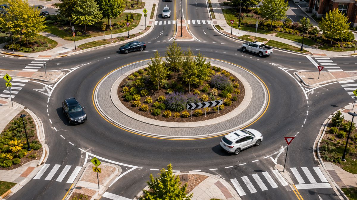
Velodyne’s Intelligent Infrastructure Solution creates a real-time 3D map of roads and intersections, providing precise traffic monitoring and analytics. It reliably collects data in any lighting or weather condition, supporting 24/7, 365 days a year operation.
The solution advances safety through multimodal analytics that detect various road users including, vehicles, pedestrians and cyclists. It can predict, diagnose and address road safety challenges, helping municipalities and other customers make informed decisions to take corrective action.
The Intelligent Infrastructure Solution is more cost-effective and easier to install than radar- and camera-based systems. This lower price point is because a single lidar sensor installed on a traffic pole can cover an entire intersection or highway section compared to radar- and camera-based systems that typically need multiple sensors to cover the same area. The solution works with Velodyne’s Alpha Prime, Ultra Puck™, Puck™ and Velarray sensors. Velodyne’s lidar sensors do not identify individuals’ facial characteristics, a growing concern for civic applications. Lidar has an advantage in privacy over camera-only systems because lidar does not record details like hair and skin colour.
“Rogers collaborated with Velodyne and Bluecity on a traffic monitoring system in Kelowna, B.C., which was Canada’s first 5G smart city project,” said Neel Dayal, Senior Director, Innovation and Partnerships at Rogers Communications. “The initiative showed how this lidar-based solution can track near-misses of accidents at problematic intersections. By using the solution’s data, municipalities can do the critical work of improving roadway safety in a cost-effective and efficient way.”
“We are excited to partner with Velodyne in order to bring to market this breakthrough solution that collects and analyses detailed traffic data about road users while preserving anonymity and trust,” said Asad Lesani, CEO at Bluecity. “We believe that Velodyne sensors are best-in-class and this solution will be a game changer for the smart city industry.”
Addressing Critical Transportation Infrastructure Challenges
Velodyne Lidar’s Intelligent Infrastructure Solution can be used for:
-
Safety Analytics. Velodyne’s Intelligent Infrastructure Solution near-miss analytics can be used to predict, diagnose and address road safety challenges before the next collision happens. Today’s camera-based solutions require several cameras per intersection or identified public area, which typically take longer processing times to get the final analysis. Traffic studies aren’t complete if they operate only at certain hours or under certain conditions.
-
Traffic Efficiency and Sustainability. Velodyne’s Intelligent Infrastructure Solution delivers reliable real-time traffic data to optimize traffic light timing based on congestion and throughput in all types of weather and lighting conditions. The solution can cover various road users, including vulnerable pedestrians and cyclists, whereas current technologies generally provide data for vehicles only. Also, lidar doesn’t require any interaction with a person’s cell phone, enabling it to accurately track people in crowded areas while preserving privacy.
-
Crowd Analytics. The solution can enable businesses and cities to improve revenue and infrastructure by providing foot traffic data analytics to learn about traffic patterns, congregation areas, congestion points and more. Knowing how people flow through a building and where they stop along the way is useful to designers, architects and city planners.
-
Vehicle to Everything (V2X) Communication. Velodyne’s Intelligent Infrastructure Solution uses extracted trajectory road user data around intersections to predict potential collisions, which can be used to warn connected vehicles via V2X communications. Vehicle manufacturers can leverage the solution’s analytics in combination with their on-board safety systems to reduce accident probability.
-
Emergency Services. Velodyne’s Intelligent Infrastructure Solution detects collisions and near-miss incidents in real time to provide data to emergency response services for faster dispatch in both urban and rural environments.
-
Environmental Protection. Velodyne’s IIS can detect wildlife crossings and help prevent collisions that often result in substantial personal, environmental and economic losses, including human injuries, fatalities, loss of wildlife and vehicle damage.