High-Resolution Drone Mapping Brings Precision Management to Rangelands
Managing extensive landscapes has traditionally required a compromise between scale and detail. Satellite imagery can cover large territories, while ground surveys reveal conditions at plant and soil level, but neither method alone provides land managers with rapid, fine-resolution intelligence across hundreds of acres. Research at Texas A&M University is beginning to close that gap by combining drones, advanced sensors, artificial intelligence and spatial modelling.
The work being undertaken by the Landscape Ecology and Drones Lab has implications extending beyond livestock production. Reliable mapping of vegetation, invasive plants, soil conditions and habitat quality can support infrastructure planning, environmental compliance, wildfire risk management and the long-term stewardship of land surrounding roads, utilities and energy developments.
Its commercial importance lies in converting ecological monitoring from a periodic, labour-intensive exercise into a repeatable operational process. If land managers can identify emerging problems sooner, forecast forage availability more accurately and direct treatment to precise locations, they can potentially reduce unnecessary fieldwork and make better use of labour, machinery and agricultural inputs.
Established in 2023 within the Texas A&M Department of Rangeland, Wildlife and Fisheries Management, the laboratory is developing practical methods rather than treating drone imagery as an end product. Its objective is to establish how spatial technologies can inform real management decisions, where their limitations lie and how the resulting information should be communicated to people responsible for working landscapes.
Briefing
- Texas A&M’s Landscape Ecology and Drones Lab is combining drones, satellite observations, remote sensors and hyperspectral imaging to assess rangeland health at fine spatial resolution.
- Current projects include drone-derived forage forecasting and artificial intelligence-assisted identification of invasive plants across large areas.
- The research could help land managers replace broad interventions with more accurately targeted grazing, treatment and conservation plans.
- Applications extend to infrastructure corridors, wildfire management, habitat assessment, environmental monitoring and land restoration.
- Seven students have secured Federal Aviation Administration drone pilot licences since the laboratory was established in 2023.
Turning Ecological Detail into Operational Intelligence
Rangeland health is governed by interconnected terrestrial conditions, including soil, vegetation, water availability, grazing pressure and disturbance. The Texas A&M team observes those conditions from above using drones, satellite data, remote sensors and hyperspectral imaging, then applies statistical and computational modelling to interpret what is happening across the landscape.
“We work at very, very high resolution because we want to understand the processes that are happening across the landscape at a very fine scale,” said Humberto Perotto, Ph.D., director of the laboratory, associate professor and Joan Negley Kelleher Endowed Professor in Ranch Management within the department.
High spatial resolution matters because many ecological changes begin below the scale at which conventional regional datasets can identify them reliably. An invasive plant may be only a few inches tall, areas of declining ground cover may initially be localised, and grazing pressure can vary considerably within an individual field. Mapping these differences can give managers a more useful picture than a property-wide average.
The laboratory’s analytical work covers land-use change, vegetation composition and cover, habitat quality, forage production, wildlife populations, soil health and the effects of grazing. These factors are not isolated indicators. Changes in one part of the system can influence erosion, water movement, fire behaviour, livestock performance and the ability of land to recover from drought or disturbance.
“The main objective of our lab is to provide new insights into how to assess the health and resilience of ecosystems, particularly rangeland systems, through the adoption of spatial technologies,” Perotto said. “We are working with ranchers, nonprofits, and state and federal agencies to answer questions and provide solutions that have a direct impact on rangeland and wildlife ecology and management.”
Forage Forecasting Moves Grazing Decisions towards Better Evidence
One of the laboratory’s projects is an application designed to convert drone observations into detailed forecasts of forage mass and quality. The intended outcome is to help livestock producers adapt grazing plans around the amount, location and condition of available vegetation rather than relying exclusively on periodic field inspection or general estimates.
A dependable forage forecast could affect several parts of ranch management. Stocking levels, paddock rotation, supplementary feeding and drought preparations all depend on knowing how much usable forage is present. Better information could help producers balance livestock productivity with the need to maintain vegetation cover, soil condition and the capacity of the land to recover.
The technical challenge is more complicated than identifying green vegetation in an aerial image. Forage mass and nutritional quality can vary by plant species, growth stage, moisture conditions, season and grazing history. Imagery must therefore be linked to field observations and calibrated against measurements taken on the ground before it can become a reliable management tool.
If that validation is achieved across different conditions, drone-derived forecasting could create a valuable decision-support layer between satellite monitoring and manual sampling. Satellites would continue to provide regional coverage and historical context, while drones could be deployed when a manager needs a closer and more current assessment of selected land.
The resulting model also has relevance to construction and infrastructure projects. Vegetation forecasts can inform rehabilitation programmes, erosion-control monitoring, grazing arrangements around renewable energy sites and the management of land within utility or transport corridors. The same analytical principles could help determine whether reinstated ground is becoming established as intended after construction.
Finding Invasive Plants Before They Become Landscape-Scale Problems
The laboratory is also developing artificial intelligence-supported methods for identifying, treating and controlling invasive species. The target capability is particularly demanding: detecting small plants across hundreds of acres while retaining the geographic accuracy needed to direct crews or equipment to the affected locations.
Conventional invasive-species surveys can require teams to walk or drive extensive areas, recording observations as they go. That process remains essential for confirmation and ecological interpretation, but it can be slow and difficult to repeat consistently. Drone mapping offers a means of screening much larger areas, allowing specialist fieldwork to concentrate on locations where intervention is most likely to be required.
Earlier detection can materially change treatment economics. A scattered infestation can sometimes be addressed through localised removal, grazing or chemical application, whereas an established population may require repeated treatment across a much larger area. Precise mapping also creates a record against which subsequent flights can assess whether control measures have worked.
The wider risks are substantial. The US Geological Survey notes that invasive species can alter wildfire behaviour, water and nutrient movement, biodiversity and the resilience of infrastructure and working landscapes. These effects connect ecological management directly with public safety, agricultural productivity and the cost of protecting built assets. USGS research increasingly treats invasive-species monitoring as part of a broader resilience strategy rather than a narrowly environmental activity.
Artificial intelligence can accelerate the classification of large image datasets, but the integrity of the result depends on training data and field verification. Seasonal colour changes, shadows, bare ground and visually similar species can all produce errors. The strongest operational systems will therefore combine automated screening with ecological expertise and targeted ground checks.
Precision Treatment Could Reduce the Footprint of Land Management
Accurate geolocation creates the possibility of moving from blanket treatment towards site-specific intervention. Instead of treating an entire management unit, operators could direct people, vehicles or application equipment to mapped patches. This approach may reduce material use, avoid unnecessary disturbance and concentrate limited budgets where they can deliver the greatest practical effect.
That model mirrors the development of precision agriculture, where geospatial data is used to vary inputs within a field. Rangelands present a different challenge because they are generally less uniform, more ecologically diverse and often managed across considerably larger areas. The terrain may also be rough, remote or difficult to inspect from the ground.
“This technology can deliver outstanding levels of efficiency and accuracy to the environmental stewardship of rangelands,” Perotto said.
Efficiency, however, should be measured across the whole workflow. Flight preparation, regulatory compliance, image processing, data storage, model validation and the delivery of results all require time and specialist capability. A technically successful system must still provide information quickly enough, and at an appropriate cost, to improve the decision facing the land manager.
The laboratory is addressing that gap by developing methodologies for applied use rather than assuming that acquiring a drone will automatically produce useful intelligence. “All of this information matters to ecosystem health,” Perotto said. “We’re focused on developing methodologies that can help us understand how these ecological processes occur and how we can translate that into tools for producers.”
A New Monitoring Layer for Infrastructure and Construction
Although the immediate focus is rangeland management, the underlying technologies have direct relevance to infrastructure owners and contractors. Roads, pipelines, transmission lines, railways and renewable energy developments all pass through landscapes where vegetation, drainage, erosion, habitat and invasive species require continuing oversight.
Drone surveys can provide a detailed record before construction begins, support monitoring during delivery and document recovery after reinstatement. Repeat flights using consistent parameters can reveal whether vegetation is returning, whether bare ground is expanding or whether drainage changes are affecting adjacent land. This can strengthen environmental reporting while helping project teams identify maintenance needs earlier.
Linear infrastructure is particularly suited to geospatial monitoring because its environmental footprint extends well beyond the paved carriageway or physical asset. Road verges can act as habitat, fire fuel, drainage infrastructure and pathways for invasive plants. Utility rights of way require vegetation management to maintain access and asset safety, while disturbed ground can create opportunities for undesirable species to establish.
The value increases when ecological data can be integrated with geographic information systems, asset-management platforms and digital twins. A vegetation map becomes more useful when it can be compared with drainage assets, land ownership, maintenance records, topography and previous interventions. This allows environmental condition to become part of the same operational picture used to manage physical infrastructure.
For construction businesses, the opportunity is likely to lie in integrated survey and monitoring services rather than isolated drone flights. Clients increasingly need interpreted findings, auditable records and recommendations linked to project requirements. Contractors and consultants capable of joining aerial data with ecology, engineering and land management will be better placed to provide that broader service.
Combining Drones, Satellites and Ground Surveys
No single sensing method can provide every layer of information needed for responsible land management. Satellite platforms offer extensive and repeatable coverage, often supported by long historical records. Drones provide much finer detail over selected areas, while ground surveys remain necessary for identifying species, sampling soil and validating interpretations.
The most effective system is therefore hierarchical. Satellite data can highlight regional patterns or areas experiencing change. Drones can then examine selected locations at higher resolution, and field teams can verify the features or conditions detected in the imagery. Information from each level improves the use of the others.
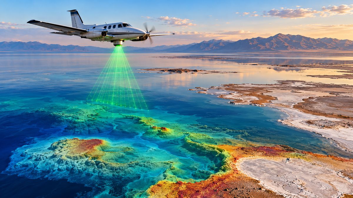
Hyperspectral imaging adds another dimension by recording information across numerous narrow wavelength bands. Differences that appear subtle or invisible in conventional colour images may provide clues about plant type or condition. Its usefulness depends on calibration, processing capability and an understanding of how spectral characteristics vary with illumination, moisture, growth stage and sensor configuration.
This layered approach is already familiar in wider Earth observation. The US Geological Survey uses remote sensing to monitor long-term rangeland condition and land-cover change, providing broad datasets that can support regional analysis. USGS Earth Resources Observation and Science has also highlighted the growing use of artificial intelligence to improve the efficiency and value of environmental data.
The Texas A&M research occupies the crucial space between national-scale observation and day-to-day land management. Its contribution is to determine how high-resolution data can answer property-level questions and support interventions that are specific, measurable and practical.
Repeatability Will Determine Commercial Value
A map produced once can establish a useful baseline, but much of the commercial value comes from repeat monitoring. Consistent surveys can show whether forage is increasing, an invasive species is spreading, restoration is becoming established or management changes are producing the intended effect.
Repeatability requires more than flying over the same land again. Aircraft altitude, camera angle, sensor configuration, illumination, season, weather and processing methods can affect the final output. Without a controlled workflow, apparent change may reflect differences in data collection rather than genuine ecological movement.
These considerations are important for infrastructure contracts and environmental commitments. Evidence used to demonstrate compliance or restoration performance must be defensible. Project owners may therefore require metadata, quality assurance, ground-control procedures, validation records and consistent data governance alongside the imagery itself.
The emerging service market is likely to favour providers that can demonstrate methodological consistency. Drone operators who understand aviation rules but lack environmental or analytical expertise may find it difficult to deliver decision-grade products independently. Equally, ecological specialists will increasingly benefit from competence in remote sensing, spatial statistics and automated analysis.
Regulation and Skills Remain Part of the Operating Model
Drone-based services operate within an aviation framework even when the aircraft is flying over privately managed land. In the United States, most non-recreational operations involving small unmanned aircraft fall under Federal Aviation Administration Part 107 rules. Operators must understand flight restrictions, airspace requirements, registration and the responsibilities carried by the remote pilot in command.
The FAA requires a Remote Pilot Certificate for pilots operating under Part 107. Since the Texas A&M laboratory was established, seven students have obtained FAA drone pilot licences while contributing to academic publications and presenting work at state, national and international conferences.
This combination of ecological understanding, analytical competence and aviation training reflects the changing employment market around land and infrastructure management. Organisations need people who can plan safe operations, collect suitable data, interrogate analytical outputs and explain the findings to decision-makers who may have little interest in the technology itself.
“One of the things that I tell my students is, yes, technology will help improve and make many processes more efficient; but at the end of the day, it is you who are the thinkers – the ones who will guide the technology and effectively communicate to the rancher or the land manager how these tools can better help them steward the land,” Perotto said.
The observation applies equally to engineering and construction. Automated classification can process more data than a field team, but it cannot independently decide whether a detected condition is commercially significant, environmentally acceptable or technically relevant to an asset. Human judgement remains central to turning measurement into responsible action.
Building Applied Spatial Capability for Working Landscapes
The strategic strength of the Texas A&M programme is its emphasis on translation. Research findings are being directed towards tools that land managers can use, while students are gaining experience in the regulatory, technical and communication skills required to deploy those tools outside the laboratory.
“My vision for the lab is to keep working, keep providing students with opportunities to conduct sound, applied science and then translate that in a way that is useful to land managers working to conserve and manage rangelands,” Perotto said.
That focus is timely. Land managers are being asked to balance production, ecological condition, wildfire exposure, water management and biodiversity across large and often difficult terrain. Infrastructure developers face similar pressures as environmental performance becomes embedded more deeply in planning, procurement, construction and long-term asset operation.
High-resolution mapping will not remove the need for field knowledge. Its more valuable role is to make that knowledge scalable, directing people towards the right locations and giving them a stronger evidence base for action. The technologies being tested on Texas rangelands could ultimately become part of a wider spatial management system spanning agricultural estates, transport corridors, utility networks, conservation areas and construction sites.
The commercial opportunity will belong to organisations capable of delivering trusted information rather than imagery alone. When drone observations are properly validated, connected with other spatial datasets and communicated in operational terms, they can help landowners and infrastructure managers allocate resources with far greater precision.
Key Industry Questions
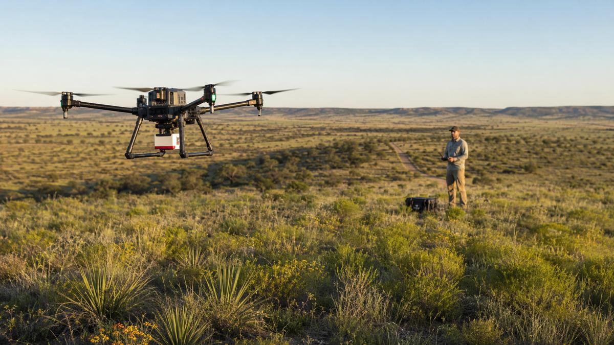
- How can drones improve rangeland management? Drones can collect high-resolution imagery across extensive areas much faster than teams conducting an entirely ground-based survey. The data can be used to map vegetation cover, locate invasive plants, assess grazing patterns and identify areas of bare or disturbed soil. Their principal value is not simply speed, but the ability to geolocate conditions accurately and revisit the same areas over time. Ground inspections remain necessary for validation, although drone mapping can direct those inspections towards priority locations and reduce the amount of land that must be searched manually.
- Can drone imagery accurately measure available forage? Drone imagery can contribute to forage estimates when it is combined with suitable sensors, field measurements and validated analytical models. Vegetation colour or cover alone does not provide a complete measure of usable forage because plant species, structure, moisture and nutritional quality also matter. Reliable forecasting therefore requires local calibration and repeated comparison with samples collected on the ground. Once validated for the relevant vegetation and seasonal conditions, the approach could help producers make more informed decisions about grazing rotation, stocking levels, supplementary feed and drought planning.
- Why is hyperspectral imaging useful for vegetation monitoring? Hyperspectral sensors record reflected light in many narrow wavelength bands, providing more detailed spectral information than ordinary colour or multispectral cameras. These data can reveal differences in plant condition or composition that may not be obvious in a conventional photograph. Potential applications include distinguishing species, detecting stress and analysing vegetation quality. Results remain sensitive to factors such as sunlight, moisture, season and sensor calibration, so hyperspectral imagery must be interpreted carefully and usually supported by ground observations.
- How can artificial intelligence assist with invasive-species control? Artificial intelligence can be trained to locate and classify suspected invasive plants within large collections of aerial imagery. This allows land managers to generate georeferenced treatment maps and focus field inspections or control measures on specific patches. The approach can reduce the time required to screen extensive areas, particularly when plants are scattered or difficult to see from a vehicle. Automated detections must still be checked because native species, shadows and seasonal vegetation changes can resemble the target plant. AI is most effective as a prioritisation tool supported by ecological expertise.
- What are the infrastructure applications of rangeland drone research? The same methods can be applied along highways, railway corridors, pipelines, transmission routes and around renewable energy developments. Potential uses include monitoring vegetation recovery after construction, locating invasive plants, identifying erosion, assessing habitat and documenting compliance with reinstatement plans. Regular surveys can also help maintenance teams observe changes around drainage assets, verges and rights of way. Integration with geographic information and asset-management systems allows ecological conditions to be evaluated alongside the location and maintenance history of physical infrastructure.
- Will drone surveys replace environmental field teams? Drone surveys are more likely to change the deployment of field teams than replace them. Aerial systems can rapidly screen large areas and identify patterns, but specialists are still needed to confirm species, assess soil, interpret ecological significance and validate analytical models. Some conditions are also hidden beneath vegetation or cannot be measured reliably from imagery. The practical model combines regional satellite monitoring, targeted drone surveys and selective ground inspection, using each method at the scale where it is strongest.
- What determines whether a drone mapping programme is commercially viable? Commercial viability depends on the value of the decision being improved, the size and accessibility of the land, survey frequency, processing requirements and the cost of field alternatives. A programme is more valuable when it helps avoid unnecessary treatment, improves grazing decisions, demonstrates compliance or detects a costly problem earlier. Buyers should assess the entire workflow, including flight planning, regulatory compliance, data processing, validation, storage and reporting. A low-cost flight does not represent good value if the resulting map cannot support a defensible operational decision.
- What skills are required for professional ecological drone operations? Professional operations require a combination of aviation knowledge, flight planning, sensor selection, geographic information systems, data processing and ecological interpretation. In the United States, pilots conducting most non-recreational small-drone operations also need to comply with FAA Part 107 requirements. More advanced work may require photogrammetry, hyperspectral analysis, statistics, machine learning and field-survey experience. Communication is equally important because analytical findings must be translated into instructions or recommendations that landowners, contractors, engineers and regulators can act upon.
- How should infrastructure owners procure drone-based environmental monitoring? Procurement should specify the management objective and required evidence rather than requesting aerial imagery alone. Contracts may need to define survey frequency, spatial accuracy, sensor type, ground validation, deliverable formats, data ownership and compatibility with existing GIS or asset systems. Owners should also ask how changes will be distinguished from seasonal variation or differences in flight conditions. Providers capable of combining regulatory competence, consistent data collection and subject-matter expertise are more likely to produce results suitable for environmental reporting and asset decisions.
Strategic Takeaways
- Drone-derived ecological intelligence could reduce the cost and footprint of monitoring extensive rangelands, infrastructure corridors and restoration sites by directing field resources towards priority areas.
- Artificial intelligence offers a scalable method for screening imagery, but validated training data and expert review remain essential before findings are used to authorise treatment or demonstrate compliance.
- The strongest operational model combines satellite coverage, high-resolution drone surveys and selective ground inspection rather than relying on a single source of information.
- Infrastructure procurement will increasingly need decision-ready spatial intelligence, including repeatable methods and auditable records, rather than stand-alone photographs or maps.
- Training programmes that unite aviation, ecology, data science and communication will help address the multidisciplinary skills required for modern land and infrastructure stewardship.