







High-Resolution Drone Mapping Brings Precision Management to Rangelands
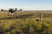
Managing extensive landscapes has traditionally required a compromise between scale and detail. Satellite imagery can cover large territories, while ground surveys reveal...
Read more