Native Colour Lidar Pushes Drone Mapping to Higher Altitudes
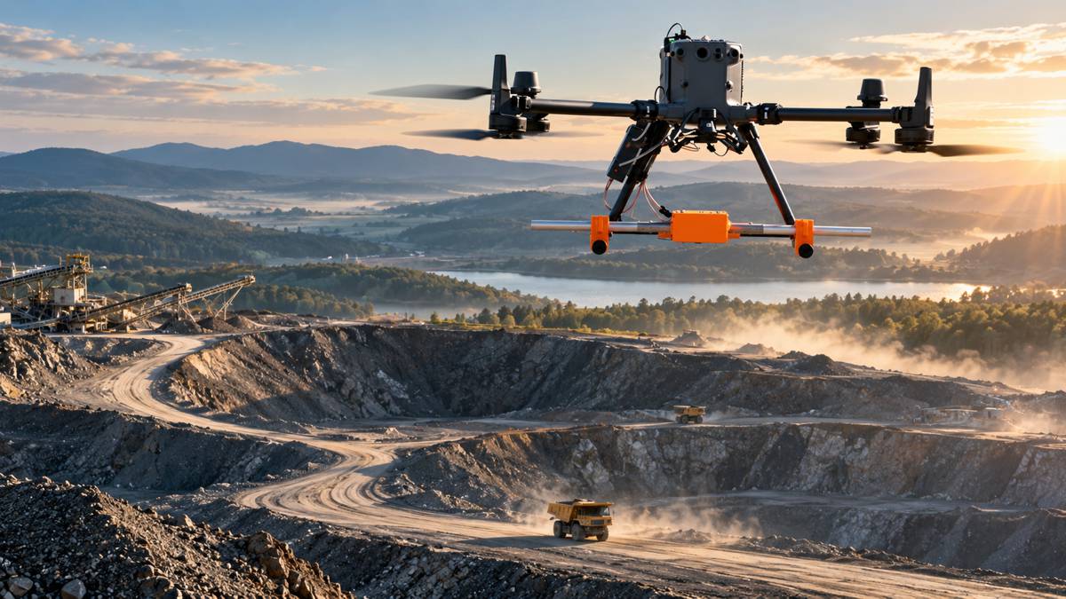
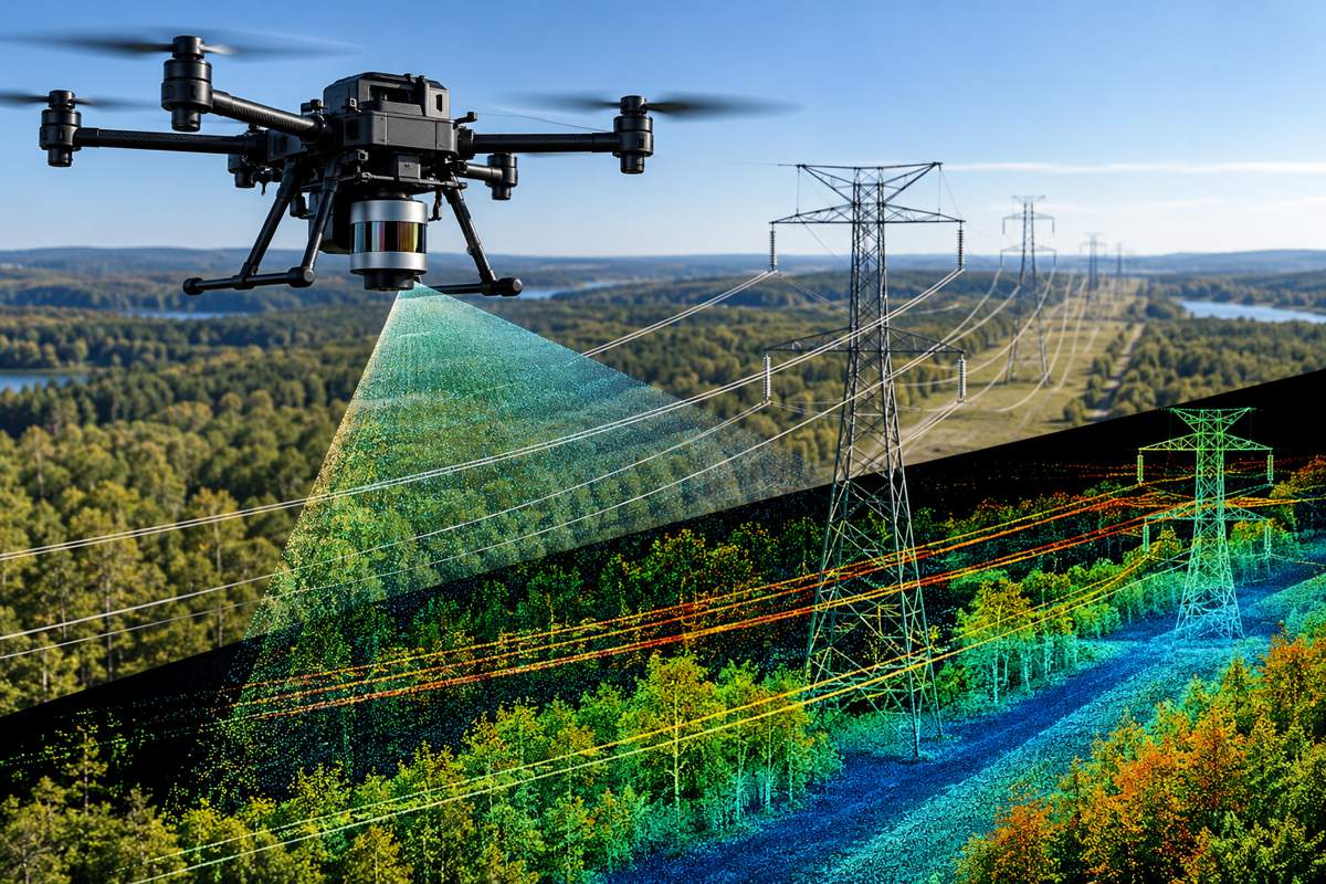
Power lines present an awkward problem for aerial surveyors. They are physically small, often surrounded by vegetation and precisely the kind of infrastructure that needs to be mapped accurately over very long distances. Flying lower improves the chances of resolving individual conductors, but narrows the survey swath and increases the number of passes needed to cover a corridor.
Ouster is approaching that problem with its Rev8 OS1 Max digital lidar, combining 256 vertical channels, long-range detection and colour information captured within the lidar itself. The sensor can detect a 10% reflective target at 200 metres, with a maximum representable range of around 500 metres, while producing up to 10.4 million points per second.
The interesting development is less the headline range than what happens to usable data when an aircraft climbs. Ouster says tighter beam collimation gives the OS1 Max a spot size up to 50% smaller than its previous Rev7 generation, helping thin objects such as wires and branches remain distinguishable at altitude. Combined with higher point density, that potentially changes the trade-off between survey resolution and the amount of infrastructure covered by each flight.
Briefing
- The Rev8 OS1 Max offers up to 256 vertical lidar channels and 4K horizontal resolution.
- Range is rated at 200 metres on a 10% reflective target, with a maximum representable range of approximately 500 metres.
- Ouster specifies precision of up to ±0.25 cm and an operating temperature range from -40°C to +85°C.
- Native 48-bit colour is captured with the lidar data rather than being added by registering imagery from a separate camera.
- GeoCue is integrating the OS1 Max into its TrueView drone mapping payloads for utility and infrastructure surveying.
Resolving Thin Infrastructure
A lidar specification can look impressive without necessarily translating into a better survey. Corridor work exposes that distinction particularly well because the targets include conductors, cables, poles, vegetation and relatively narrow structural elements, often viewed against complicated backgrounds.
The OS1 Max uses Ouster’s L4 Max silicon architecture and supports up to 256 vertical channels. Its published specification gives vertical angular resolution of 0.17 degrees in the 256-channel configuration and horizontal angular resolution of 0.09 degrees, with selectable horizontal resolutions up to 4,096 points per revolution. The sensor weighs approximately 670 g and typically consumes between 15 and 25 W, keeping it within the practical payload envelope of aerial platforms.
Ouster claims the Rev8 OS1 Max achieves ±0.25 cm 1σ precision and ±1.25 cm accuracy, twice the precision and accuracy of its Rev7 predecessor. Sensors are calibrated across range, reflectivity, temperature and beam angle before shipment. Those figures are manufacturer specifications rather than results from an independent comparative field trial, but consistency between individual sensors is relevant to operators running multiple aircraft and standardising repeat surveys.
Higher point density becomes particularly useful as aircraft speed increases. More measurements within the same area can allow a mapping platform to move faster without leaving an increasingly sparse point cloud underneath it. The current specification puts the OS1 Max at up to 10,485,760 points per second.
GeoCue has begun integrating the sensor into its TrueView aerial mapping products. Its September 2026 partnership with Ouster pairs the Rev8 OS1 Max with TrueView payloads and LP360 software for utility and infrastructure surveying. GeoCue identified higher-altitude operation, point density at faster flight speeds and the additional colour reference among the advantages of the integration.
Colour Inside the Lidar
Colourised lidar is not new. A common approach combines a lidar point cloud with images from a separate camera and subsequently registers the two datasets. That produces coloured 3D information, but the geometry and RGB imagery originate from different sensors with different optical positions and must remain correctly calibrated.
Ouster has moved the colour measurement into its lidar architecture. Its Rev8 sensors produce native colour alongside the range measurement, assigning RGB information to the point without relying on a separate camera to colourise the cloud afterwards. The company describes the system as point-for-point colour and depth fused at sensor level, with 48-bit colour depth and a claimed 116 dB dynamic range.
That does not necessarily make separate aerial cameras redundant. GeoCue, for example, continues to use dual cameras in its TrueView payload while employing the OS1 Max colour data as an additional RGB reference for registering imagery with the point cloud. Survey systems can therefore retain dedicated photographic equipment where image quality or photogrammetric products require it, while the lidar itself produces geometrically aligned colour information.
For applications concerned principally with a coloured 3D representation rather than conventional aerial photography, the architecture can also remove one element of post-processing and sensor alignment.
Moving Beyond Open-Air Surveying
The same sensor architecture is being explored at the opposite end of aerial inspection. Flyability already uses Ouster’s compact OS0 lidar on its collision-tolerant Elios 3 drone, designed to enter confined and GPS-denied environments where conventional aerial platforms cannot operate. The companies have worked together for five years, and Flyability is now evaluating the Rev8 OS0 for native-colour 3D mapping in hazardous industrial spaces.
“Our collaboration with Ouster began with a shared ambition: to capture reliable 3D data in places where people should not have to go,” said Adrien Briod, CTO at Flyability. “Ouster’s lidar has become a critical part of the Elios 3 mapping platform. Bringing our teams together at INTERGEO gives us the opportunity to show surveying professionals how aerial access and high-performance lidar are already changing the way complex industrial environments are documented and understood.”
The operating problem is different underground, inside process equipment or within industrial structures. Range becomes less dominant, while field of view, localisation, compactness and reliable perception in darkness become more important. The Rev8 OS0 consequently uses a 90-degree vertical field of view and is intended for shorter-range, high-precision applications.
A geometrically accurate point cloud describes the shape of an environment, while colour can make the resulting model easier for engineers and inspectors to interpret when identifying components, surface conditions or other visible features. Whether that translates into measurable inspection gains will depend on individual applications and the performance of complete mapping systems rather than the lidar alone.
Durability in Aerial Operations
Survey-grade performance has limited value if the sensor cannot tolerate the aircraft and environment carrying it. The OS1 Max carries IP68 and IP69K ingress protection, an operating temperature range from -40°C to +85°C and shock resistance of up to 100G, while weighing about 670 g.
Seneca is using the OS1 Max in aerial work supporting fire agencies, where temperature, airborne contamination and difficult operating conditions place additional demands on sensors.
“Seneca’s fire agency partners operate in some of the most unforgiving environments — obviously heat, but also sometimes cold. The Rev8 OS1 Max has been invaluable in minimizing concerns about sensor durability and performance,” said Stuart Landesberg, CEO of Seneca. “Its IP68/IP69K rating, shock tolerance, and broad temperature range mean we can fly in conditions that would ground other platforms, meaning we can support firefighters, utilities and communities on missions that were previously unsafe, inefficient, or impossible.”
For commercial survey fleets, ruggedisation eventually becomes a question of how many missions can be completed without weather, vibration, handling or equipment failures removing an aircraft from service.
Procurement and Domestic Sourcing
Sensor origin is becoming part of the payload specification for some US infrastructure work. Ouster says Rev8 OS sensors are designed and developed in the United States and offers products intended to meet applicable National Defense Authorization Act and Build America, Buy America requirements. GeoCue has consequently positioned its Ouster-equipped TrueView products towards US utility and infrastructure customers requiring domestically sourced technology.
The procurement regimes are not interchangeable. Build America, Buy America applies domestic-content requirements to iron, steel, manufactured products and construction materials used in federally assisted infrastructure projects, subject to the relevant rules and potential waivers. The US Made in America Office distinguishes these Buy America requirements attached to federal financial assistance from the separate Buy American rules governing federal procurement.
“We are moving America’s drone surveying onto American sensing by pairing our TrueView payloads with Ouster’s Rev8 OS1 Max,” said Frank Darmayan, CEO of GeoCue. “This transition allows us to offer our customers a compliant, high-performance solution that delivers the survey-grade data they depend on for critical infrastructure monitoring and large-scale mapping projects.”
For mapping companies bidding into public infrastructure programmes, compliance can therefore sit alongside accuracy, range, payload weight and processing workflow when equipment is selected. A technically capable sensor that cannot be accepted under the sourcing conditions attached to a project may be of little practical value to the contractor bidding for it.
Mapping More Infrastructure Per Flight
The OS1 Max enters a surveying market where improvements in sensor performance are valuable when they remove an operational constraint. For corridor mapping, that constraint has often been altitude. Flying closer to the target improves the ability to capture small features but reduces coverage, while increasing altitude widens the swath and places greater demands on range, beam geometry and point density.
A sensor capable of retaining usable detail on conductors and other narrow objects at 80 to 120 metres above ground gives operators more room to optimise the aircraft rather than simply the lidar. Wider survey lines can reduce the number of passes, while higher point rates can support greater ground speed. The exact productivity gain will vary with aircraft, terrain, flight regulations, vegetation, required point density and the specification of the final survey.
The combination also points towards a change in aerial mapping hardware. Lidar, colour imaging and processing have traditionally been assembled as separate pieces of a payload and reconciled through calibration and software. Rev8 brings two of those sensing functions together at silicon level.
Ouster is demonstrating the Rev8 OS1 Max at INTERGEO 2026 in Munich from 15 to 17 September. The more revealing demonstrations will come afterwards, over kilometres of transmission line, transport corridor and industrial infrastructure, where centimetres of measurement performance have to translate into fewer flights and dependable survey deliverables.
Key Industry Questions
- What is the range of the Ouster Rev8 OS1 Max? Ouster specifies 200 metres on a target with 10% reflectivity and a maximum representable range of approximately 500 metres.
- How many lidar channels does the OS1 Max have? It can be configured with 32, 64, 128 or 256 vertical channels, with the maximum configuration providing 0.17-degree vertical angular resolution.
- What does native colour lidar mean? The Rev8 architecture captures colour alongside the lidar measurement so RGB and 3D information are inherently aligned, rather than colour being added later by registering a separate camera image to the point cloud.
- Does native colour eliminate the need for an aerial camera? Not necessarily. Dedicated cameras may still be required for photographic or photogrammetric deliverables. GeoCue’s TrueView implementation retains dual cameras while also using native lidar colour as an additional RGB reference.
- Why does beam size matter when surveying power lines? A smaller lidar spot can improve the ability to distinguish thin targets such as conductors, cables and branches from their surroundings, particularly as the distance between the aircraft and target increases.
- How fast does the OS1 Max collect data? Ouster specifies a maximum rate of 10,485,760 points per second.
- Can the OS1 Max operate in severe weather conditions? The published specification includes IP68 and IP69K ingress protection and an operating temperature range from -40°C to +85°C. Actual flight operations remain subject to the limitations of the aircraft and other payload components.
- Where is native-colour lidar likely to be useful beyond corridor mapping? Potential applications include industrial inspection, confined-space mapping, robotics and infrastructure surveying. Flyability is evaluating Rev8 OS0 technology for colour 3D mapping in hazardous and GPS-denied environments.
Strategic Takeaways
- Higher-altitude corridor mapping depends on maintaining thin-object resolution and point density, not simply extending maximum lidar range.
- Native colour removes a calibration relationship between separate lidar and colour sensors where a dedicated external camera is not otherwise required.
- Higher point rates can support faster aircraft movement while retaining useful point density, potentially improving the productivity of long-corridor surveys.
- Ruggedness becomes commercially relevant as aerial mapping moves from controlled survey work into utilities, emergency response and industrial inspection.
- Domestic sourcing and procurement compliance can form part of payload selection for US public infrastructure applications alongside conventional technical specifications.